Cape Byron
First to see the sun
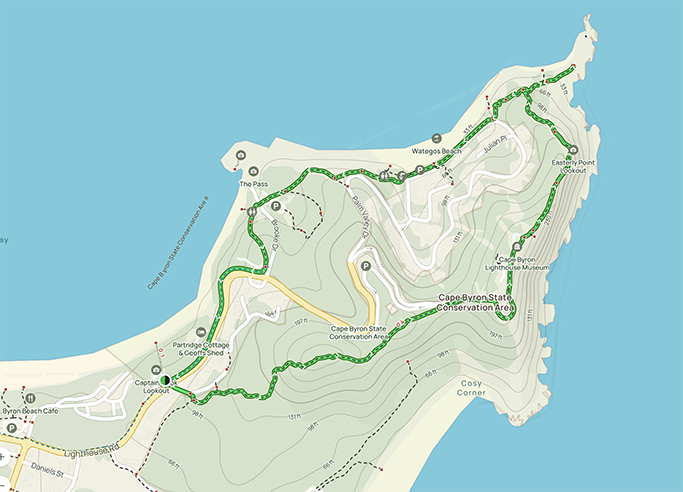
Having made it to the very top of Australia I was keen to tick off another first from the bucket list on the drive back down the east coast and stop at the most easterly point of the Australian Mainland – Cape Byron.
The town of Byron Bay was once known for its alternative culture and off-the-grid hippies. These days it is still just as beautiful but has matured to embrace award-winning restaurants, luxurious beach houses and craft breweries. From backpackers to celebrities, Byron Bay has something for everyone.
Byron is popular year-round, we had not booked ahead and camping in the area is limited. Despite our lack of organisation we were lucky enough to score a night at the Reflections Holiday Park – a great location right on the beach front, an easy walk into town and within spitting distance of the Cape Byron Walking Track.
Cape Byron was named by Captain Cook, not after Lord George Gordon Byron the famous poet, but rather after his grandfather John Byron.
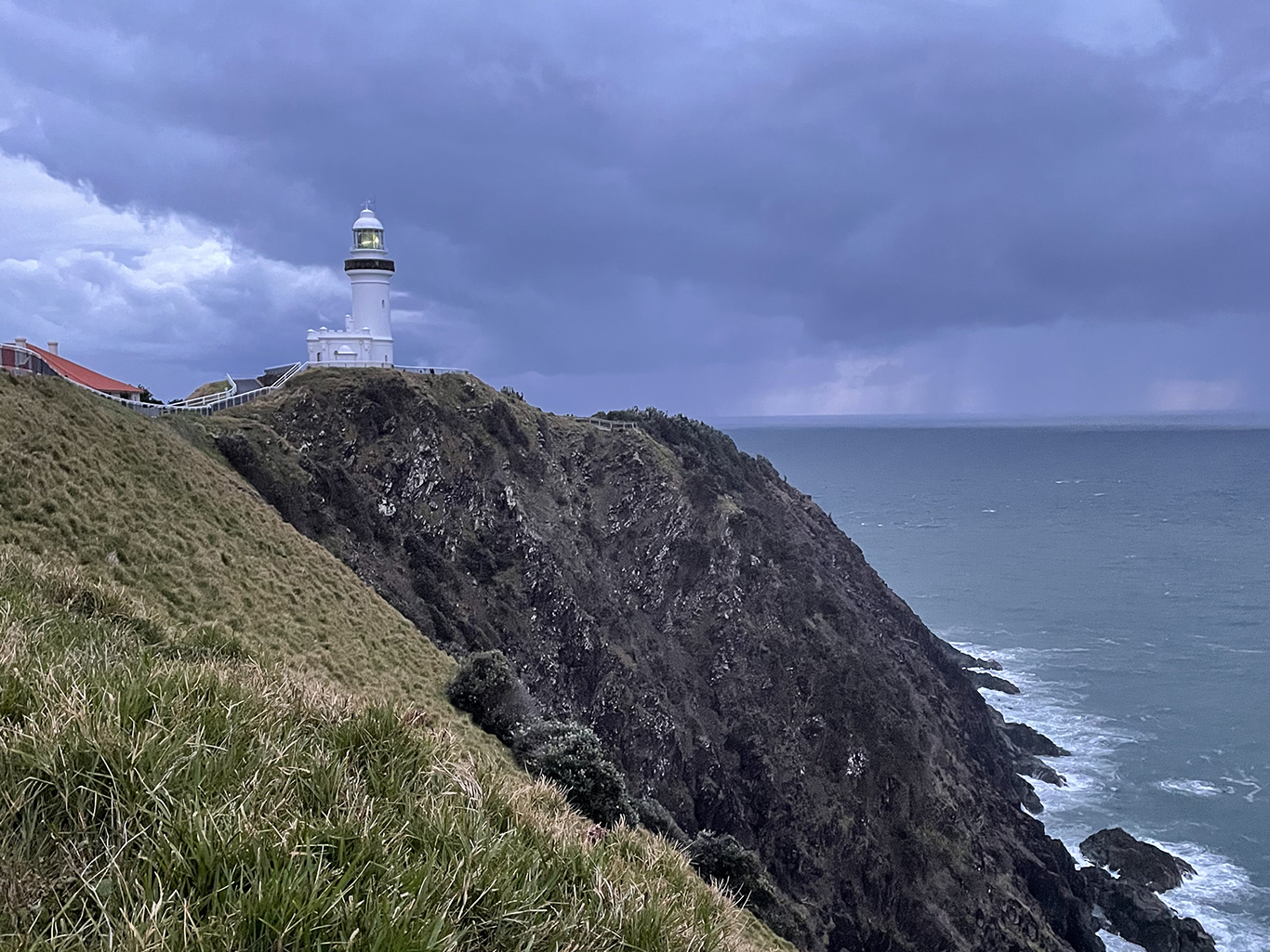
Cape Byron Lighthouse is as famous as the town itself. Shining out to sea since the beginning of the 19th century the lighthouse is perched on the end of Cape Byron. With sweeping views over the Pacific Ocean the lighthouse is undoubtedly one of the outstanding features of Cape Byron Headland Reserve.
The building was constructed of prefabricated concrete blocks and the eight-ton lens contains 760 pieces of polished prismatic glass. The original six wick burner was replaced in 1922 by a vapourised kerosene mantle burner, and then in 1956 it was converted to mains electricity, becoming Australia’s most powerful light at 2,200,00 cd.
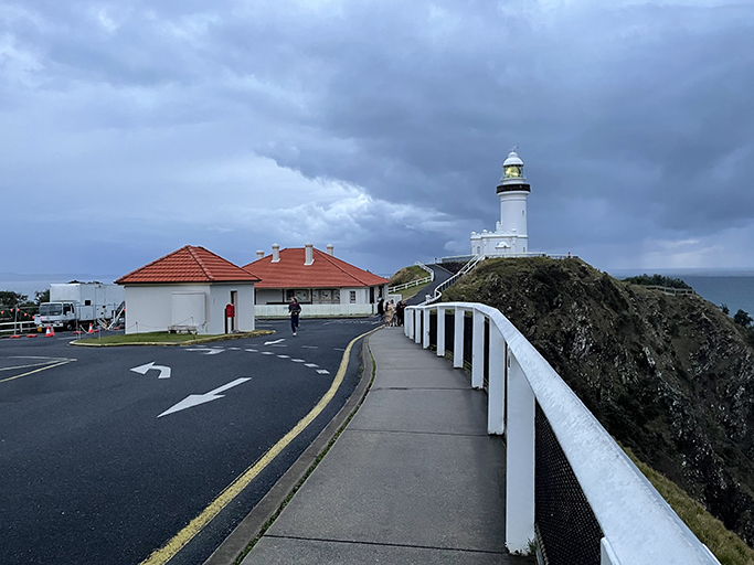
To learn more about the history of the lighthouse and town, the Cape Byron Lighthouse Maritime Museum can be found in what was once the head lightkeepers office at the base of the tower (open 10 – 4 daily). You can also take advantage of the 360-degree views from the top of lighthouse by doing a volunteer run tour (10am – 3pm daily for a gold-coin donation). If all this exploring is making you hungry stop in at the café to refuel.
If you are short on time, you can drive right up to the light house and vie with the crowds for a carpark (parking fees apply in the National Park). If you have more time on your hands nothing beats putting on your walking shoes to do all or part of the Cape Byron Walking Track.
Cape Byron Circuit
This loop walk takes you through an ever-changing landscape, from rainforest and beach to grasslands and cliff tops. With breath-taking coastal views it is a beautiful walk, there are a lot of stairs around the headland but it is well signposted and easy to follow, a must do for any visit to Byron Bay. If you are not up for the whole thing, you can access the Cape Byron track at different points where there’s parking (such as the Captain Cook Lookout, Palm Valley and Wategos Beach).
Being the most easterly point of Australia, Cape Byron is the first spot on the mainland to catch the sun’s rays each day. This was my chance to be one of the first people in Australia to watch the sunrise and my plan was to walk to the end of Cape Byron for first light. Mother nature was not on my side though. When the alarm went off at 5am, the rain could be heard drumming on the roof of the van and I knew my chances of convincing either of my travel companions to get up for an early morning walk was about zero. But it was now or never, so I pulled on my walking boots and raincoat and grabbed a torch.
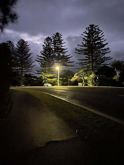
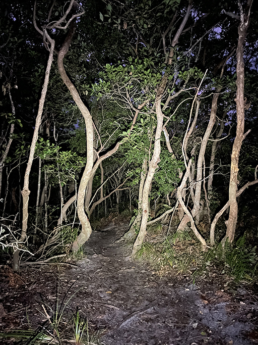
As I started from the caravan park the rain was just a light drizzle and the warm glow from the streetlights was reflected in the puddles along Lighthouse Road. Turning right at Lee Lane it is easy to follow the signs onto the Tallow Ridge Track. As the trees enveloped me the streetlights were left behind and I was surrounded by darkness, only a few meters of track ahead lit by torch light. The track was well defined, sandy with occasional timber and stone steps, and wound its way through rainforest (with added rain) for about 1km before the trees parted to reveal the lighthouse up ahead, silhouetted against the sky.
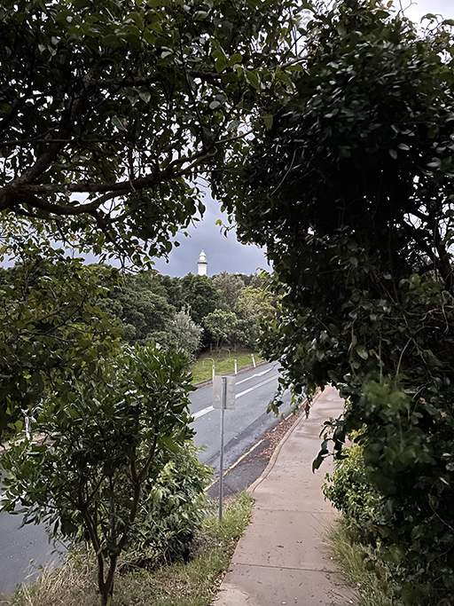
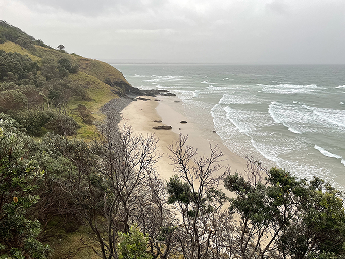
Leaving the bush track and following Lighthouse Road again, you will pass the gate to the national park which at this hour is still locked – if you want to get up to the cape for sunrise you will need to walk at least part of the way. The road winds its way up the headland with spectacular views south over Tallow Beach.
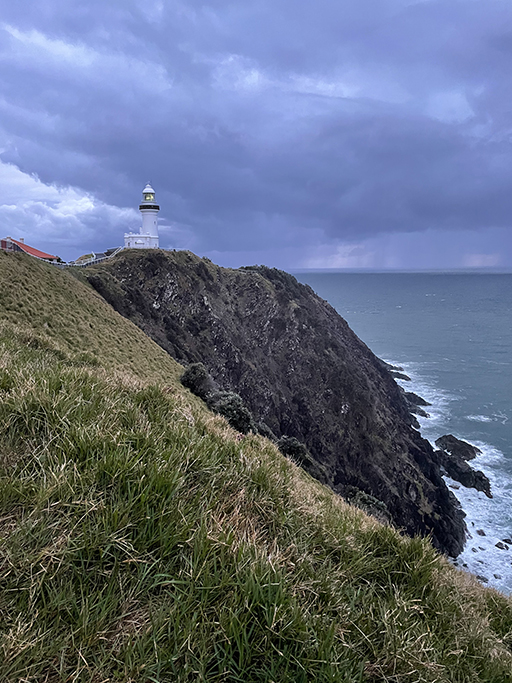


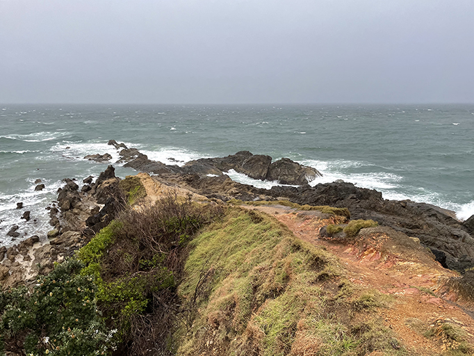
At the peak of the headland I joined other soggy tourists taking photos of the grey sky and even greyer sea. Just below the lighthouse there is a lookout which I had all to myself, most visitors choosing to take shelter at the base of the lighthouse. From here the track keeps heading north along the ridge to the end of the headland. The next big lookout is the official easternmost point. The sun did manage to peak out from between the clouds, but I will admit it was not the most spectacular sunrise I have crawled out of bed for. From here you have panoramic views back down to the lighthouse and north to the Little Watego Beach lookout.
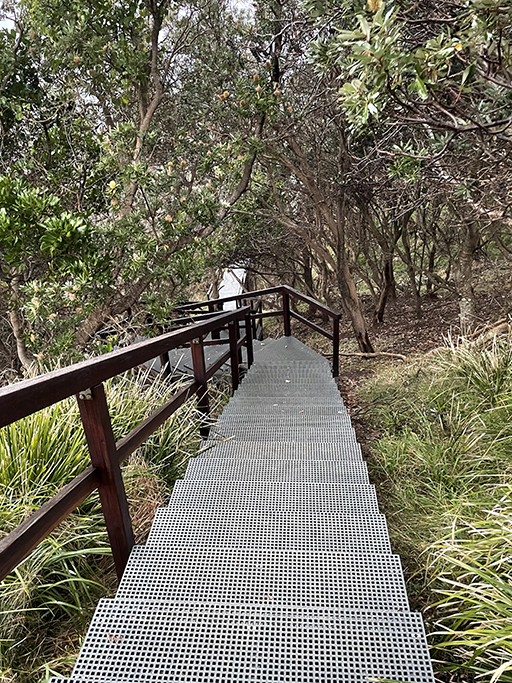
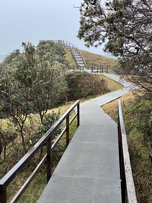
Up till now the rain had been light and intermittent, but it was getting heavier, so I pushed on. Steep steps and boardwalk take you down toward to northern side of the headland where the track splits. Turning right is a side track, Little Watego’s Track, this detour has some very steep stairs but is worth the effort for the views along the rocky shore. You can also access Little Watego’s Beach from here if you want to explore the stretch of golden sand or sit and watch the surfers.
Heading back to the main track the path continues west, soon leaving the nature reserve and following Marine Parade along the Wategos Beach shore line. When Marine Parade curves to the left, the walking track leaves the road and heads through the Wategos Beach picnic area and over the headland to Clarkes Beach. There is a side track detour to Fishermans Lookout and another for Palm Valley Loop, but the rain was getting pretty heavy by now and I was soaked to the bone so I decided to give these a miss. Shortly the track joins back up with lighthouse road and heads back toward town.
From the caravan park the circuit walk was 5.5km and took me about 2 hours allowing for time to soak in the views (as well as the rain) at the lookouts along the way.