An Iconic Sydney walk
The start of our circumnavigation of Sydney Harbour
Manly to Clontarf | 9.5km
The iconic Spit to Manly walk – just done in reverse. Most people seem to walk from The Spit Bridge and end up at Manly. Maybe the views are better walking in that direction, or maybe it is the appeal of ending your walk at the pub or one of Manlys many ice-cream parlours. But for Jen and I it had to be the other way around to begin our circumnavigation of the harbour.
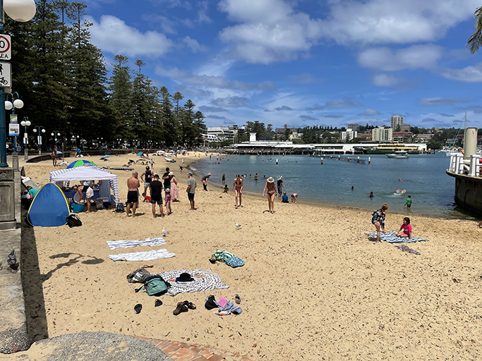
Starting from the ferry wharf in Manly we headed toward the northern end of Manly Cove Beach and followed the path past the Manly Waterworks, listening to the screams of the children. Walk through the colonnades of the Manly Pavilion before hanging a right and heading up the stairs to the beginning of the Fairlight Walk.
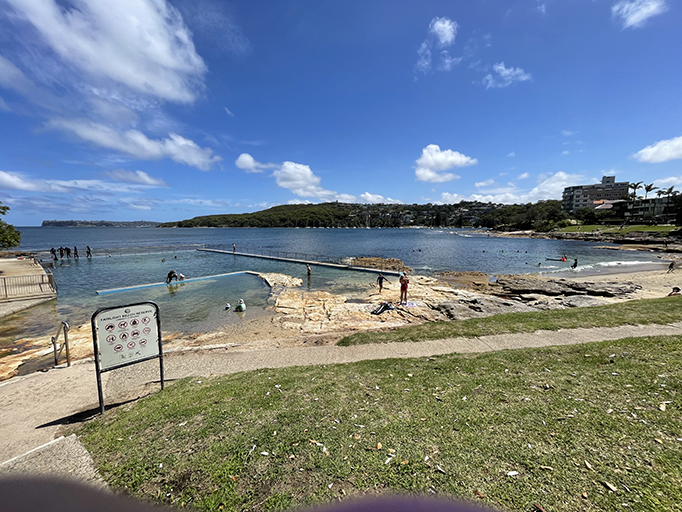
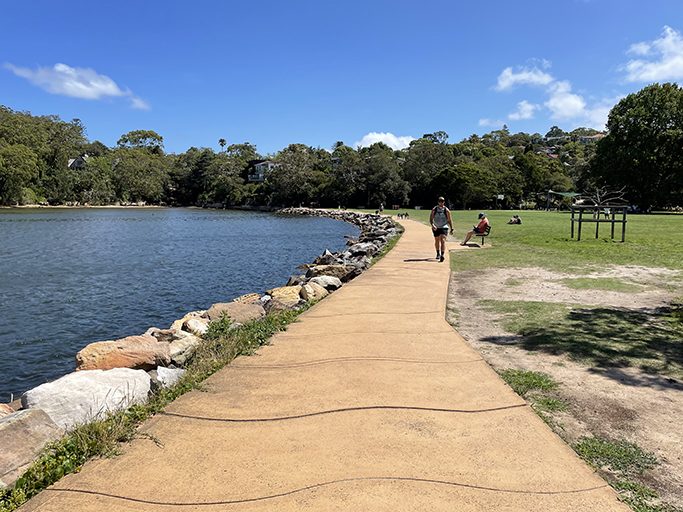
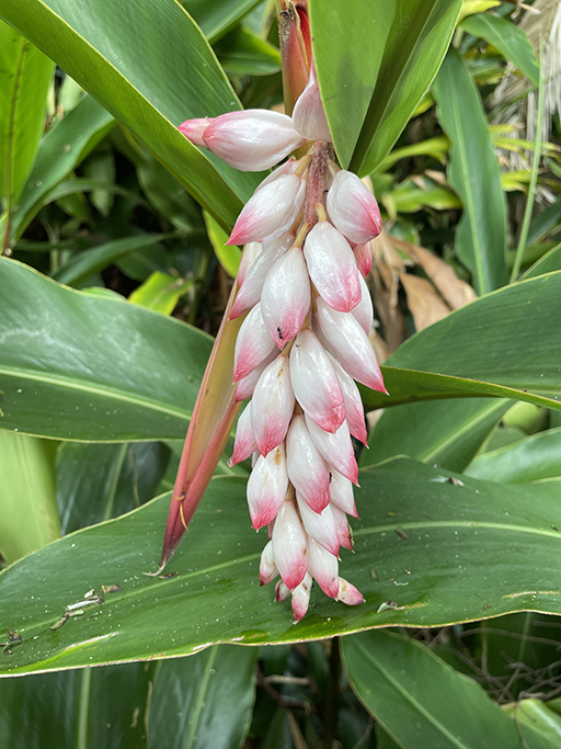
This beautiful walking and cycling path meanders through the foreshore park past several lovely harbour beaches and the Fairlight Beach Rockpool (although not technically an ocean pool I think this one will have to be added to my list for next summer’s ocean swimming adventures). There are toilets near the pool if you need a pit stop before continuing to the end of the park.
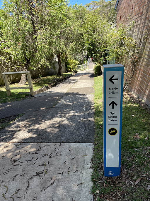
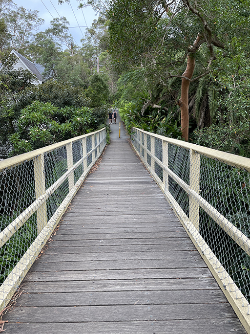
The walking path ends at Lauderdale Avenue where you head left and then left again into King Avenue. At the end of King Avenue another walking path takes you through North Harbour Reserve (more public toilets) and back down to the water’s edge. At the south end of the reserve on some maps the walking track is marked as continuing around the shoreline, if the tide was low you might be able to do this although the mud looked quite unappealing. For us it was up the stairs and back to the road. Head up North Harbour Street until it meets Clarence Street and there is a sign pointing left for the Manly/Spit Walk. The walking path takes you down to a lovely timber bridge over the gully and up the other side to Gourlay Avenue.

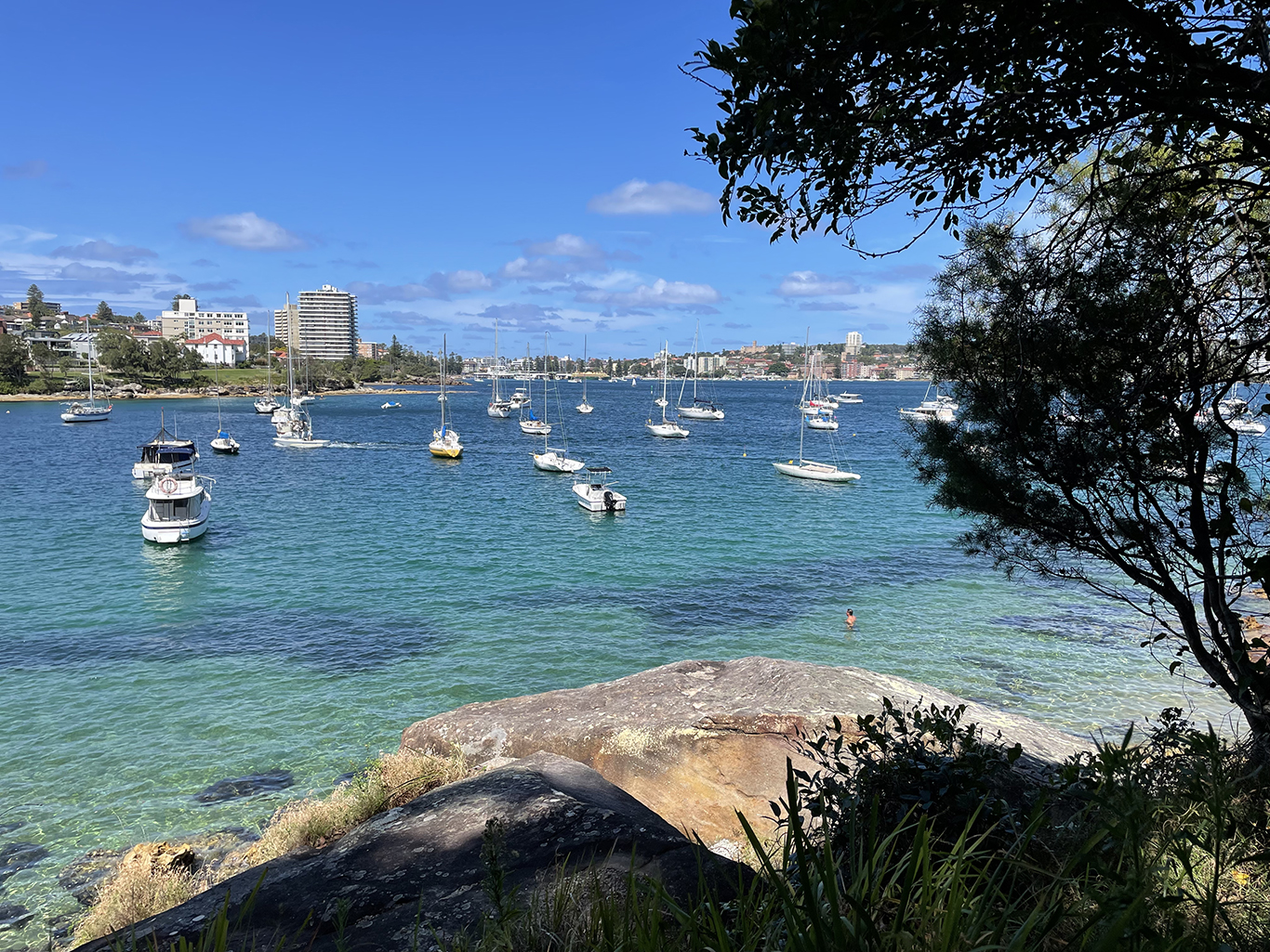
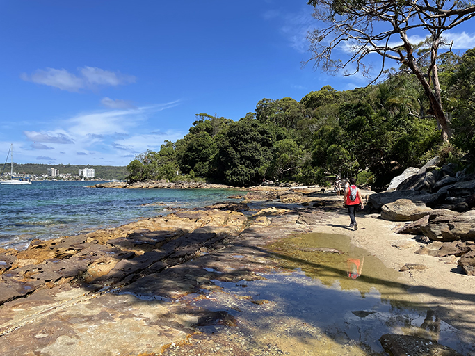
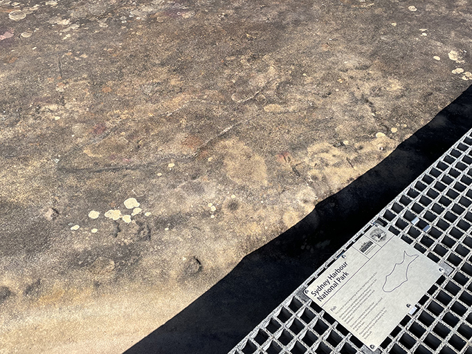
Follow the road through the bush down to Forty Baskets Beach – a beautiful park and beach with a netted swimming area and some fabulous views back to Fairlight and Manly. At the southern end of Forty Baskets head along the sand and rocks until you meet the track into Dobroyd Head, part of the Sydney Harbour National Park.

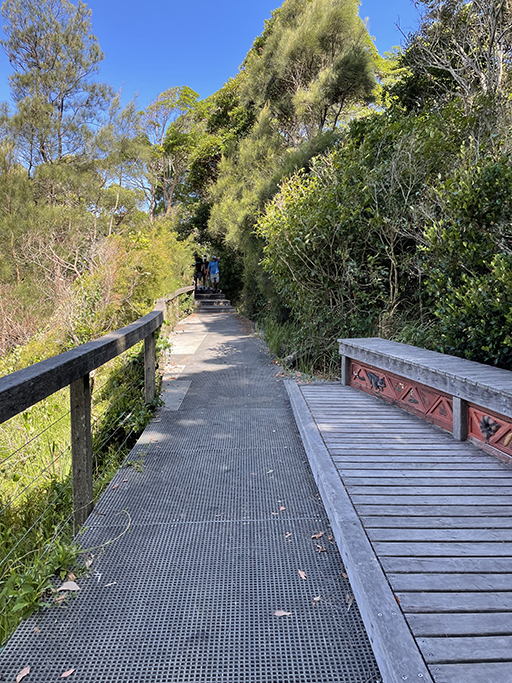
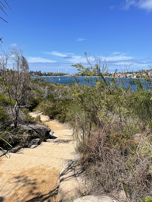
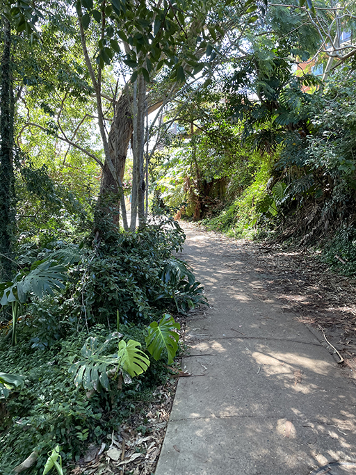
The walking track through the National Park is very well maintained and offers some unbeatable views over the harbour. It has some ups and downs, and many stairs, but with ample opportunities to stop and admire the scenery if you need to catch your breath. Follow Reef Beach Track to Dobroyd Lower Lookout and then head up Dobroyd Track.
Crater Cove
There are a couple of side trips you can add to this walk – the first, which I have been wanting to do for a while, is to Crater Cove. It is not an easy track to find, there are no signposts as people aren’t really encouraged to explore the area. From Dobroyd Track, when you reach a track to the right marked Beatty Street, turn around and look at the other side of the path, a few meters downhill. The hidden path is not obvious, but it is there, a narrow track leading down toward the cliff tops. It isn’t easy to follow, can be overgrown in places and will require a certain amount of rock scrambling, but if you find your way you are in for a treat.
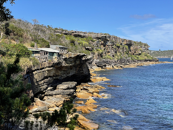

As you reach Crater Cove you will see a group of huts perched precariously on the edge of the cliff, like a little row of terraces. Built mostly from stone, wood and found items they are a unique glimpse into Sydney’s history. Further along the track there are more timber shacks scattered, along with the remnants of gardens and veggie patches once lovingly maintained.
The first of the huts were built in the 1920’s by fisherman wanting somewhere for short stays at the cove, but during the 1930’s it is thought they were permanently occupied by those seeking to escape the harsh economic times. More huts were built in the 1960’s and a small group of people called them home until the 1980’s when the NSW Government created Sydney Harbour National Park, incorporating Dobyoyd Head and Craters Cove. Despite taking their case to the High Court of Australia the occupants of the huts were forced out and the huts were boarded up.


A team of volunteers work with the NSWNP to watch over the huts and surrounding area. Although the NSWNP does not stop people walking to Craters Cove, it does not encourage visitors. The path leading to the huts, Crater Cove Walking Track, is deliberately not signposted. People are not encouraged to go there. If you do decide to explore the Crater Cove huts, please be respectful of this fabulous slice of history and help ensure it will be there for generations to come.
There were no other visitors to the huts when we were there. We sat in some thoughtfully provided canvas chairs and enjoyed the peace, imagining living a much simpler life with this spectacular view, before scrambling back up to the main track.
Back to the walk…
Continuing up Dobroyd Track you will come to Fairlight Lookout and a turn off on the right to Arabanoo Lookout. We didn’t do this one this time, but rather continued on to the Dobroyd Head Lookout. From here you have 180° views from Manly down to Watsons Bay and a birds eye view of the Crater Cove Huts on the cliff tops below. There is a path from here up to Dobroyd Scenic Drive and Tiana Park where toilets and drinking water are available on the other side of the oval.

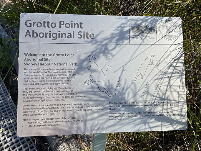
The track south is Grotto Point Track and following this will bring you to the Grotto Point Aboriginal Rock Engravings on a sandstone outcrop on the left of the track. Timber sleepers are arranged around the engravings to protect them, and there is interpretative signage to help you learn more about the rock art. The site features kangaroos, a whale, boomerangs, sharks and fish.

Shortly after the rock carvings there is a track to the left that leads to Grotto Point Lighthouse. This is the second of the side trips I mentioned and will probably add an extra 1km to your total walk length. We didn’t attempt this one on this trip but is on the list to come back to.
The lighthouse at Grotto Point is one of the two leading lights into Sydney Harbour, together with The Parriwi Point light located just off Parriwi Road near Chinamans Beach. By lining the two lights up before they enter the harbour ships can ensure they are on the correct course.


Back on the main track the path continues up and down around the headland through eucalypt forest and ferns. There are sections of board walk, dirt track and a fair number of stone stairs, you will pass a couple more small lookouts before you come to a t-junction with the track down to Castle Rock Beach. Down the steep stone stairs to the left is a beautiful tiny beach that made me wish I pack my swimmers and a towel. I did not however, so we pushed on turning right then immediately left again to continue along the foreshore track to Clontarf.
Depending on the tides at Clontarf you may be able to walk along the sand in front of the houses. If the tide is too high, you will have to take Monash Street up to Clontarf Reserve. The walk along the street is no second prize though, there are some lovely homes and gardens to have a sticky beak at in this area.

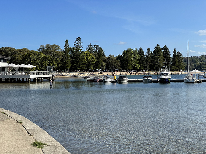
Clontarf Reserve is the perfect spot if you need a break. There are toilets, water refills and a cafe. Sit in the shade of the Norfolk Island pines or Port Jackson figs and enjoy the views of the water for a while.
From here take the footpath around Sandy Bay past Clontarf Marina. We finished up here as we had run out of time, but if you continue along Fisher Bay Walk from the north end of the bay it will take you to The Spit Bridge and Military Road where buses can be caught back to the starting point at Manly.