Atherton Tablelands
We had the opportunity to spend a few days exploring the Atherton Tablelands before and after our trip to the tip. There is so much to see in this beautiful area you could easily spend a week and not cover it all. Waterfalls, wildlife, hiking, biking or just relax and enjoy the local produce.
Before we headed north we spent some days exploring with the young ones, and on our return to Cairns we had a few days with just the two of us. It struck me as quite a contrast in touring styles, when it is just Andrew and I squeeze as much into a day as I can, wanting to make the most of every opportunity and not miss out on anything. I read about where we are going, write lists and scribble on printed maps to find the best way to squeeze in everything possible.
Sightseeing with young adults is much more spontaneous. Decisions are made on the day and much more time is spent relaxing and soaking in the sights. I have to say it was really nice to slow down a bit, switch of my busy brain and just go with the flow.
Getting around the Tablelands
There are three roads to get from Cairns up on to the tablelands. The Kennedy Highway or National Highway One is the northernmost one, it takes you via Karanda and Mareeba. The Gillies Range Road is the middle one, it is the shortest route from the town of Atherton back down the mountain but is steep and windy so if you are towing a van maybe avoid this one (this is the way the tow truck driver brought our car and van down to Cairns after our misadventure, it was quite a ride!). If you head south through Malanda and Millaa Millaa the Palmerston Highway will bring you back to the coast at Innisfail. A more relaxed road but a bit longer to get back into Cairns.
Yungaburra
This little treasure of a town was not on my radar at all until we arranged to meet some friends for breakfast and they suggested it. Quite appropriately it turns out, as Yungaburra translates to Meeting Place in the local indigenous dialect.
Surrounded by rainforest the picture-perfect village is listed by the National Trust of Queensland. The former timber town has a very high portion of heritage-listed buildings with many of them still in use as cafés, galleries and shops.
The icing on the cake for me was the chance to spot a platypus. There is a platypus viewing area on the Gillies Highway, on the Atherton side of the village where you can park your car try your luck. Or if you have a bit more time, take a walk along the banks of Peterson Creek for a chance to glimpse the elusive creatures. We spent about half an hour wandering along the path and saw several platypi?? (is that the plural of platypus? Platypuses?) frolicking and feeding amongst the water weeds. Unfortunately, we weren’t close enough to get any decent photos, so you are just going to have to take my word for it.

Giant Fig Trees
If you, like me, are a sucker for an awe inspiringly large tree then the Atherton Tablelands has a treat in store for you. There are three giant strangler figs to satisfy your cravings.
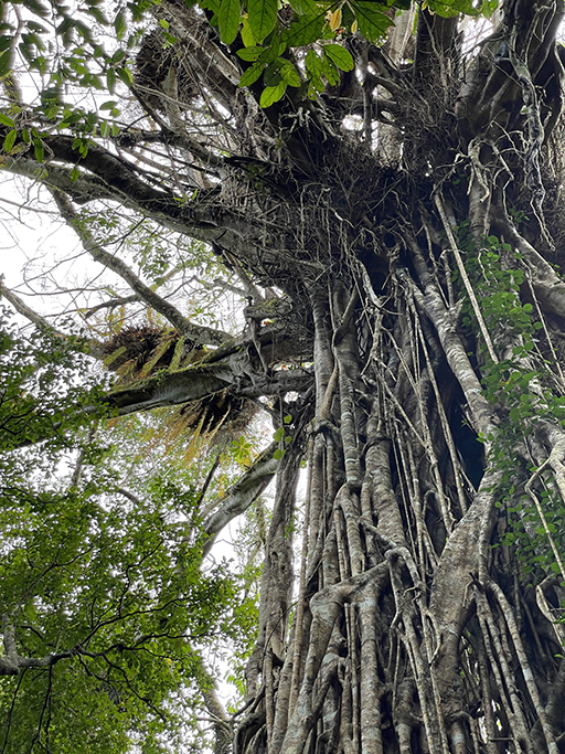
These majestic trees begin as a tiny airborne seed that lodges in the crown of another tree. From here it sends aerial roots to the ground far below. Once established the fig slowly takes over the host tree, eventually killing it.
Clohesy River Fig – Sadly we didn’t make it to this one – the road was not suitable for 2WD and our little hire car was not cut out for the job. But if you do have the means to get there it is about 9km off the Kennedy Highway along Clohesy River Road. A 300m return walk along a wheelchair-accessible boardwalk encircles the magnificent Clohesy River fig tree with signs along the walk interpret the local rainforest environment.
Cathederal Fig – 1.4km from Gillies Range Road, along Danbulla Road. Most of the road is unsealed but doable in a 2WD car. Thought to be over 500 years old with a crown that is over 2000 square meters this tangle of branches and giant buttress roots is a sight to behold. A 300m return walk into the rainforest brings you to boardwalk around the giant tree and more information about the wonders of nature that brought it into existence.
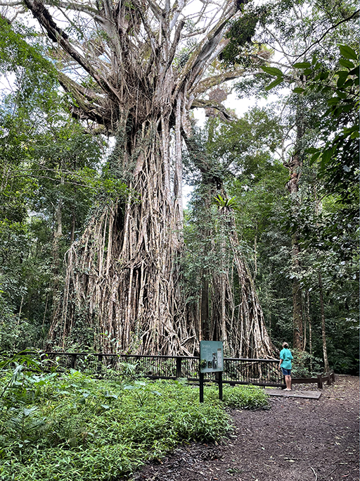
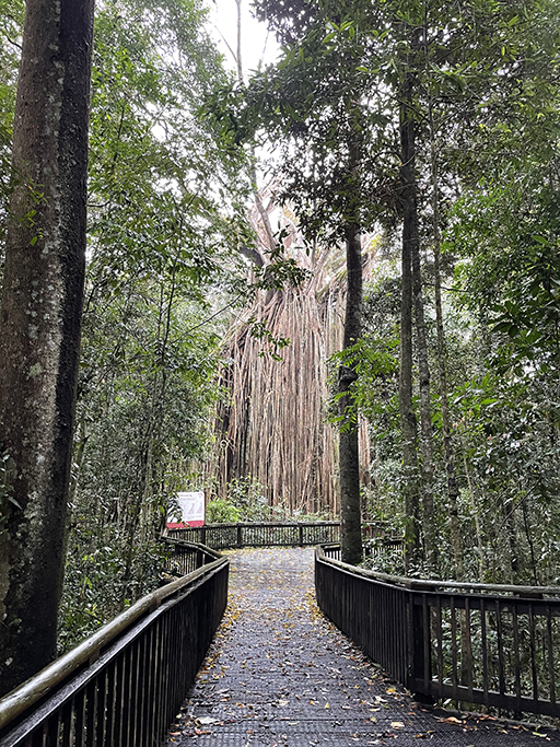
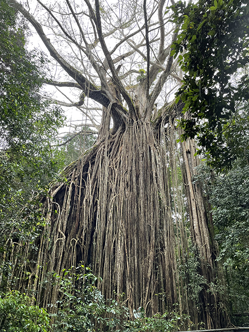
Curtain Fig – The most famous and the most easily accessible of the three giants figs sits just outside Yungaburra. In a carpark on Curtain Fig Tree Road, in Curtain Fig Tree National Park you will find the beginning of an easy 180m return walk to view the Curtain Fig Tree – are you seeing a theme here? There are no dirt roads or windy drives required and the elevated boardwalk around the tree is stroller friendly.
Curtain Fig looks a little different from the two as its host of choice (or chance) was a partially fallen tree leaning on another at a 45-degree angle. The strangler vine grew along the leaning tree, dangling its roots 15 metres to the ground creating a draped curtain affect.
Waterfalls
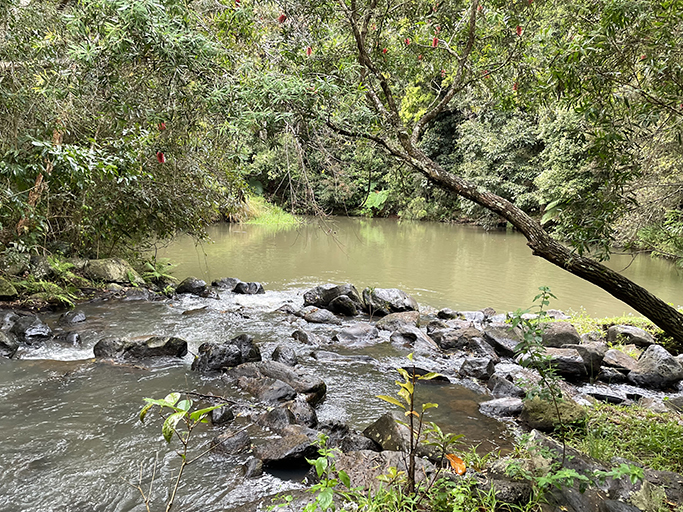
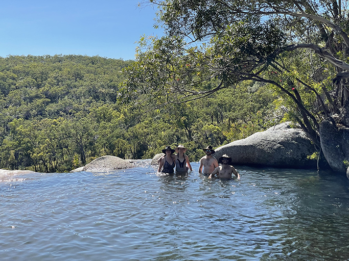
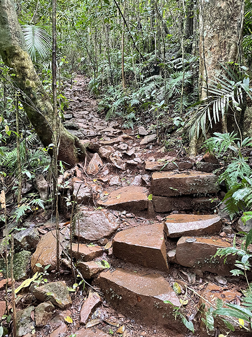
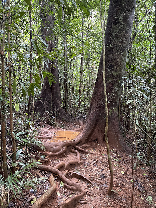
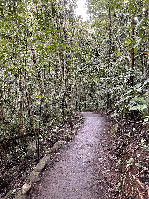
So many waterfalls! Some spectacular to look at, others you can have a soak in to cool off. Beautiful clear creeks flowing through stunning landscapes. Accessibility to each waterfall varied from a few meters down a paved path from the carpark, to a couple of km of bush walking, and generally the harder it was to get to the more spectacular the scene at the end. The weeks leading up to our trip have been very wet in Queensland – well all of Australia really – and the storm water runoff has made a lot of waterways very brown and murky. Some of the swimming holes don’t look as inviting as they might otherwise, but the waterfalls are flowing well and are as powerful and dramatic as you could hope for in the dry season.
Working from north to south these are the falls that we visited….
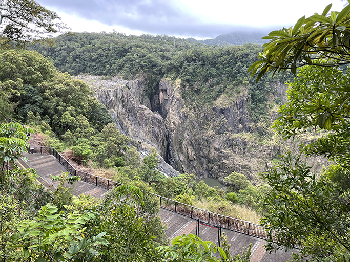
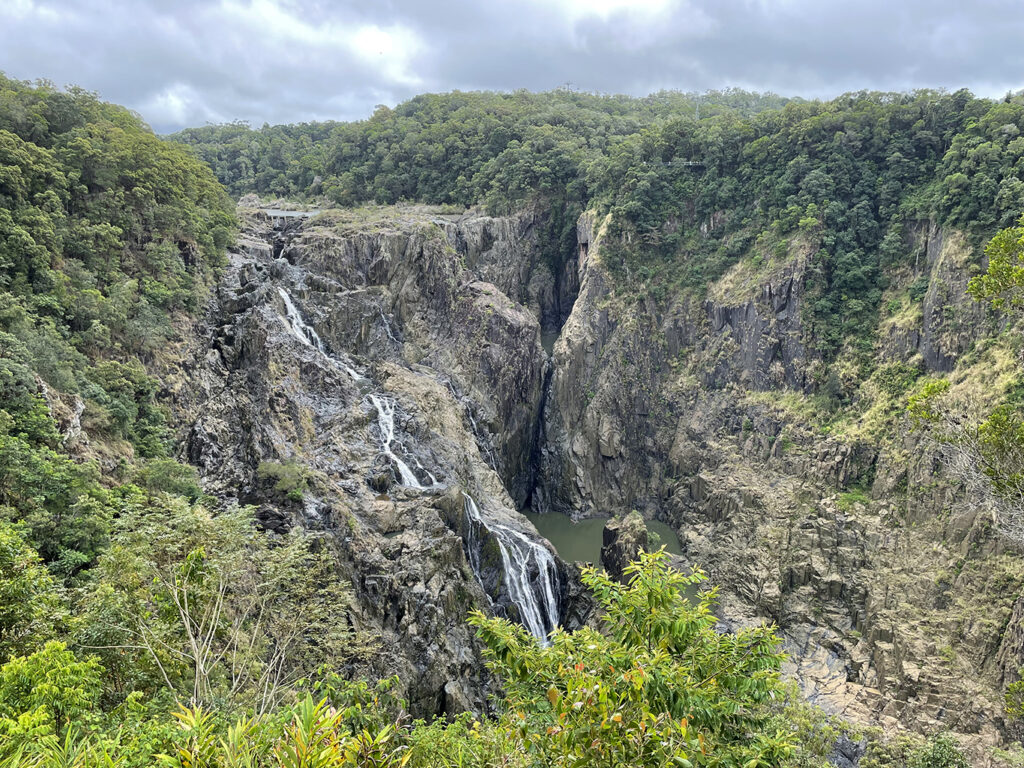
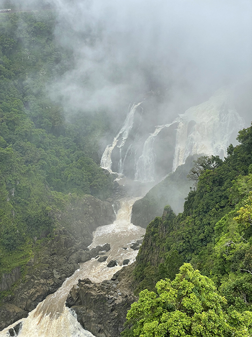
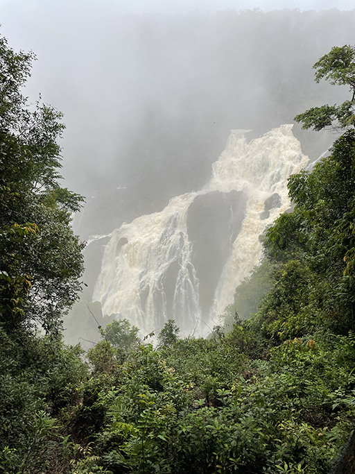
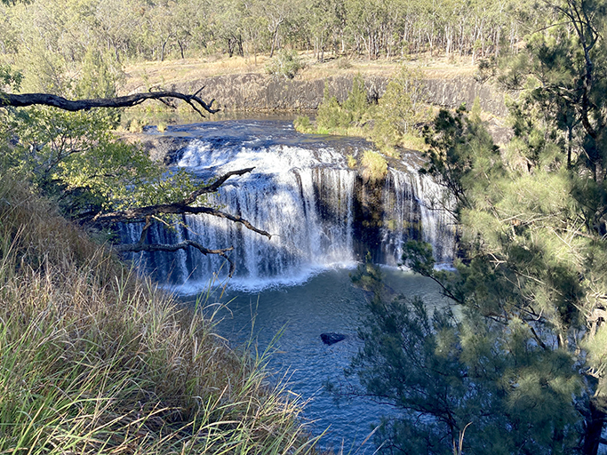
Baron falls
The Baron River flows over 60km across the Atherton Tablelands and falls over 250m by the time the water reach’s the coast. As it plunges through the narrow gorge near Kuranda it forms one of the most dramatic and photographed waterfalls in Far North Queensland.
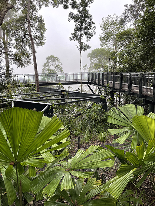
On the western side of the falls the Baron Falls lookout track is an elevated walkway, suspended high above the forest floor. The first section of the boardwalk to the top lookout is wheelchair-accessible and offers stunning views over the falls and gorge. If you would like to get a little closer to the action, a 550m track winds through lush rainforest and open eucalyptus forest down to the lower lookout and railway platform.

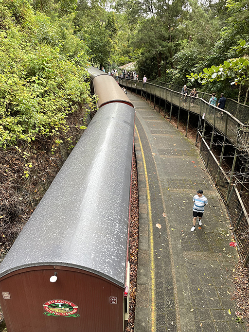
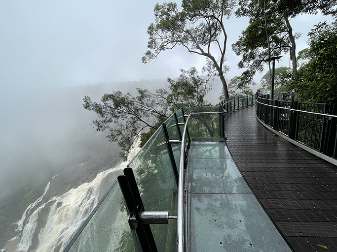
The lookouts on the eastern side of the falls can only be accessed via the Kuranda Skyrail. The gondolas ride stops twice on its way up the mountain and each stop offers a short walk to a lookout with magnificent views over the gorge and falls. The second lookout is suspended off the side of the cliff and offers the closest vantage point to the thundering water below.
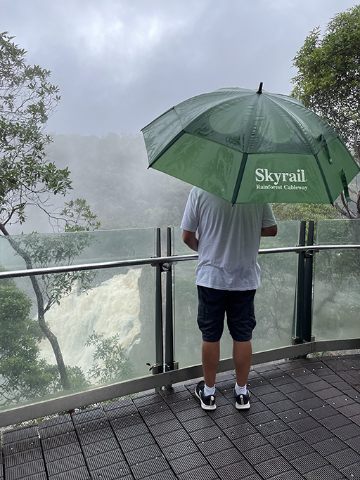
During the wet season views of the falls are enveloped in mist as the river thunders down. In drier times the flow is less dramatic but just as pretty as the river tumbles over multiple granite tiers through the steep Barron Gorge. We have been luck enough to visit in both the wet and dry and experience the contrast of the change in seasons.

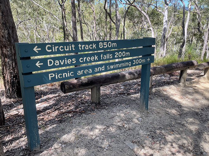
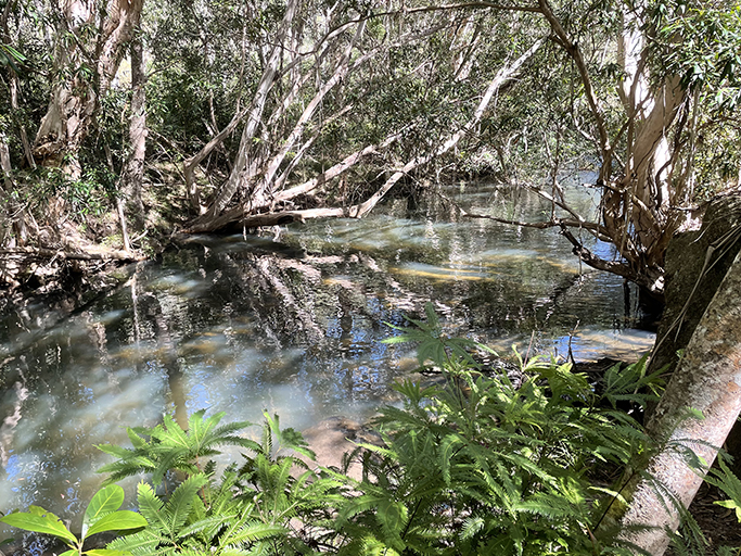
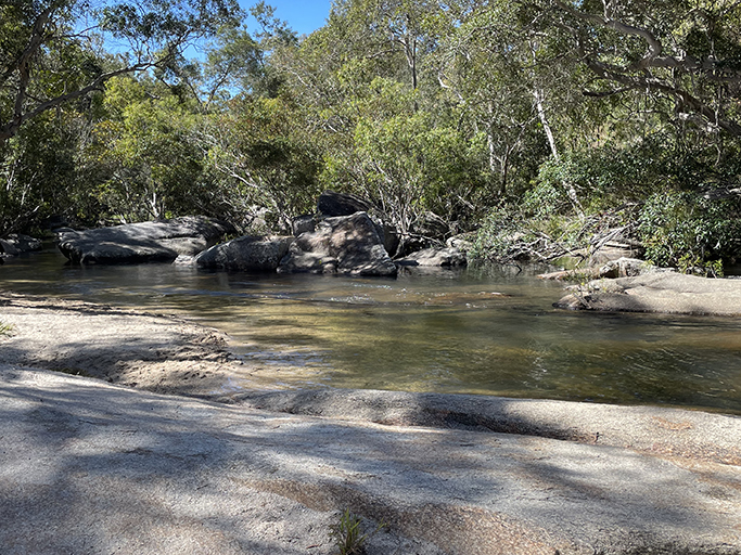
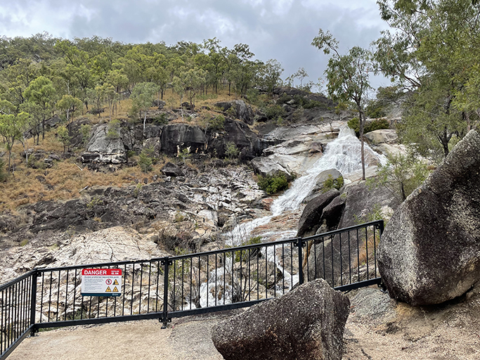
Davies Creek Falls
A little over 8km from Highway One is Davies Creek Falls. The road is unsealed but quite doable in a 2WD car. We spent an afternoon exploring and swimming in the crystal-clear waters here. From the carpark it is a short bush track to a lookout with spectacular views of the water cascading over huge granite boulders into the valley below,. A little further along you will reach the infinity pool at the top of the falls. The rocks can be slippery and you won’t be able to get to the pool if you don’t want to get your feet wet, but if the conditions are in your favour it is worth the effort. The water is very refreshing and the pool is surrounded by lovely flat rocks to spread your towel and lie in the sun after your swim. If you are going to take the plunge, be prepared for a challenging exit from the water after your swim, as mentioned earlier – slippery rocks.
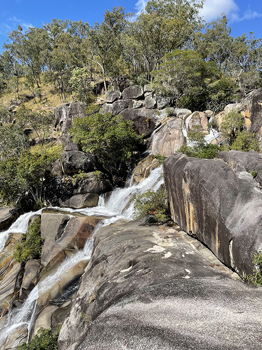
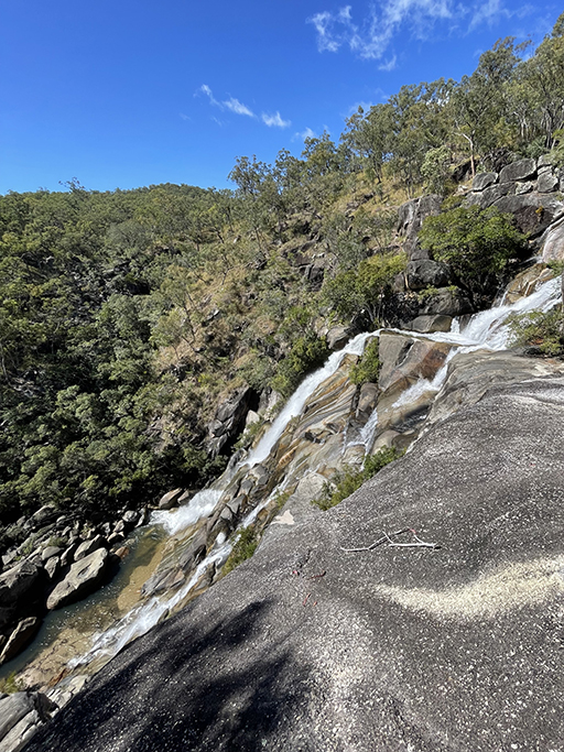
Please take care and don’t swim here if it is raining or the creek is flowing to hard, and don’t get too close to the edge – it is a very long way down! If you follow the track further upstream you will find a much easier and safer swimming spot, particularly for little ones. The whole circuit track is only 1.1km and should take about 20 minute to do.
Despite the impressive waterfall and a spectacular swimming hole this spot a bit less busy than many others, I think the 8km of unsealed road makes it less appealing to many…
There is camping available in the National Park at Lower Davies Creek camping area and Upper Davies Creek camping area, book through Qld parks.
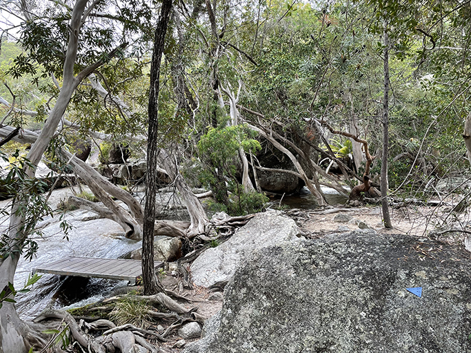
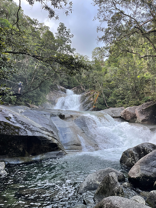
Emerald Creek Falls
Turning off Highway One near Mareeba the drive out to Emerald Creek Falls is about 12km, the last six of which are unsealed with some steep sections. Not a great road for trailers or caravans.
At the end of Emerald Falls Road there is a carpark and if you are just after a quick swim there are tracks to the creek from here where you can find your own private swimming hole. Emerald Creek Falls has some of the most spectacular swimming holes around Cairns, with multiple places you can swim in deep pools.
If you are happy to walk a little further, follow the wide trail at the end of the carpark upstream along the creek.
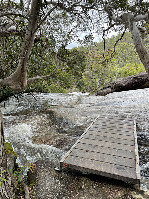
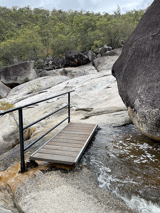
After about 600m the track divides. The left fork goes for another 200m to the ‘Bottom of Falls’ where Lower Emerald Creek cascades into a deep pool. There are plenty of options here for a private plunge pool as a series of cascading waterfalls tumble over the granite boulders creating a chain of swimming holes. This section of track is graded 4 and while it is not difficult to follow through the eucalypts and water gums, it can be quite slippery even when the rocks are dry.

The fork to the right will take you about 400m up to a fenced lookout at the top of the falls with a great view of the top section of the waterfall and back down the creek.
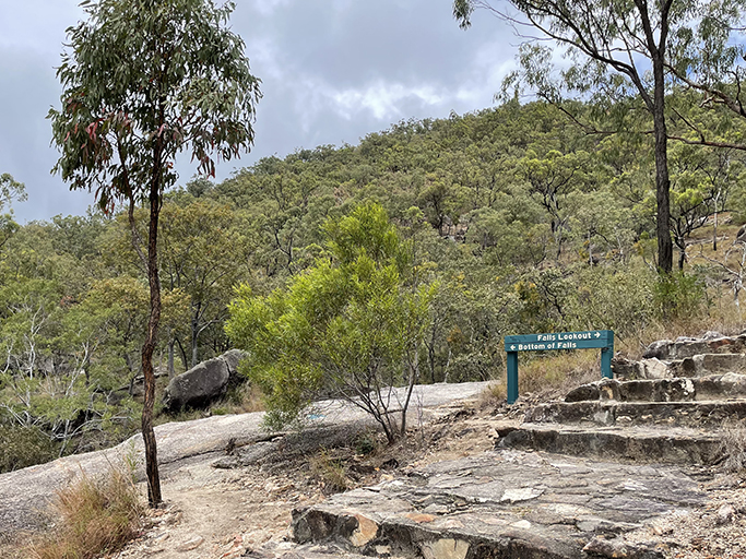

The return walk to Lower falls is 1.6km, the return walk to the lookout is 1.9km.Walking to both lower falls and the lookout is about 2.4km. There is no camping at Emerald Creek but you can find a map of the walks here.
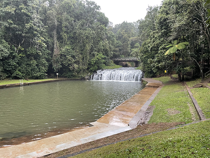
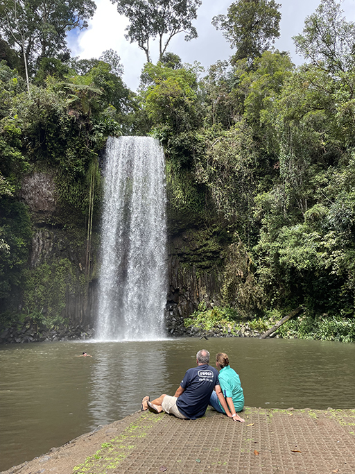
Malanda Falls
Many of the waterfalls on the Atherton Tablelands are going to require at least a short walk to get to, but Malanda Falls are right next to the main road, just near the visitor information center.
The falls are low and wide, flowing under the Malanda Atherton Road and over old basalt lava flows into a man-made swimming pool. The area is supposedly safe for swimming, except after very heavy rain and there is a little beach and plenty of shallow spots for children to paddle. The pool is surrounded by large grassy areas perfect for picnics and barbecues with terraced gardens and lots of shade.
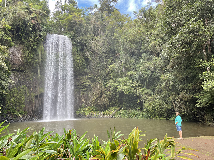
Millaa Millaa | Zillie Falls | Elinjaa Falls
These three waterfalls are all very close, not walking distance but only a few minutes drive apart. Known as The Waterfall Circuit, simply follow Theresa Creek Road for 17km in a loop from the town of Millaa Millaa.
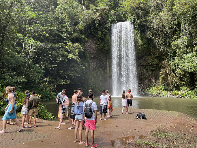
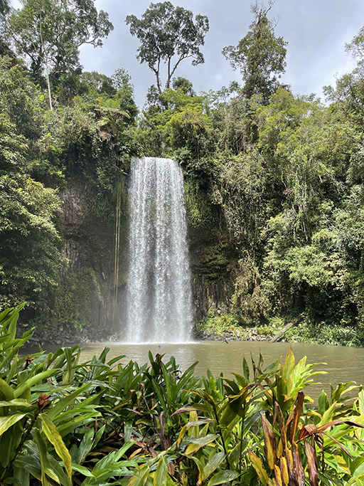
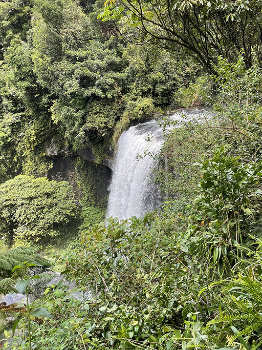
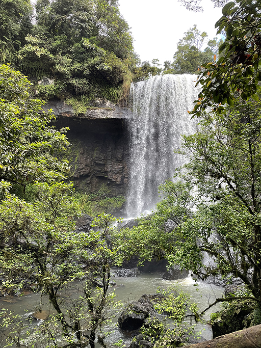
Millaa Millaa falls is the most famous. You have probably seen shots of the stunning cascade tumbling into a beautiful swimming hole surrounded by lush rainforest. Unfortunately, its fame has brought with it the crowds. When we arrived at Millaa Millaa there was a bus of high school students swimming under the falls which did somewhat ruin the serenity of the place. Determined to get my Instagram moment we waited for them to leave so we could take some photos in peace (even though the weather wasn’t fabulous). Its popularity is also encouraged by the easy access – you can see the falls from the carpark, and it is only a few meters to walk to the edge of the pool.
Just eight minutes scenic drive away is Zillie Falls. A well-formed level path takes you to a viewing platform at the top of the falls. The falls are nice from here, but the trees have grown since the platform was built and you can’t really see the whole cascade. So we decided to head into the bush and see if the view improved. There is an unmarked rough track that starts behind the far end of the lookout and with all the rain we had been getting lately it was quite muddy and slippery. About a hundred meters through the rainforest you come out downstream of the falls. At 30m high this is the tallest of the three falls on Waterfall circuit but even from the bottom it isn’t a very clear view of the whole cascade. But is more than you see from the top.
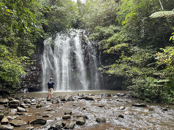
Ellinja Falls are about 200m from the carpark down a well-formed path with some steps – it can be slippery when wet but worth the effort. The path brings you to the gentle cascades downstream of the falls and walking a few metres upstream will bring you to the swimming hole at the base of the fall. There were some brave souls taking a dip in the pool and apparently there is a hidden ledge behind the falls that you can sit on to admire the scenery.
Big Millstream Falls
Just off Highway One, near Ravenshoe, at the southern end of the Atherton Tablelands a 700m paved walkway takes you to a viewing area over these spectacular falls. Reputedly the widest single drop fall in Australia, The Millstream waterfall plunges steeply down basalt lava columns into a wide freshwater pool.
These last two are not strictly on the Atherton Tablelands but if you are heading back to Cairns via Innisfail you will be going past them and they are both worth a visit…
Josephine Falls
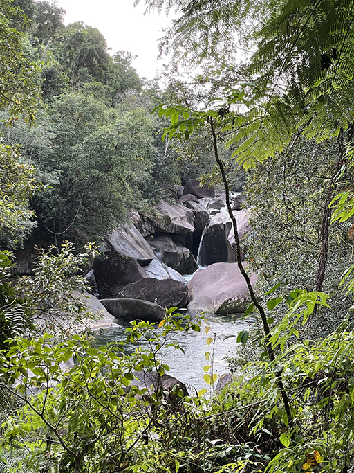
Josephine Creek starts as a trickle on the summit of Queenslands highest peak, Bartle Frere, before flowing into the Russell River. Approximately 7.5km from its source the river tumbles over massive granite boulders, forming the picturesque Josephine Falls. One of the most beautiful we saw in Far North Queensland.
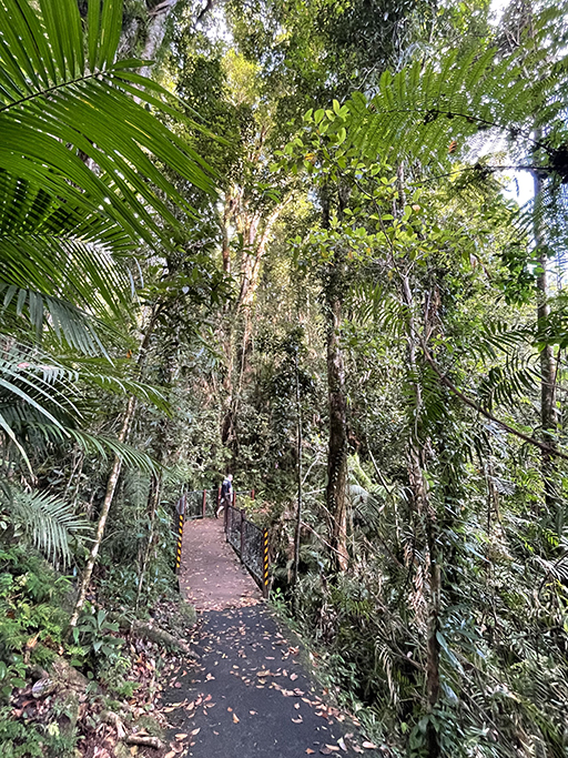
From the carpark there is an easy well-formed walking track of about 700m to the Top Pool Platform which is the furthest lookout. This raised viewing area offers a great view of the waterfall leading to several other sections of cascades and eventually the bottom pool. There is no access for swimming in the top pool and there are plenty of warning signs to reinforce this. A little way back along the track is the Middle Creek Platform where you can get a bit closer to the river overlooking the bottom pool. However the main attraction at this popular swimming hole is the Bottom Pool with its natural water slide. Hundreds of years of water flowing over the granite rock face has worn it down to form a smooth flat surface, creating an all-natural fun park entry into the crystal clear water.
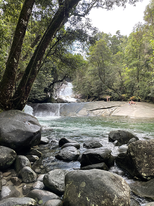
Near the carpark are BBQs, picnic tables and toilets, everything you need for a great day out. The carpark isn’t huge so get in early on a sunny day to secure your spot. Water conditions can be unpredictable and hazardous after heavy rain – even if that rain was a distance away. Safety signs indicate water depth and when levels are high you should put your swim off for another day.
Babinda Boulders
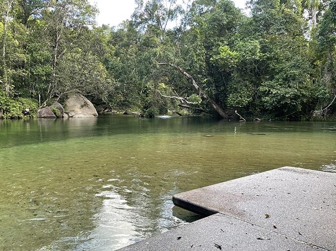
Just outside the township of Babinda, surrounded by rainforest, is a beautiful swimming hole called Babinda Boulders. There are BBQs, picnic tables and toilets if you are looking for a day out, or just drop in for a splash in the crystal-clear creek. An extra bonus is a 72-hour free camp site just to the right before before you reach the picnic area.
A short walk from the car park is a wide shallow swimming area. A concrete path leading down to the edge of the sandy bottomed creek. The water is invigorating, verging on icy, and flows steadily but not too fast to be a problem. On a hot Queensland day, it is just what the doctored ordered.
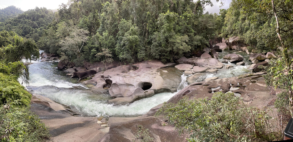
Further downstream is an area known as Devil’s Pool. A 1.3 km return walk from the picnic area undulates along a rough bitumen track. The walk leads through the rainforest to two viewing platforms where the creek cascades down a series of spectacular waterfalls and washpools snaking through the boulders. As spectacular as the rock formations and turquoise waters are, there is no swimming allowed in this section of the creek.
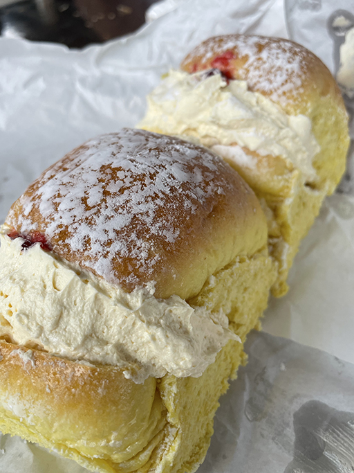
Another must see in Babinda is not waterfall related, but is just as spectacular. Near the beginning of the main street you will find the Babinda Bakery, a good old fashioned country bakery famous for their cream buns and pies.
