Cape York Adventure Part 1
Cairns to the Jardine River
Cape York is one of Australia’s ultimate 4WD destinations and not for those without a sense of adventure. Crystal clear waterfalls, 4WD tracks for any level of challenge, rainforest, wetlands and a history covering the gold rush in the 1800’s through to WW2.
Cape York Peninsula encompasses everything north of Cairns. The Northern Peninsula Area (NPA) is the area above the Jardine River, about 25km long, from the river crossing to the very northern tip of Australia. It is a beautiful but remote area with a few small settlements and only basic supplies available. Exploring this area requires planning. Carrying the correct equipment is a must. If you have any problems on Cape York, you are a long way from anywhere to get things fixed.
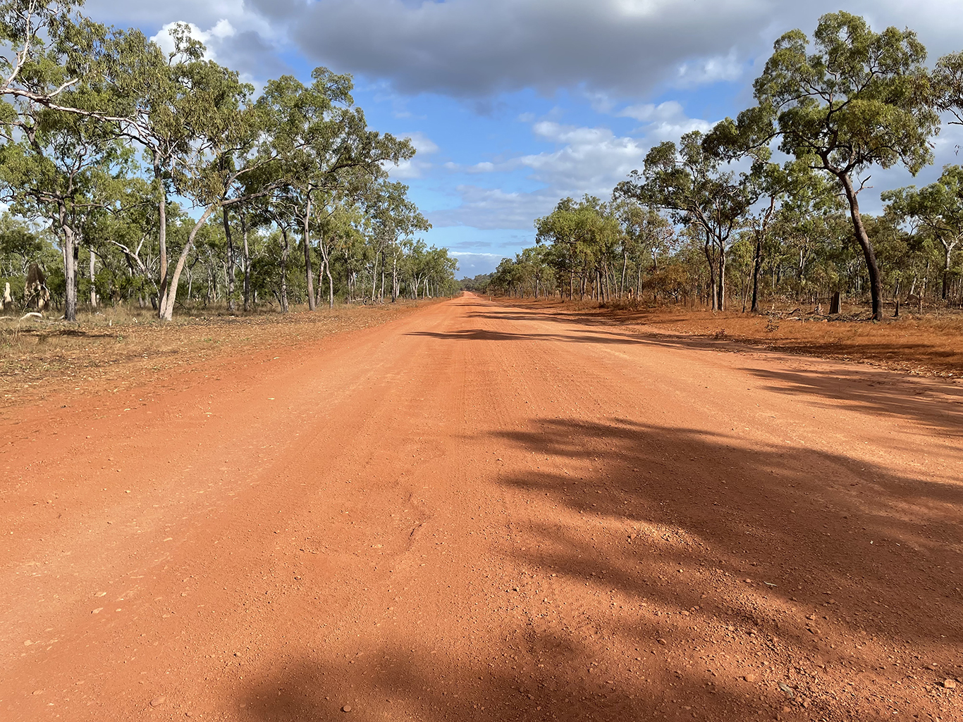
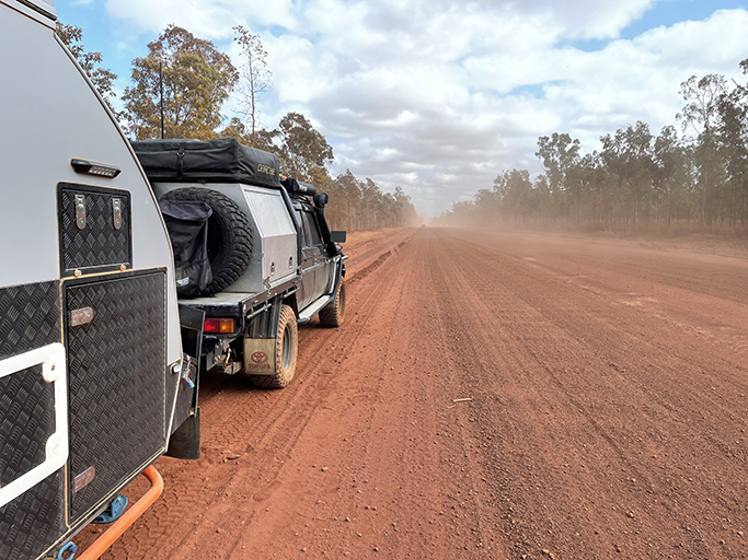
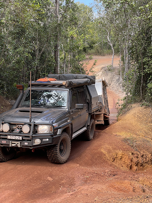
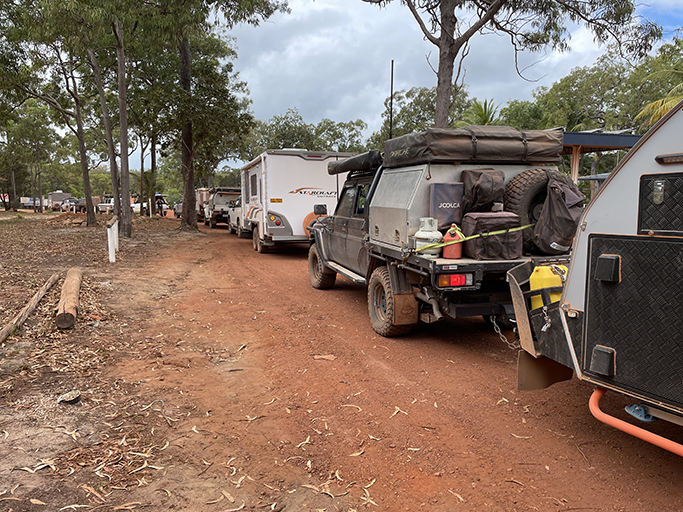
Driving the 1000km north from Cairns to the top feels like being in the middle of a migration. 4WDs from all over Australia heading north for the dry season. Off road vans, roof top tents and swags strapped to roof racks making their way through the red dust. If we had a dollar for every Land Cruiser we saw we could have paid our fuel bill for the trip several times over.
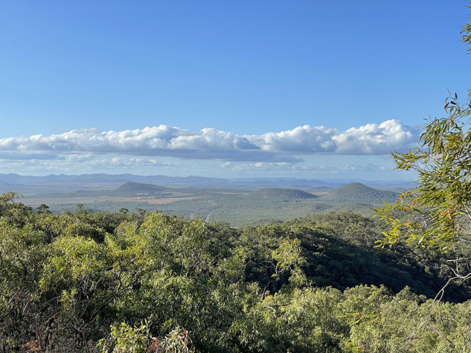
Our plan was to go straight up the middle of the peninsula to the tip and then spend more time exploring on the way back down. The journey up the Peninsula Development Road (PDR) takes you through some stunning outback landscapes. Red dirt alternates with stretches of bitumen and the condition of the road can be quite variable. We were lucky on our trip that much of the road had recently been graded, along with travelling early in the season so the corrugations were not as bad as they could have been.
Getting started
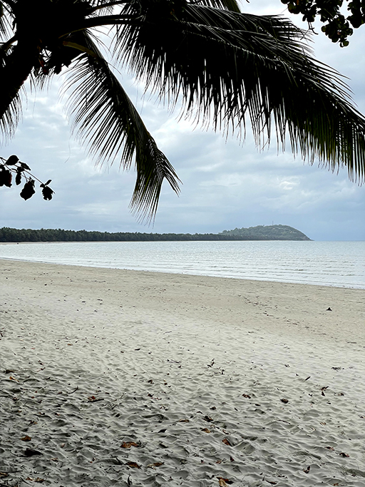
If you followed my instagram posts of our travels through QLD you will know that it was not without drama. Our stay in Cairns was extended while we worked out our new travel plan and we were very happy to be getting on our way again. Leaving late morning we headed up the very scenic Captain Cook Highway towards Port Douglas and stopped at Four Mile beach for a picnic lunch. From here the road goes up over the Great Dividing Range on to the Mulligan Highway.
Lakeland and Laura
Breaking up the kms of dusty driving on the way up the PDR are the roadhouses. Dotted along the highway these local stores are a welcome sight, offering fuel, basic supplies and often the chance to break the trip with a drink, a meal or a campsite for the night.
The first of these is Palmer River Roadhouse. Perched on the hill above the Palmer River it is the lone survivor of what was once a thriving prospecting area. The Palmer River was the richest alluvial goldfield in Australia, Cooktown started out as a port town for the gold from Palmer River. In the 1870s tens of thousands of miners flocked to this area. Upstream at Maytown in the Palmer Goldfields you can explore the remnants one of Northern Queensland’s most famous goldfields.
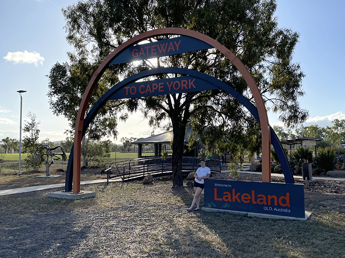
Shortly after crossing the Palmer River, on the right, is the James Earl Lookout. It is worth stopping for the breath taking view over the Cape and a series of interpretive signs that give a fantastic rundown of the history and ecology of the peninsula. Where the Mulligan Highway meets the PDR is the settlement of Lakeland and we took our mandatory photo in front of the ‘Welcome to Cape York’ sign. This is where the adventure really begins.
Our next stop is Laura. The Peninsula Hotel at Laura offers camping, but it pays to book ahead. We missed out on the way up but stayed a night on our way back down. Powered and unpowered camping with showers, toilets and water, unfortunately the laundry was out of action when we stayed. The pub is a classic little country pub with a fabulous covered deck out the back, perfect for a cold beverage to wash away some of the red dust. To top it off the pub does the best lamb shanks I have had in a while.
If camping at the pub is unavailable there are other options in Laura. On the main road there is the Ang-Gnarra Caravan Park, and at each end of town there is free camping off the highway down by the river. The river camping looked nice but the road down to the waters edge was very sandy and the prospect of getting bogged on our first day out of Cairns was unappealing, so we pushed on a little further.
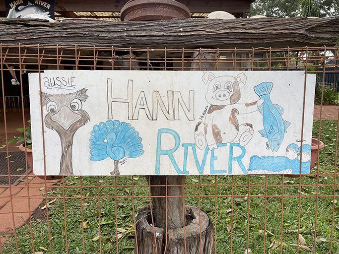
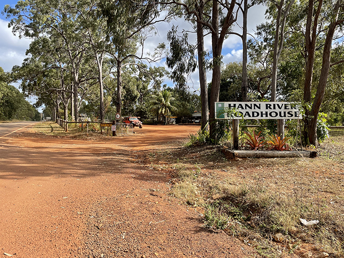
Hann River Roadhouse
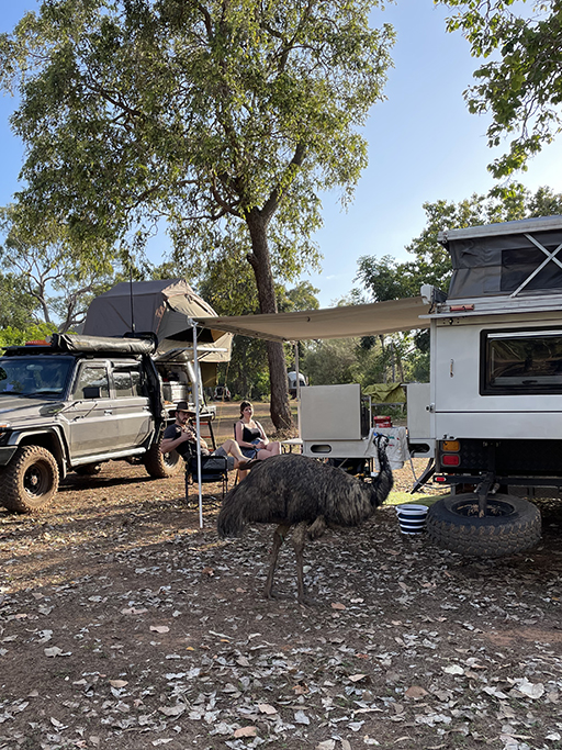
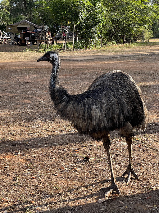
An hour north of Laura is Hann River Roadhouse. It was dark by the time we pulled in, but there was plenty of camping available. We picked our site under the watchful eye of Aussie the Emu and set up camp for the night. The facilities at Hann River are good, along with standard toilets and showers there are some fabulous open air showers. Surrounded by corrugated iron for privacy, the quirky shower cubicles offer a chance to cleanse yourself under the bright blue of the Queensland sky. Don’t be afraid of the occasional cane toad watching from the corner, he won’t tell anyone what he has seen.
Hann River Roadhouse has a small shop with a few essentials and offers meals and fuel for weary travellers. They have quite a menagerie to entertain the kids, with chickens, ducks, a peacock, a pig and rescue wallabies. We were saddened to hear that Aussie the Emu was killed just a few days after our stay, he was quite a character.
The next morning we topped up the fuel tank before heading out on a long day of red dust and varying levels of corrugations. A quick break at Musgrave Station where you could be excused for thinking you had pulled into a used LandCruiser car yard. We treated ourselves to some of their famous hot chips and gave our bodies a rest from the vibrations. Our next stop was for fuel again at Coen, where we also bought a few supplies and some ice creams at the small supermarket.
The next sign of civilisation was the Archer River Roadhouse. We sailed past this stop on the way up but stopped when we were heading back south and treated ourselves to an Archer burger and chips – one between two people was more than enough. About 50km past Archer River the PDR swings left toward Weipa and we keep heading north on what is now the Telegraph Road.
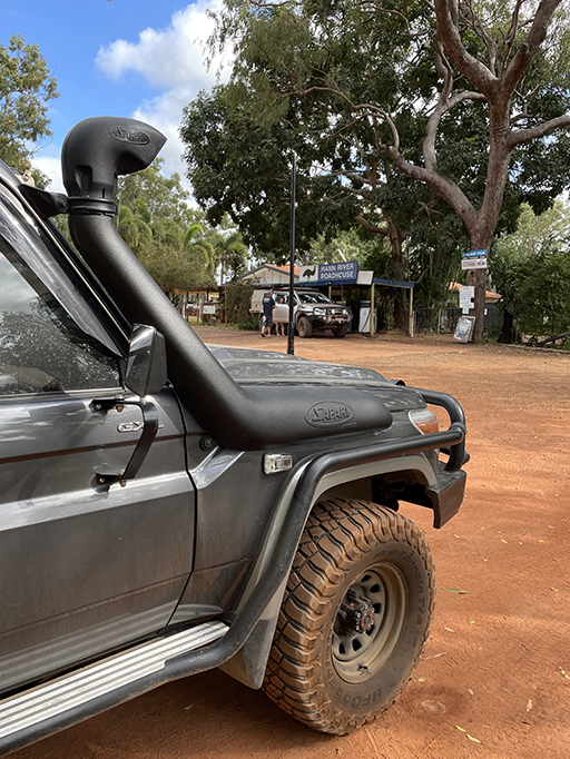
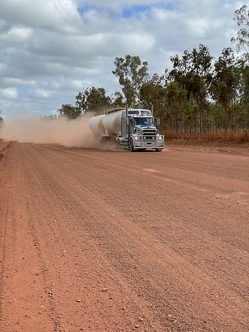
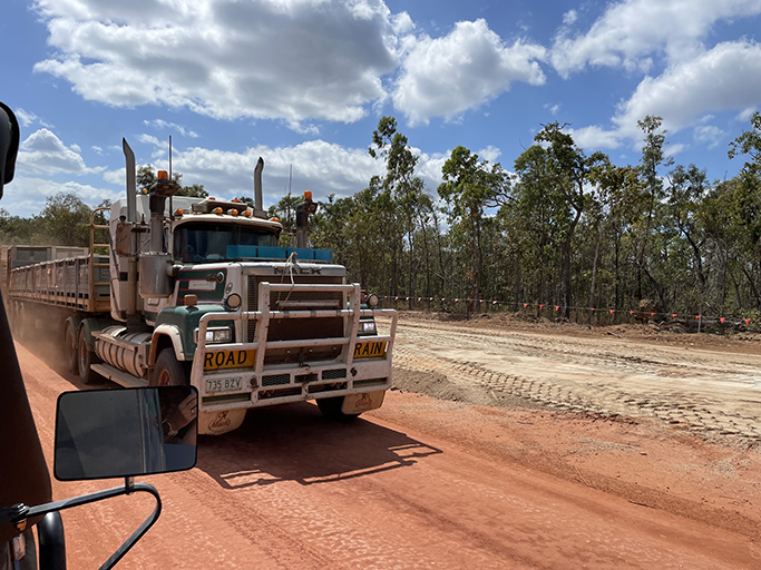
By this point we hadn’t seen bitumen for a while and the red dust was starting to seep into everything. Driving on these roads requires a lot of concentration, with corrugations, bull dust, road trains and wildlife all thrown into the mix. Some sort of radio communications is a must so you can listen and talk to other drivers on the road.
Bramwell Station and Roadhouse
Bramwell had me a bit confused when I was doing research for this trip. There is Bramwell Roadhouse and Bramwell Station Tourist Park. Although both businesses were once owned by the same people, the two sites are quite separate.
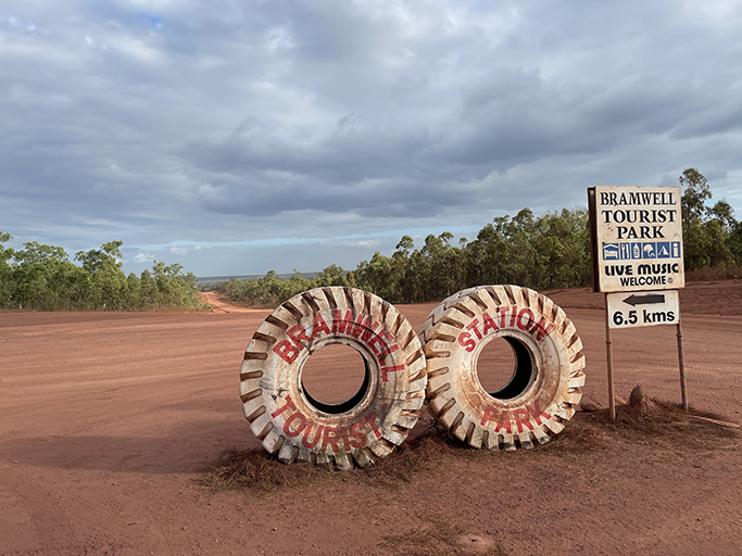
The first one you come to is Bramwell Station Tourist Park. You will see the iconic white painted tyres marking the turn off. From the turn off it is about 6km to the entrance of The Station. Camping here can’t be booked but the camping area is huge, just roll up and pay at the bar then set up camp wherever you fancy. There is no power but there are toilets, hot showers and free wifi included in your $30 per car camping fee, you are also welcome to fill up your water tanks. But the main attraction is the dinner and show that they put on every night in the open air bar. Live entertainment, may it be a singer, comedian or magician, is accompanied by a traditional country buffet dinner. The dinner and show you do have to book, and don’t leave it too late as it fills up fast.
Until recently Bramwell Station was the most northerly cattle station in Australia. It has now been purchased by the Queensland Government in the name of conservation but, to the relief of us northern adventurers, will continue to operate as a tourist park.
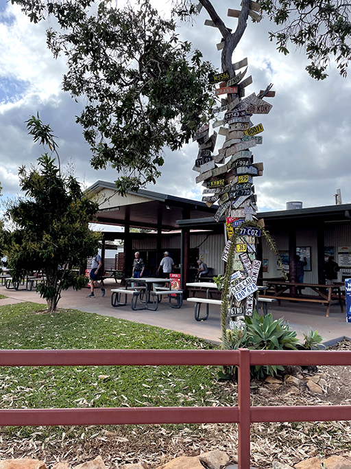
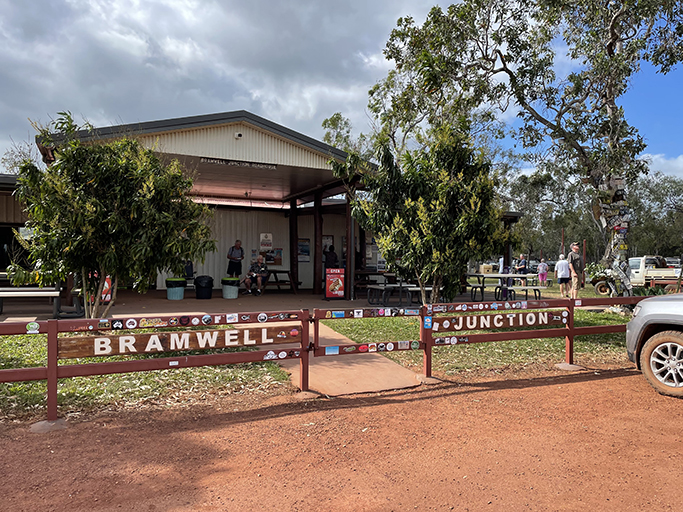
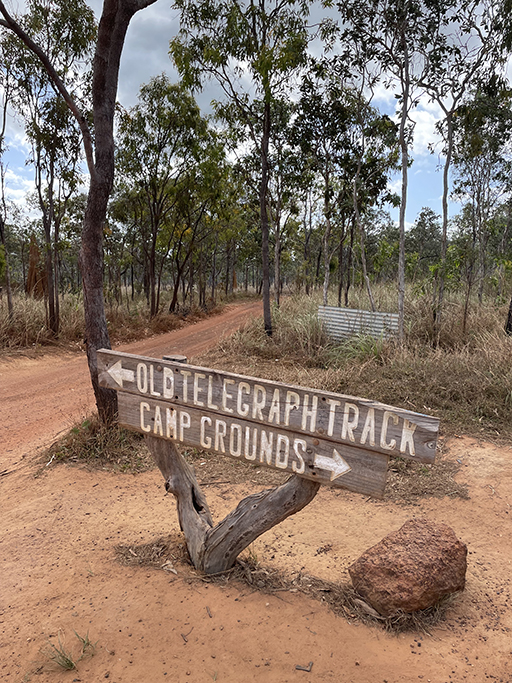
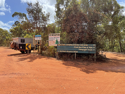
A few km further north, at the junction of The Old Telegraph Track and the Bamaga Road is Bramwell Junction Roadhouse. The roadhouse also offers camping – and this one can be booked. The shop has the usual offerings – fuel, takeaway food, cold drinks and a few supplies, check out the number plate tree out the front.
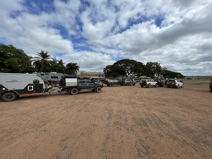
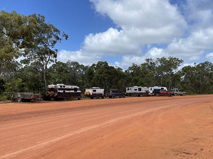
A very popular fuel stop for people heading up the OTT, the queue can get quite long first thing in the morning. We stayed at Bramwell Station Tourist Park for two nights, giving us a whole day to explore the southern section of the Old Telegraph Track. We weren’t brave enough to drive the whole thing, not interested in doing any damage to what was quite a new car and bringing our trip to a premature end. Definitely not towing the van along it.
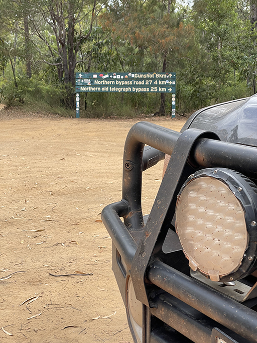
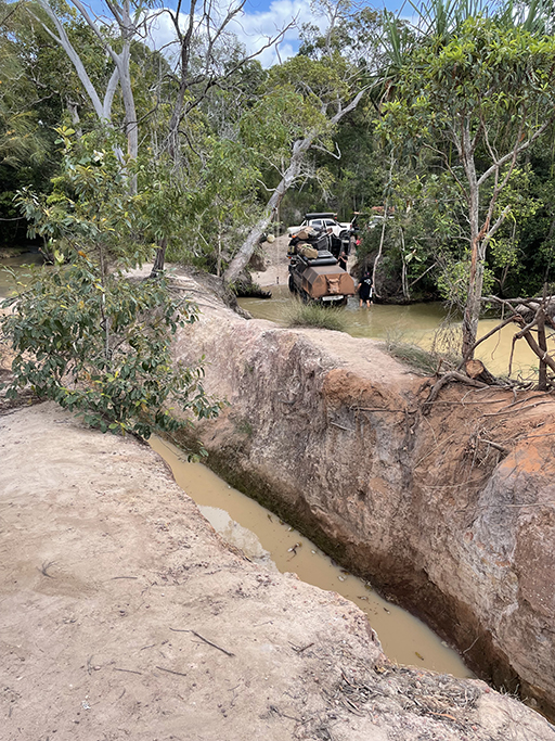
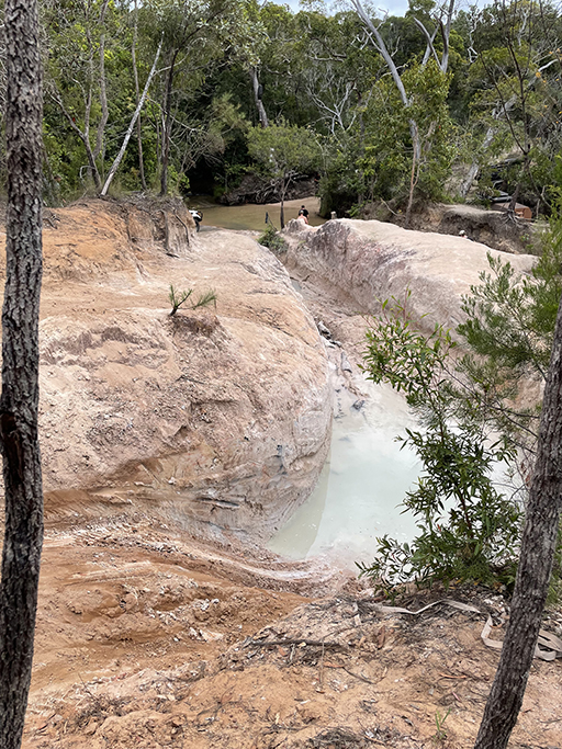
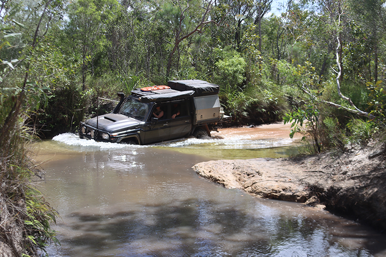
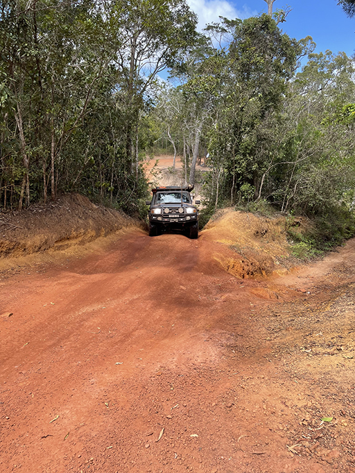
From Bamaga Road you can cut through the Heathland Regional Park to the OTT and have a little look-see at parts of the famous track. We took the Southern Bypass Road to check out Gunshot first and just missed a group who had made the crossing. Parking off the track we had a wander around and confirmed there were not any creek crossings here that we would attempt. The damage to the cars on the other side of the creek reassured us that we had made the right decision. Backtracking south we checked out Bertie Creek and Dalhunty River crossings before heading back to the main road and the roadhouse for an icecream.
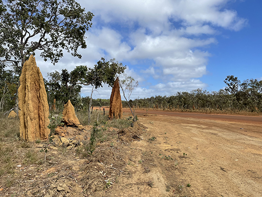
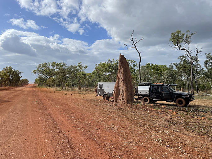
Since beginning our road trip through Queensland we have been impressed and amazed by the termite mounds dotted along the sides of the roads. In some places they stretch for as far as the eye can see in their hundreds. The shape and colour of the mounds varies in different areas and depending on the species of termite, and as we head north the size of some of these mounds has become staggering. There are some great examples of these towering structures along the road near Bramwell Roadhouse and Station.
Eliot and Twin Falls
After our second night at Bramwell Station we hitched up the van and headed up to the Northern section of the OTT. We had a camp site booked at Eliot Falls but had heard mixed reports about towing a van into the camp area as it is 8km up the OTT. The number of signs we saw advertising 4WD rescue and repairs wasn’t very encouraging either.We were hoping there would be somewhere we could leave our house on wheels while we checked out the condition of the track, we weren’t the only people with this thought. The side of Bamaga Road near the OTT was like a caravan sale yard. We added our little camper to the line-up and drove the 8km up to Eliot Falls.
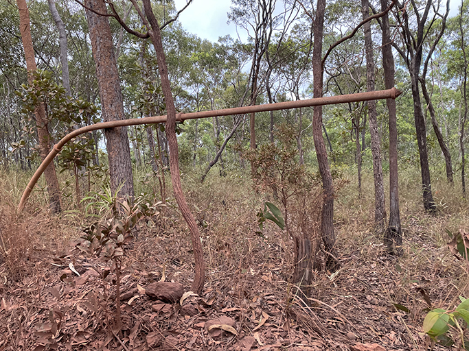
The track had some rough spots and there is one creek crossing but over all we decided it was doable and the camp site was worth the effort. 8km back to pick up the van and a slightly slower trip up to set up camp. Dotted long the side of the OTT are the original telegraph poles, now a little worse for wear. Until 1962 the Telegraph Line was once the only method of communication for those living on the Cape York Peninsula, with just two wires sending morse code via repeater stations in the old homesteads along the way. The line was still used for telephone cable until 1987 when it was finally dismantled.
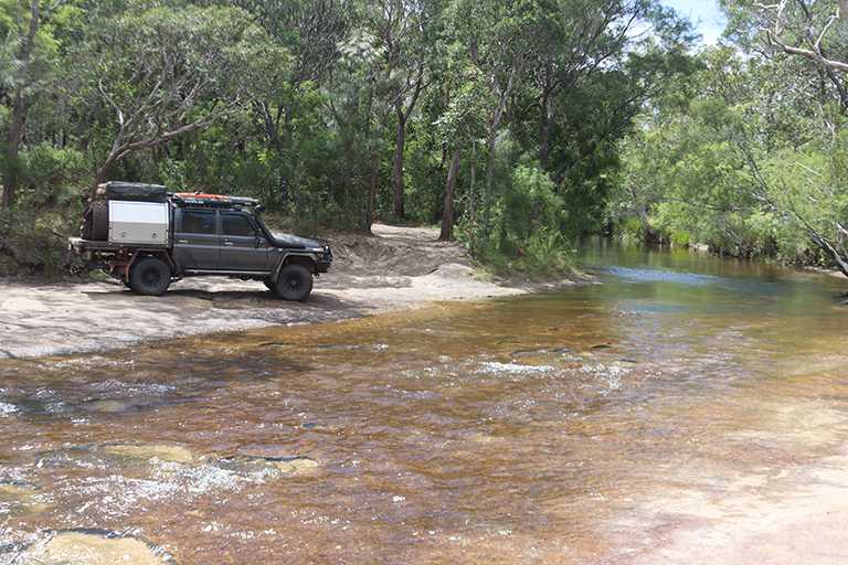
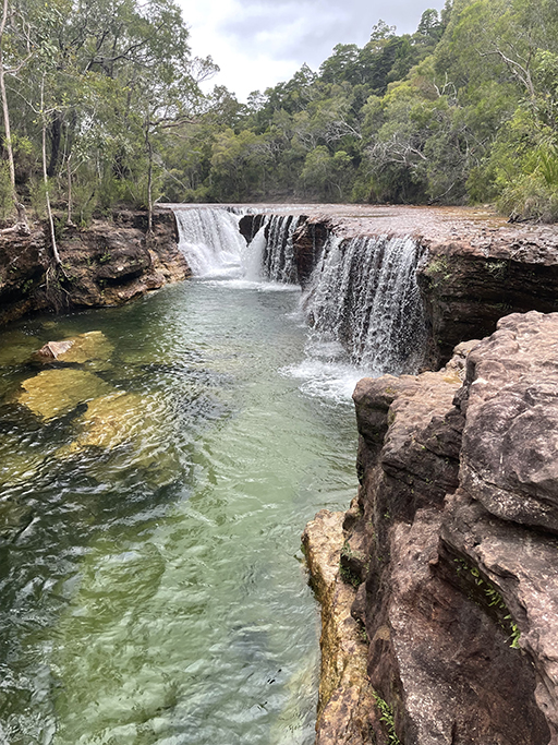
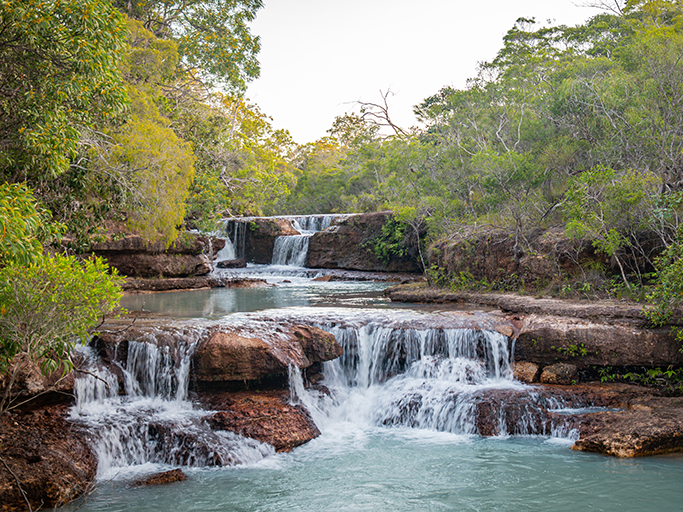
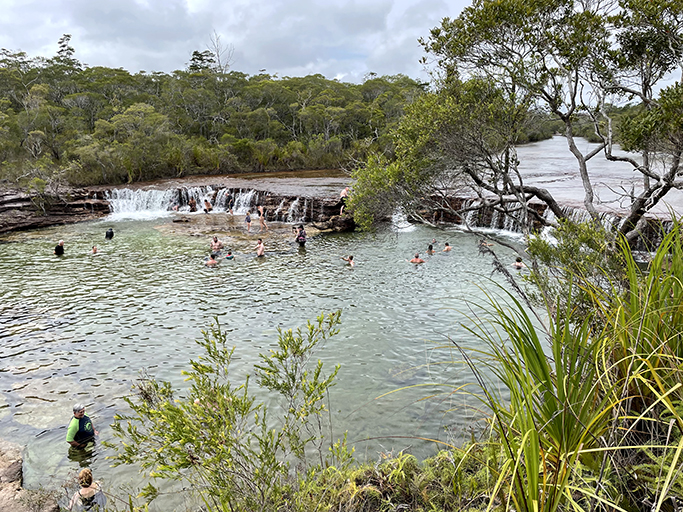
We had two nights camped at Eliot Creek, which was a lovely opportunity to relax and swim in the waterfalls. This is a National Park camping area and has drop toilets but no other facilities. The camp sites are numbered, a good size and nice and flat. Marked walking tracks lead down to the various falls, Twin Falls and Eliot Falls being the most famous, but our favourite was the Saucepan. We wandered down from camp several times to float in the crystal clear water and cool off. In the middle of the day it became busier with day trippers stopping for a swim, but early in the morning and later in the day when it was only the campers around, you had a good chance of getting a waterfall all to yourself.

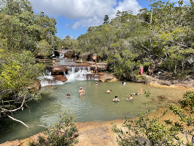
Fruit Bat Falls
After our stay at Eliot Falls we backtracked to the Bamaga Road and made a quick detour to Fruit Bat Falls. It is only 2.6km from the intersection of the Old Telegraph Track and Bamaga Road but we dropped the van on the side of Bamaga Road again as we weren’t sure what the condition of the track would be. We were surprised by the ease of access and facilities at the end of it. The dirt track, while narrow, is an easy drive in a 4WD and at the end of it you will find an enormous car park with room for caravan/trailer parking and tour buses. There are multiple toilets blocks and picnic areas. An easy walking track to the falls varies from gravel to boardwalk and only takes a few minutes.
Which is probably why the falls looked a bit like a public swimming pool when we arrived. Teaming with bodies in and out of the water. I was the only one in our group willing to take the plunge with the crowds, mostly just so I could say I had swum there. A quick paddle to sit under the waterfall for a second and then we were on our way again. Such a beautiful spot, but our experience was very disappointing after the peace and quiet of our previous camp, possibly we were victims of very bad timing.
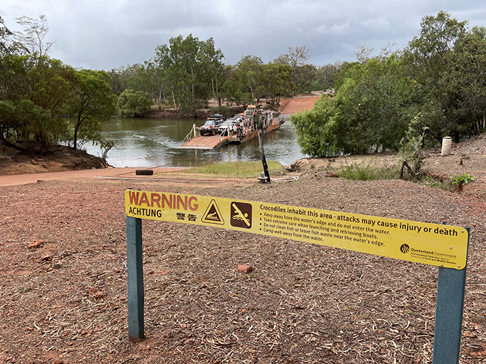
Crossing the Jardine River
More red dust and corrugations to get to the Jardine River Ferry, the most expensive ferry we have ever been on and the only way to get over the river to the Norther Peninsula Area. $175 for a car and van to ride over what was only a very narrow stretch of water. The good news is that your ticket includes camping at non-commercial camp sites in the NPA and the return ferry ride is free!
The queue when we arrived was about 100m long and was moving steadily, which was a relief. The ferry can probably hold about 6 cars on a good run, but given that the cars are all large 4WD and a lot of them are towing, it was often only 2 or three at a time, and occasionally only one if they had a big van. We paid for our ticket and waited our turn, being entertained by watching the loading and unloading of vehicles on each side of the river and excited to be getting closer to the top of Australia.
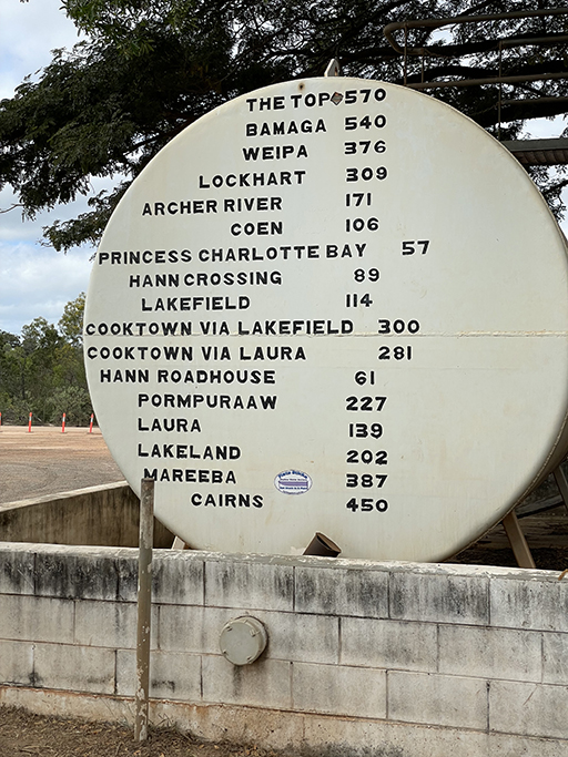
Some basic distances and times.
We had a top speed of about 80km/hour on the corrugated roads, at that speed you kind of glide over the bumps and it actually feels a bit better. Getting up to 80km/hour is the hard bit.
Cairns to Lakeland 248km – about 3hrs (sealed road)
Lakeland to Laura 61km – about 1hr
Laura to Hann River Roadhouse 76km – about 1hr
Hann River Road House to Musgrave 62km – about 1hr
Musgrave to Coen 108km – about 1.5hrs
Coen to Archer River Roadhouse 65km – about 1 hr
Archer River Roadhouse to Bramwell Roadhouse 165km – about 2 – 2.5hrs
Bramwell Roadhouse to Jardine Ferry 171km – about 2 – 2.5 hrs
Jardine Ferry to Bamaga 41km – about 45 minutes
Fuel Costs
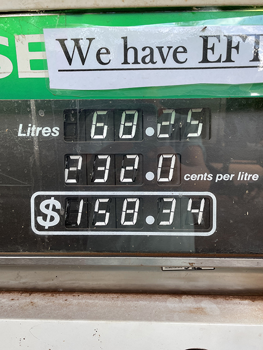
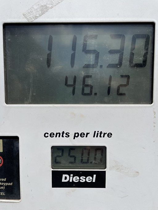
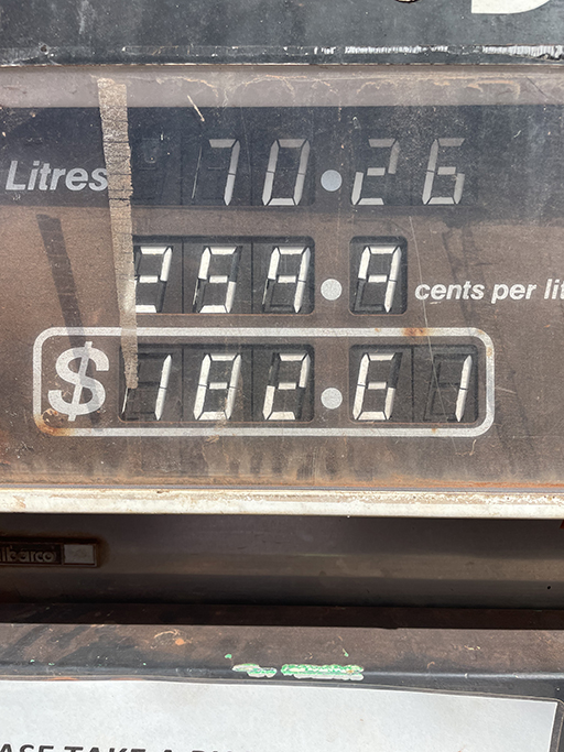
We refuelled (diesel) at…
Cairns $2.07/litre | Hann River Roadhouse $2.32/litre | Coen $2.50/litre | Bramwell Roadhouse $2.60/litre
