Cape York Adventure Part 2
The Top of Australia
Of our three weeks exploring Cape York we spent five days exploring the Northern Peninsula area (NPA) which stretches from the Jardine River to the top of Australia.
Bamaga
After crossing the Jardine on the ferry, the road continues past the small communities of Injinoo and Umagico and we make our first brief stop to restock in Bamaga. There is a small supermarket here, a bakery and a pub with a bottle shop.
The supermarket had a good range of most groceries, and the staff were lovely, chatting with us about our trip and suggesting things to see and do. While the prices were a little higher than they are at home they were not as bad as I had expected. Fresh fruit and veg was the exception, as you can imagine, transporting fresh produce this far north is difficult and costly. The selection was limited and the prices were high. Bread was also an issue, apparently they freeze it to make it last the trip up and it is not as fresh as we are used to. We discovered the little bakery after a couple of days which was a much better option.
Alcohol restrictions apply to many areas of Cape York and the rules change depending on where you are travelling. The limits are per car not per person, so the fact that we had four people in one car meant we had less choices. In the NPA there are no straight spirits, but you can buy premixed cans. The limit was one case of EITHER premixed spirits OR beer, PLUS up to 2 litres of unfortified wine. Unexpectedly alcoholic cider was considered the same as wine (I thought it would be the same as beer) so along with our case of premix we could buy a few cans of cider – each six pack in the shop had one can removed to keep it under the 2 litre limit.
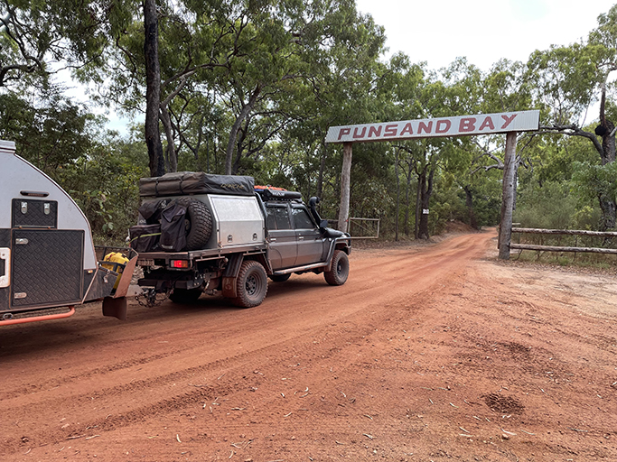
After stocking up the fridge we headed off to Punsand Bay via the infamous Croc Tent. There are not a lot of options for retail therapy on Cape York and if you are after souvenirs your best bet is the Croc Tent. The girls working here are lovely and there is a huge range of knicks-knacks and clothing to help you remember your adventure. We refrained from purchasing the very popular fishing shirts but still managed to spend a few dollars on some new fashion items.
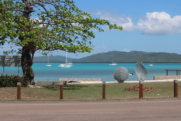
Punsand Bay
I had booked two nights at Punsand Bay, the camp area is very popular and you should book well ahead. I made our booking four months ago and we were disappointed to find we were given a tiny site in the back blocks well away from the famous beach front camping. When we planned this trip we had allowed for two cars and a van, and that is what I had booked for, there is no way we would have fitted in this space if our plans hadn’t changed. With no other options available we squeezed the van and car onto the site and made the most of what we had been given.
Punsand Bay is a lovely spot and is the closest camp site to the tip of Australia. The famous wood fire pizzas didn’t disappoint, although with no tables available we paid the extra $1 for a takeaway box and ate ours on the beach while watching the sunset. The upside of this was we could BYO drinks instead of paying bar prices for alcohol.
Loyalty Beach
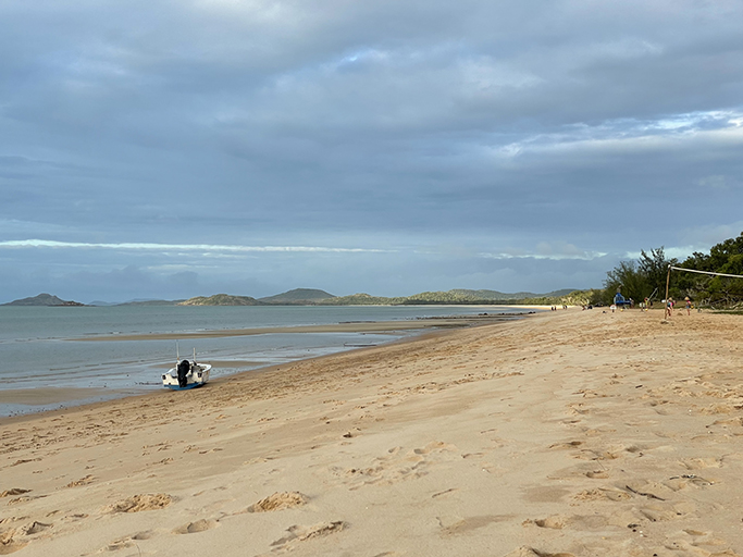
Once you have crossed the Jardine river nothing is very far from anything, so after a bit of scouting around we decided to move camp sites to Loyalty Beach. The camp ground at Loyalty Beach doesn’t take bookings, you just rock up and pick a site then go to the kiosk and let them know you where you have set up and pay. $14.50 per person + 10/night for power, a bit cheaper than the $100 per night we paid at Punsand Bay for four people without power. There is a restaurant at Loyalty Beach that does a very popular fish and chip night on Fridays, lucky we arrived on a Friday – that’s dinner taken care of.
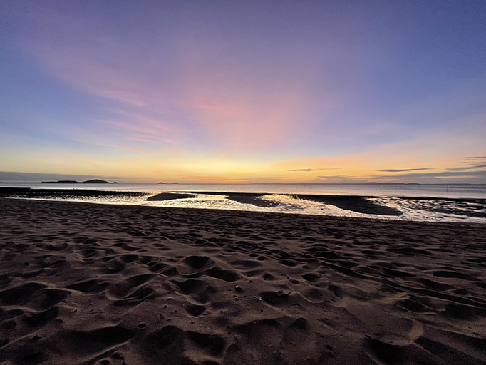

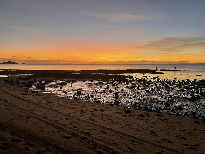
The sunsets on Cape York never disappoint
We also popped into check out Alau Beach camp while we were driving around. Looks nice and had heaps of space, works in a similar way to Loyalty Beach with no bookings. Probably a bit quieter with no restaurant or bar.
WW11
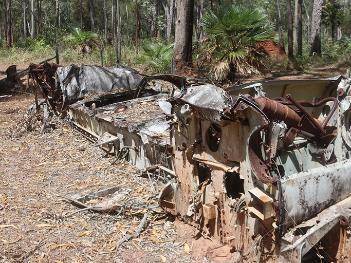
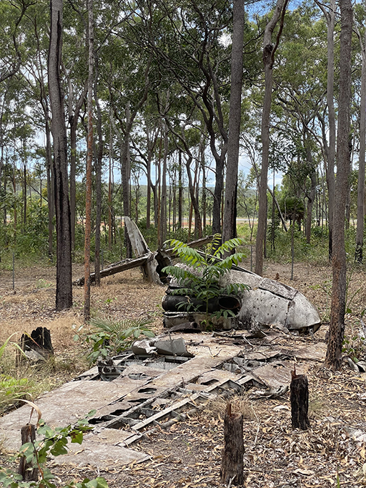
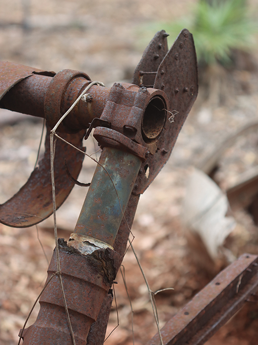
Once we were settled in our new camping spot we went for a drive to explore some of the historic WWII sites scattered over the peninsula. There are several plane wrecks you can visit near the Tip, where there were functioning allied air bases during the war. It’s a reminder just how close the fighting was to Australian shores.
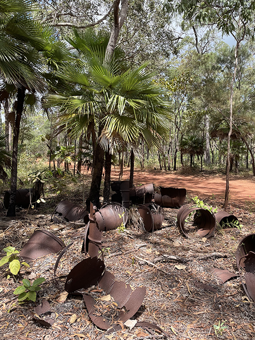
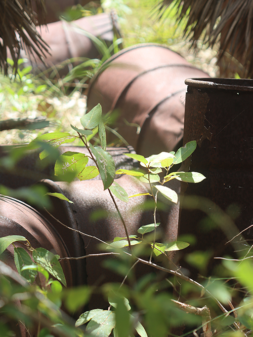
Just north of what was Higgins Airfield, and is now Bamaga Airport, you can find the fuselage and wings of a RAAF Beaufort bomber. This area was probably a salvaged parts dump, the bush around the airfield is littered with rusting fuel drums and while the track is narrow it is a clear and easy drive.
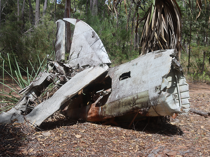
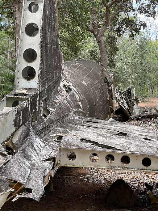
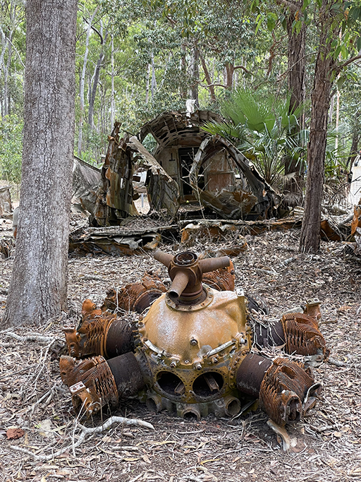
At the junction of the Peninsula Development Road and the Bamaga Airport Road you can see the wreck of a C-49 transport aircraft that crashed and caught fire while coming into land on a flight from Brisbane. The pilot, crew and passengers all died in the crash. The tail section, wings and engines of the wrecked aircraft have been arranged within a fenced area and a monument erected.
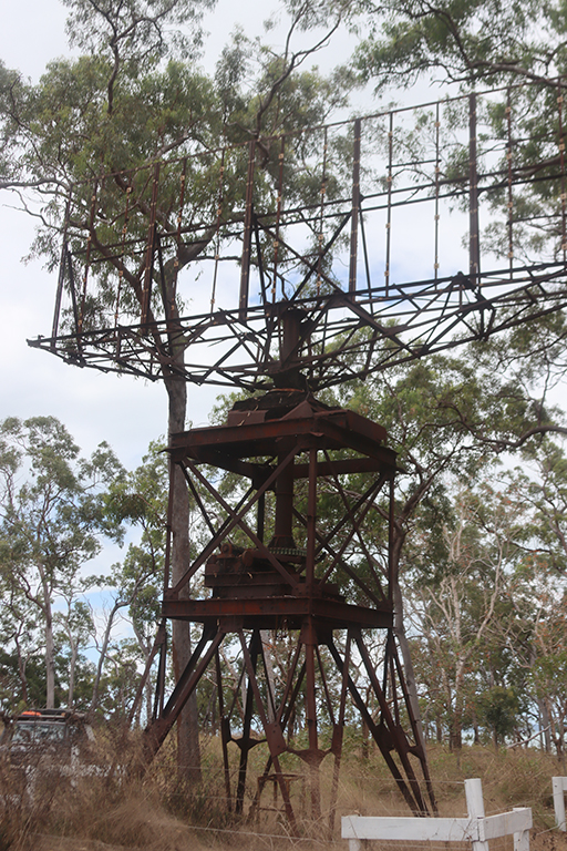
West of Injinoo, at Muttee Head is what remains of a RAAF 52 Radar Station built during 1943. Its surviving radar tower and aerial is the only intact example of a World War II Air Warning radar tower on its original site in Queensland.
The WW11 history of the area is extensive and if you are interested in knowing more there is some good information on the Queensland Government website
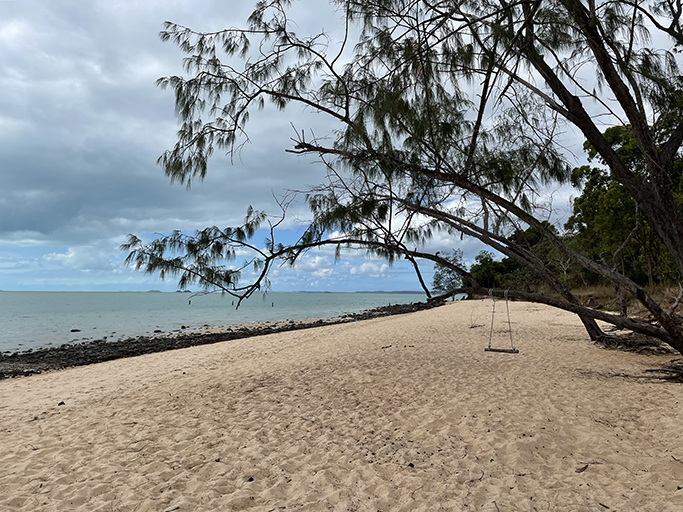

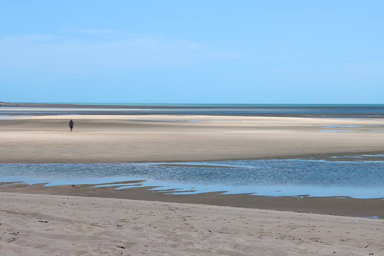
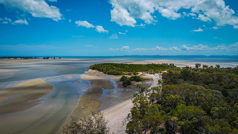
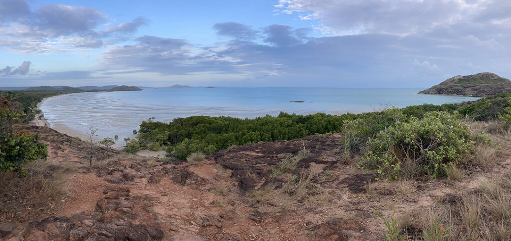
Mutty Head and the Mouth of the Jardine
While at Mutty Head it is worth heading down to the beach. There is free camping here and the fishing is supposed to be pretty good although we had no luck.
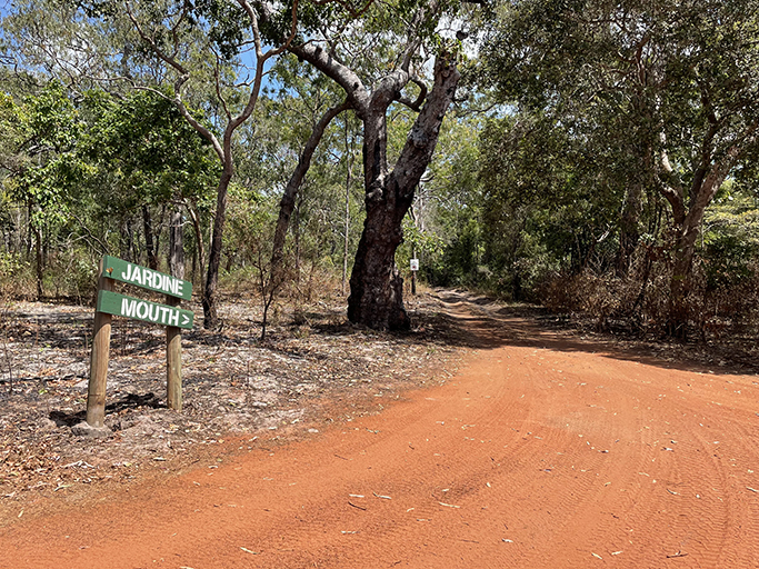
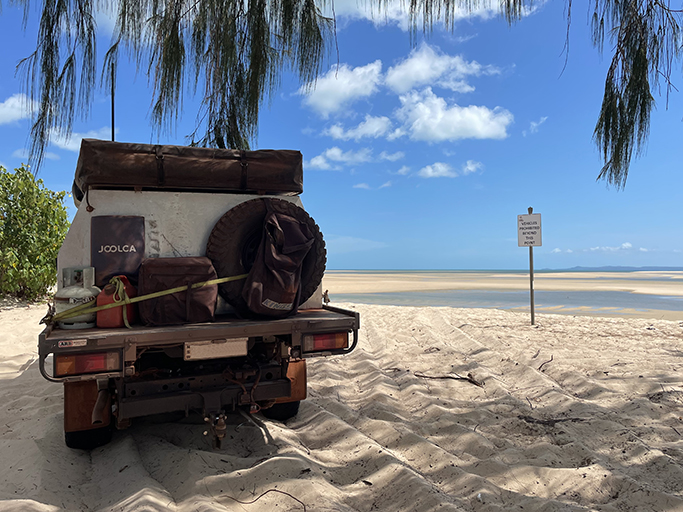
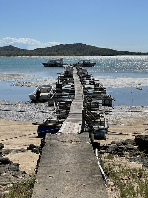
You can also drive to the mouth of the Jardine River. The track gets a bit sandy and you will have to let your tyre pressure down to make it all the way to the end. The views out over the sand flats are stunning, there were people fishing in dinghies in the estuary and I am sure there would have been crocs around, but we didn’t spot any.
Pajinka
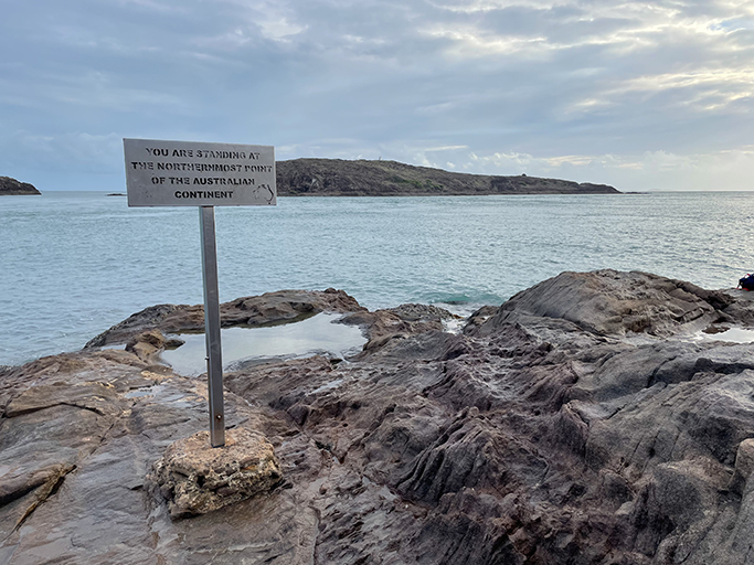
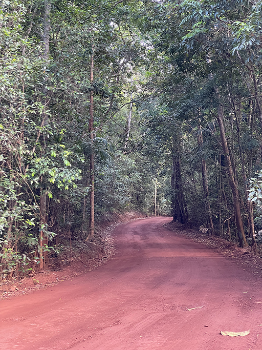
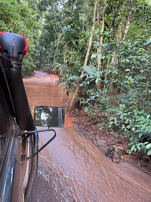
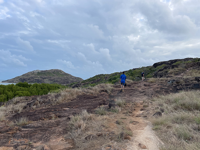
Of course the reason we all make the pilgrimage this far north is to stand at the very northern tip of Australia. To avoid the crowds we decided on an early start and were on the road by 6.15. The drive from Loyalty Beach is about an hour and once you pass the croc tent the road narrows to a single lane track.
Most of the peninsula has been dry forest and scrub and this patch of rainforest is very pretty. through rainforest very with a couple of unexpected creek crossings. And one point some tiny bats fly across in front of the car and one of them miss-times his run and gets stuck on the UHF arial on the bull bar, clinging on grimly. We have to come to a complete stop before he can disentangle himself.
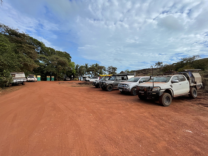
The indigenous name for the very tip of Cape York is Pajinka, at the end of a windy road you will find a carpark, no facilities and very little signage – logic says just head north.
There are actually two ways to walk to the tip, around the shoreline on the eastern side of the point or up and over the hill. We opt for up and over and are happy with our decision when we see the views from the top.
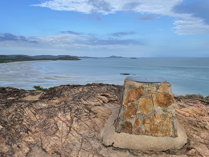
Walking down the hill to the end of the point we were surprised to find a couple there fishing – one of them is standing right behind the sign! He was not impressed when we asked him to move so we could take our requisite photos, not quite sure what his expectations were when choosing his fishing spot on the most famous rock on Cape York! Once the fishermen relocated a little further around the point we had the place to ourselves and our cameras.
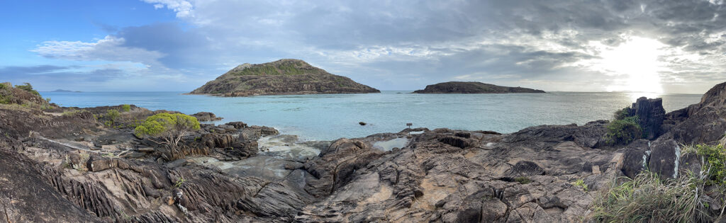
Many people are shocked to find that although you are on the most northerly tip of mainland Australia the York and Eborac Islands are almost within spitting distance of the point. It feels like you haven’t quite made it all the way, although the current running between us and the island looks very strong – that and the crocs are a good reason to be happy with this far north.
On the walk back to the car park we passed several people on their way up including one very large group and when we got back to the car park there was a tourist bus arriving and we are thankful for our early morning start.
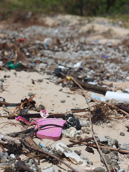
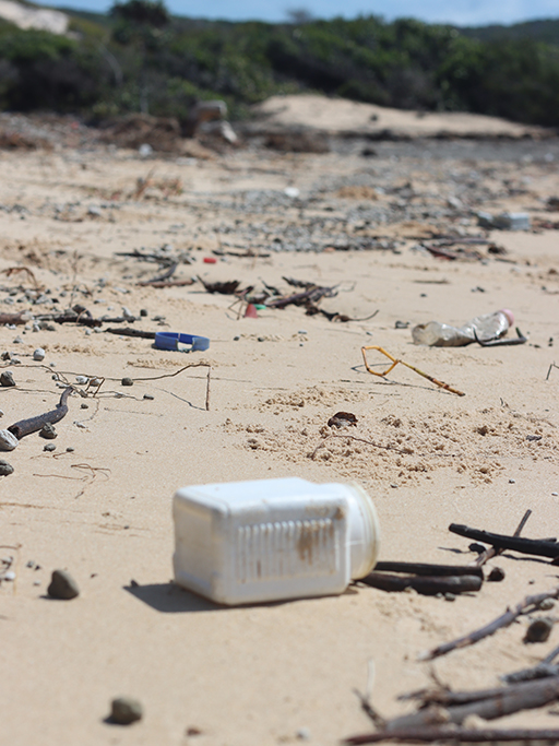
There have been rumours of the tip being closed to tourists by the traditional owners of the area and when you see the state some people leave the area in you can see why. Please take your rubbish with you and respect this beautiful land that we are so lucky to be able to explore.
Somerset and the Five Beaches Drive
From the tip we drove east to Somerset and did the five beaches track. There are some nice camping spots near Somerset and there is supposedly a cave of aboriginal art near the beginning of the drive but we couldn’t find it.
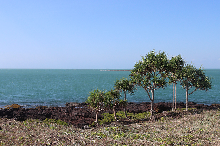
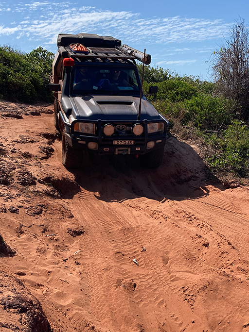
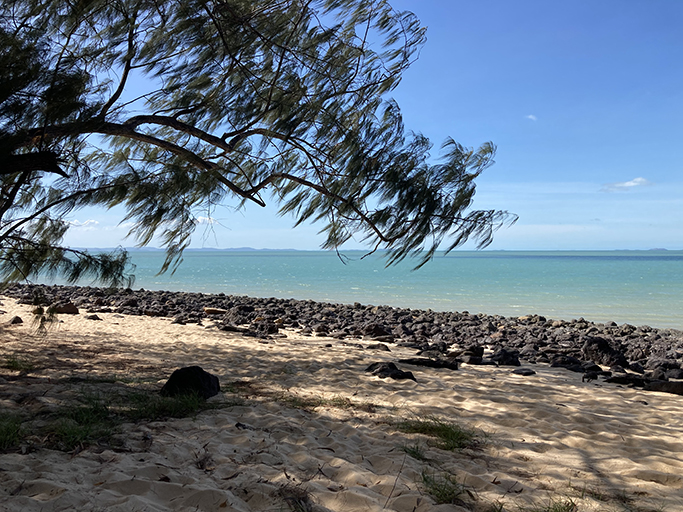
The 4WD track heads south over the windswept beaches and headlands. A mixture of rocky, sandy, medium-level 4wd tracks weaved themselves up over ridges, down onto the sand and along the shoreline. Other than one small section down off a headland it is not at all difficult. The views are spectacular and we pass through a mix of landscapes, from tropical rainforest to stark cliff tops with spiky pandanas, but the drive isn’t as long as I thought it would be.
On the first beach we come across a guy drone fishing – a concept new to me. He has snagged himself a shark, he calls us over to help unhook the poor thing so he can put him back in the water. The amount of flotsam and jetsam that washes up on those beaches due to wind and current is staggering. The high tide marks are littered with coloured plastic bottles, lids and thongs. Car parts, gas bottles and ropes are scattered through the dunes above the beaches. At the southern end of the fifth beach we stop at a shady camping spot to make our lunch.
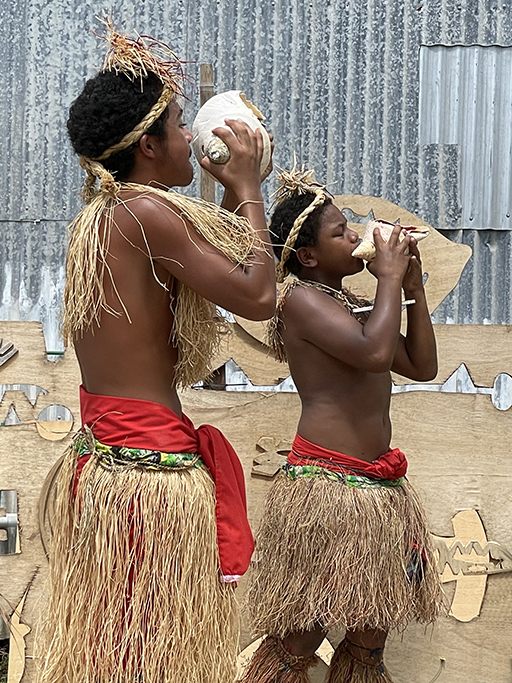
Torres Strait Islands
Unsure of what to expect of the Torres Straight Islands we booked a guided day trip. Leaving from Seisia, we were whisked across the channel over beautiful turquoise waters. We visited two islands – Thursday Island where we visited the Gab Titui Cultural Centre and wandered the main street of town before reassembling at Island Stars for lunch and a show.
After lunch we headed back to the boat and on to Roko Island with a little detour past Possession Island. Roko Island was once a working pearl farm but is now a privately owned glamping resort with a fabulous palm leaf thatched cocktail bar. Read more about our day exploring the Torres Strait Islands below.
I feel like we have covered the tip of Cape York pretty well in our days here and tomorrow it is time to head back south and explore some of the coastal areas we skipped past on the way up. If we were to revisit the area it would be with a swag instead of a van to enable us to explore some of the less travelled tracks of the NPA.
