Morton National Park
Camping in the Southern Highlands
The Southern Highlands is just a hop, s kip and a jump from Sydney. Easily accessible for a weekend escape and filled with cute villages and spectacular scenery. We have spent a few weekends exploring the area lately, doing some lovely walks and admiring the myriad of waterfalls on offer.
Camping
We have stayed at two National Parks camping areas in the Southern Highlands that you can drive in to, Gambells Rest in Morton National Park and Carrington Falls in Buderoo National Park. Options with vehicular access are limited, but if you are the walking with a pack kind of camper there are more choices, have a look at the NSWNP website here.
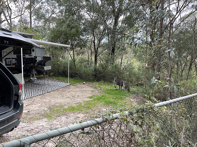
Gambells Rest is just outside Bundanoon and is the bigger of the two camping areas, offering spots suitable for tents, campervans, and smaller caravans. As with all National Park camping these days you need to book, the sites are marked and numbered, and the facilities well looked after. The camping area has a large communal shelter with a camp kitchen, and the campers’ toilets are separate from the picnickers’ toilets, with a code for entry so they are not quite as trashed by the end of the day as they might be.
Carrington Falls is a little further north near Robertson. This is a beautiful spot but not very big, there are only 4 camping sites and they are tent only. There are toilets at the picnic area but no other facilities. Read more here.
Walking
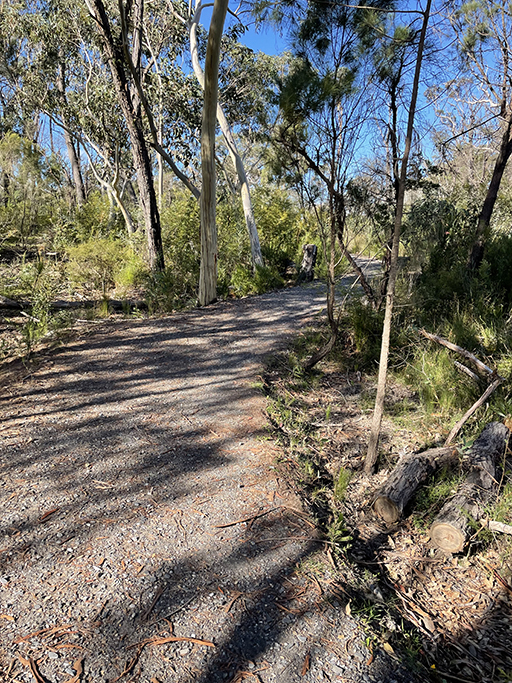
Gambells Rest Camping area is near the entrance of the National Park and from here Echo Point Road loops through the park to several spectacular lookouts and picnic areas. There is a choice of lovely walks you can access from the camp area – some a short stroll away and others a short drive along the loop road.
Erith Coal Mine Falls | 2km | Moderate
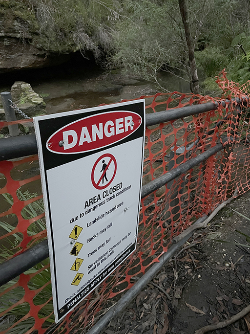
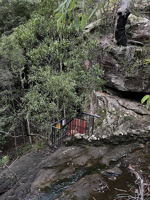
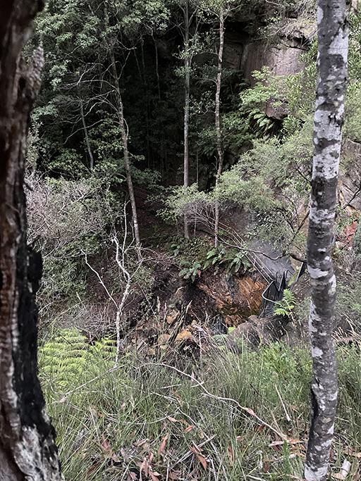
Erith Coal Mine is the closest track to Gambells Rest camping area but unfortunately this walk is currently cut short due to track closures. It was still a pleasant enough way to stretch our legs after setting up camp, but we were very disappointed at not to be able to get down to see the waterfall and coal mine.
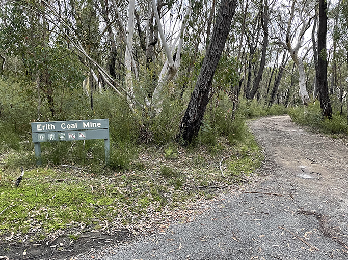
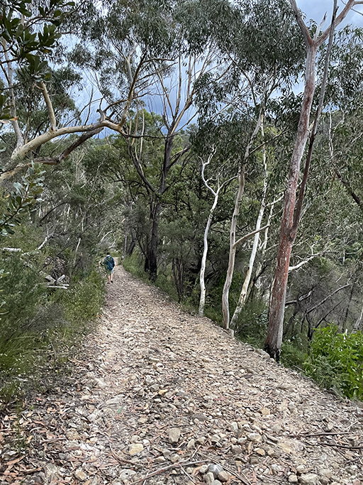
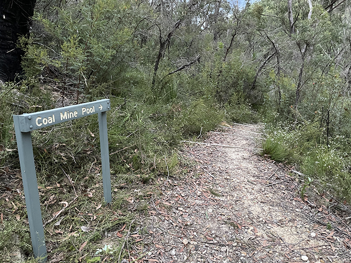
From the campsite, the start of the track is just a short walk along Echo Point Road. It is a loop walk which you can do in either direction. We did the longer stretch along the road first, turning down The Erith Coal Mine Trail to Coal Creek which is surrounded by lush vegetation. Signs and orange mesh fence block access to the creek crossing at the top of the falls. From here you can just see the top of the metal stairs that lead down to the entrance of a coal mine carved into the sandstone cliff face. Further down is a swimming hole at the bottom of the waterfall. It looks intriguing and will be added to the ever-growing list of places to visit when they reopen.
Continuing along the loop track there are several sets of steep metal stairs climbing back out of the valley to get your heart racing, but once the track levels out it is an easy walk back to camp.
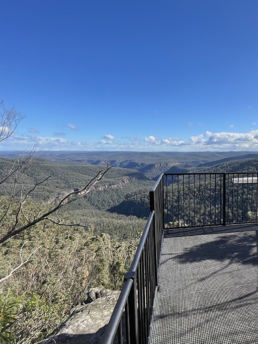
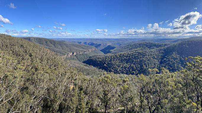
Echo Point Lookout | 300m return | Easy
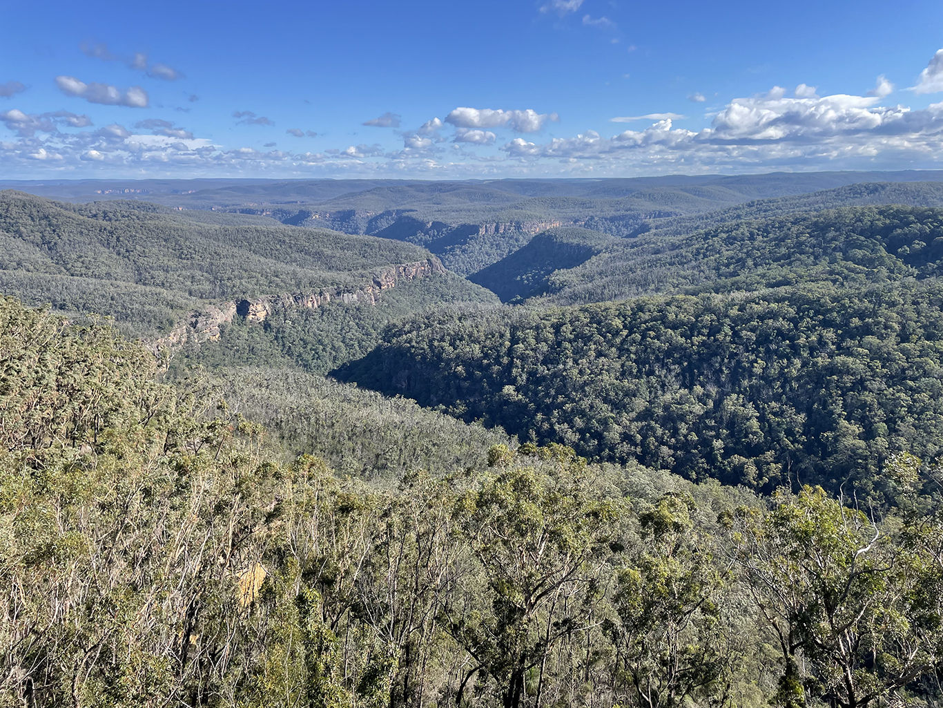
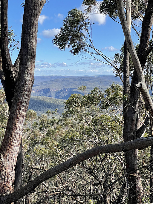
From the carpark next to the picnic area at Echo Point, head to your right and you will find an easily accessible boardwalk out to a raised lookout over the valley. The view from here is breath taking, looking out over Larkins Gap where Coal Creek and Bundanoon Creek wind through the trees at the foot of the escarpment.
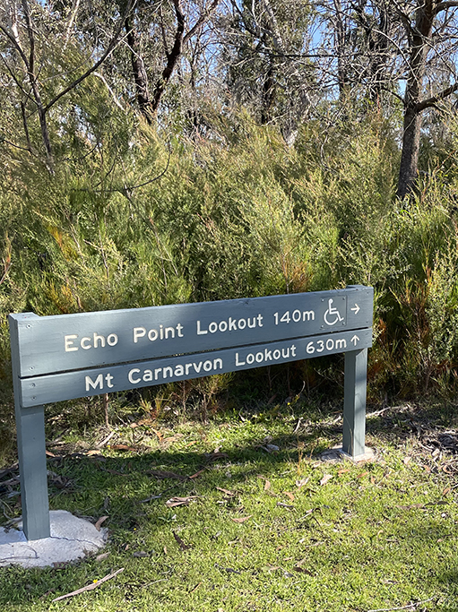
Mount Carnarvon Lookout | 800m return | Moderate
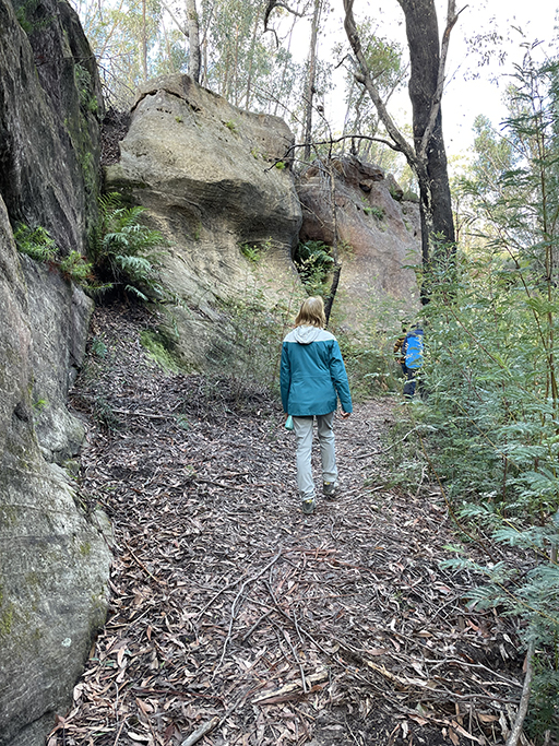
Also beginning from the picnic area at Echo Point, but not as well travelled as some walks in the area, this track heads through the bush and a little way down the sandstone escarpment. Once you leave the carpark the track is not well signed and we found it a little harder to follow than some, but we got there in the end. The track descends the cliff via stairs carved out of the sandstone and then gently undulates up to a secluded lookout atop Mt Carnarvon. The view from the lookout is quite obscured by trees but if you detour across the sandstone rocks just before the lookout, you can get some fabulous glimpses of the valley below, don’t get too close to the edge though.


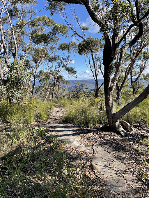
Echo Point Loop and Lovers Walk
1.5km loop | Moderate
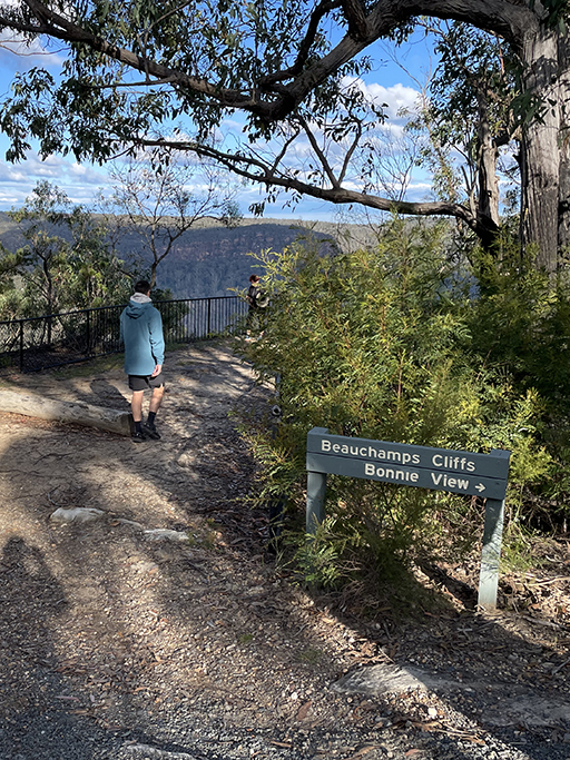
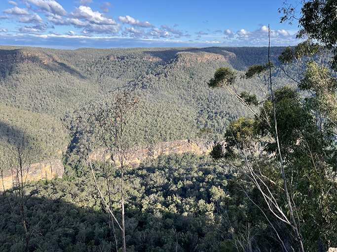
Behind the picnic shelter at Echo Point you will find the beginning of Lovers Walk which connects Echo Point with Bonnie View Lookout. The sandy track undulates through open forest before heading downhill and along the base of the smooth sandstone rockfaces. After about 750m you head back uphill to Bonnie View where you are greeted with another spectacular panorama.


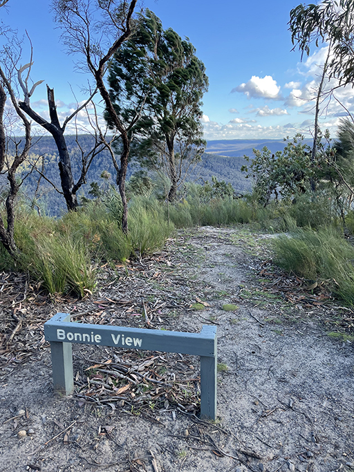
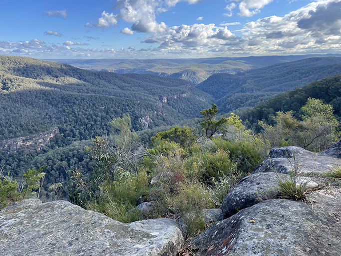
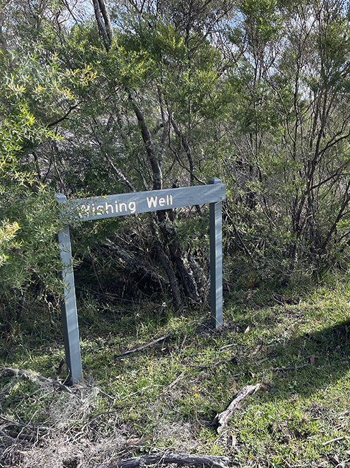
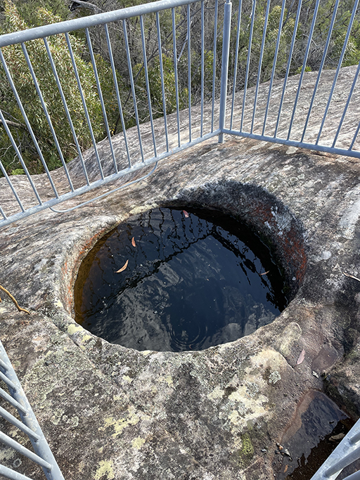
100 meters up the road, and a little higher in elevation, is Beauchamps Lookout sitting on the edge of Beauchamps Cliffs. This lookout offers yet another perspective of the valley views and the escarpment cliffs opposite. From here head back up Bonnie View Access Road past the Wishing Well, a natural hole in a large sandstone plateau. The hole is about 60cm in diameter and filled with water, so it is hard to tell how deep it is. It has been fenced for our safety, which suggests it is deep enough to drown in, but does kind of ruin the charm. Continue to follow the gravel road turning left and left to bring you back to the picnic area at Echo Point.
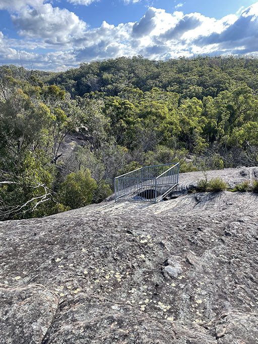

Grand Canyon Lookout, Gambells Lookout and Fern Glen | 400m return | Easy
From the Grand Canyon Lookout car park, you get not just one but two lookouts!
Grand Canyon lookout offers spectacular views and picnic tables from which to enjoy them. A rough walking track on the right leads down to the smaller Gambells Lookout and from there on to Fern Glen. Both lookouts offer expansive views over the green sea of eucalypt below.
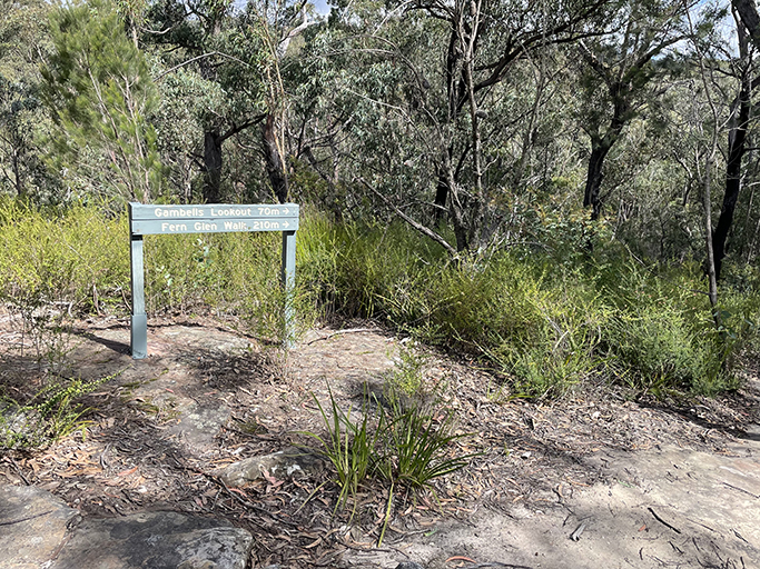


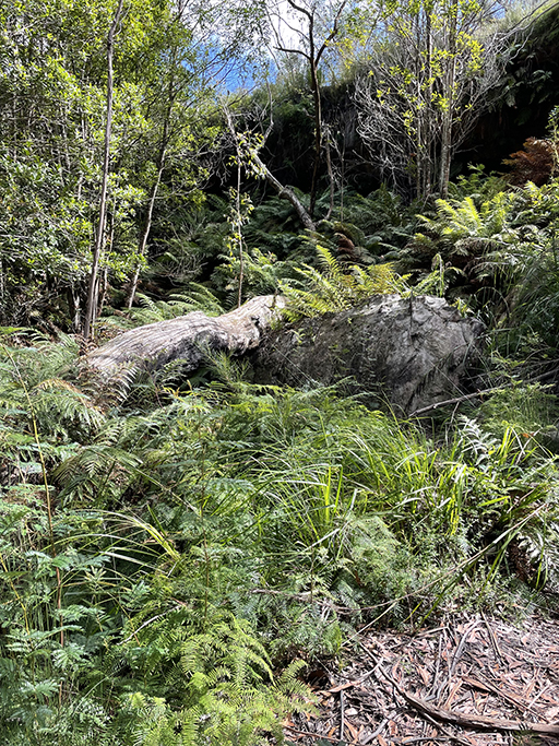
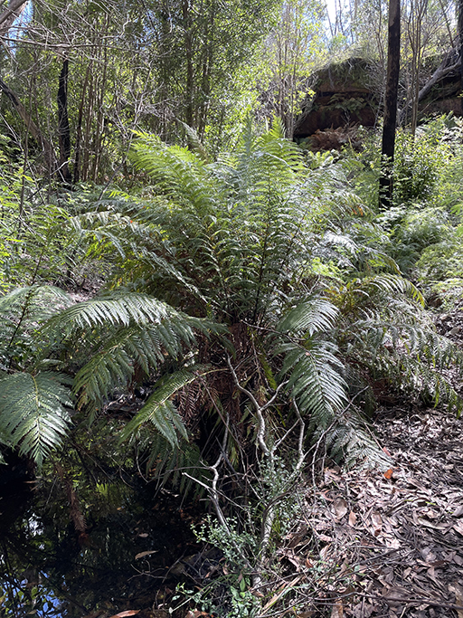
An easy walk down to Fern Glen takes you through a patch of rainforest and amongst gigantic king ferns. The track seems to pitter out and you find yourself encircled on three sides by sandstone overhangs and surrounded by ferns.

Fairy Bower Falls and Bundanoon Creek via Tooths Lookout Trail | 6km loop | Very Hard
This was the most ambitious walk we attempted in Morton National Park and is not one for the inexperienced bushwalker. From Tooths Lookout it is a very steep climb down into the valley to Bundanoon Creek. Several scrambles down rough stone steps and over boulders required. If you are going to give this one a go you will need good walking shoes and lots of water!
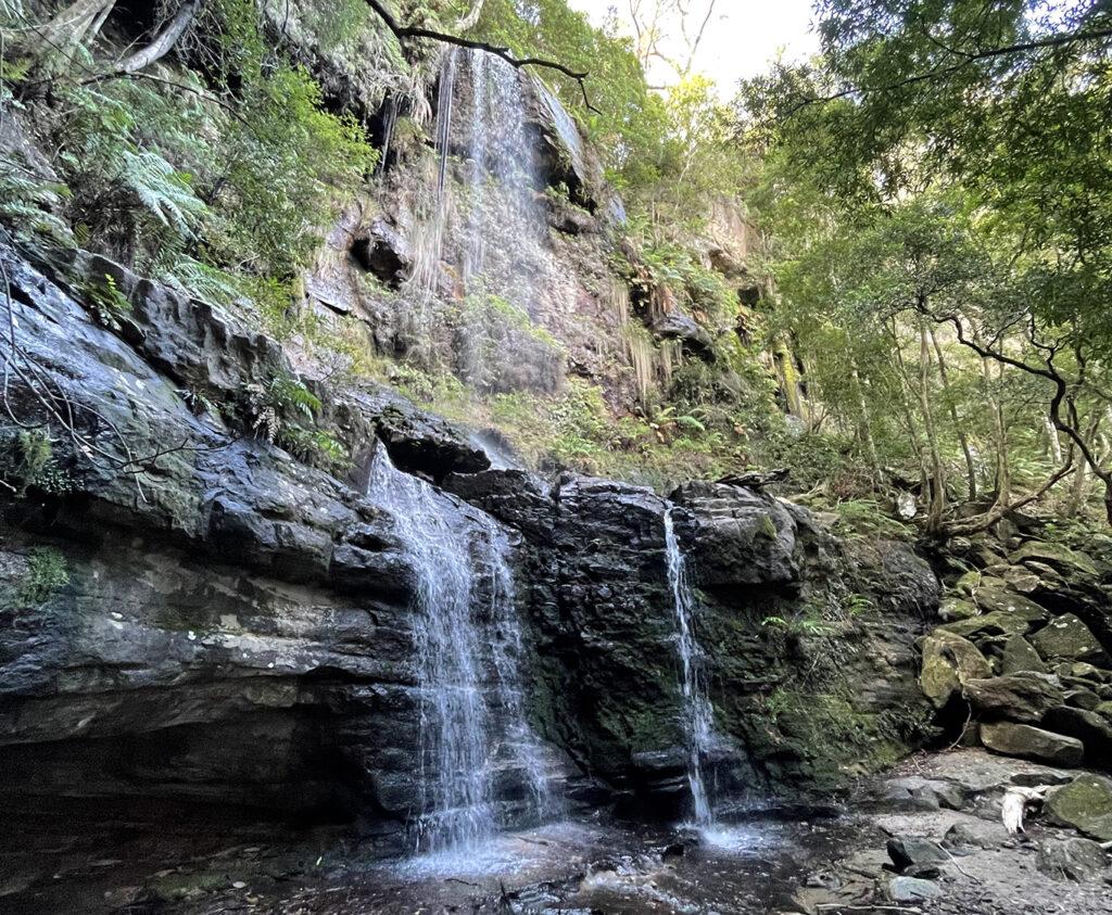
Rather than come back up the same escarpment we walked up the valley to Fairy Bower Falls which were beautiful – I suspect a good place to see glow worms if you were adventurous enough to come here at night. From the falls the track continues to the top of the cliff and back to the loop road where you can stroll back to your starting point.
Read the full story of this beautiful walk to Bundanoon Creek and Fairy Bowers Falls here.
