Galston to Berowra Heights | GNW
The Great North Walk
Galston Gorge to Berowra Heights | Approx. 13km | 5.5 Hours | Hard
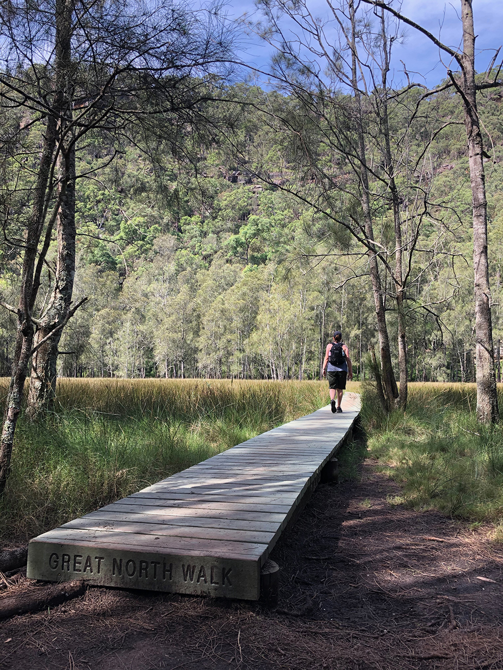
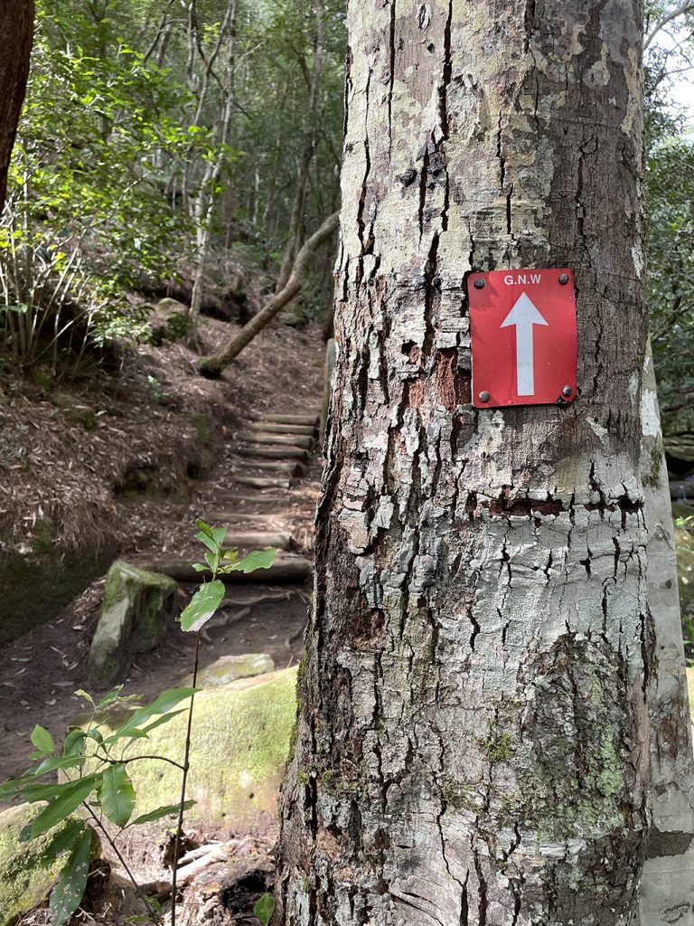
We set out this morning from Galston Gorge leaving our options open as to where we would finish. Leaving Jen’s car parked at the Galston Bridge we follow the ‘Crosslands’ sign up the timber stairs. This is the beginning of the Benowie track which follows 27km of the Berowra Valley and Berowra Creek from here to Berowra Waters.
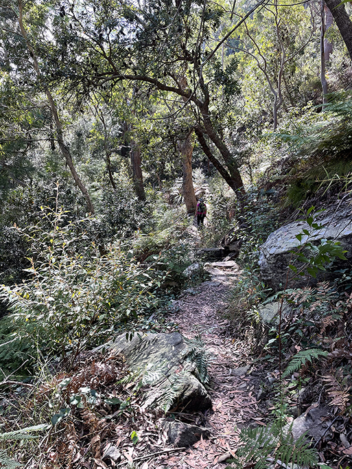
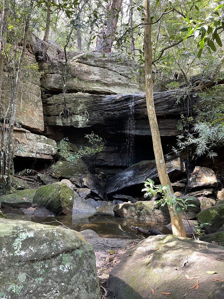
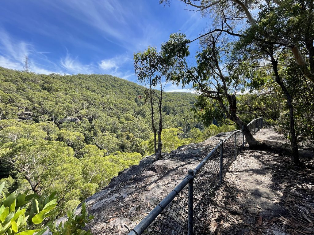
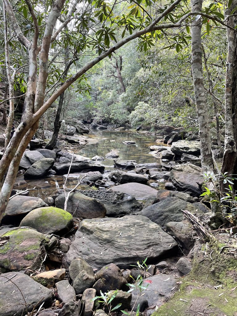
The track runs along the side of the valley before heading up and over a ridge, then back down to cross a mossy gully with large boulders and a small waterfall, Gulley Creek Falls. From the gully the track heads back uphill until you are walking along the top of the valley across unfenced rock platforms with views over the trees. After passing a fenced lookout we wind back downhill towards the creek. On the opposite bank of the creek we spot a couple of groups of campers who have come in by canoe or kayak, that is one way to make sure you don’t have any annoying camper neighbours.
Along the creek you will pass two official campsites, the first is Berowra Creek Campsite which is about 1.4km south of Crosslands reserve. A great spot for walkers who want a quieter camp area than Crossland Reserve. Plenty of shade, flat ground and a fire circle but no amenities.
The second camping area is Crossland Reserve itself. A well established campsite beside the river managed by Hornsby Council. There are picnic tables, barbecues, toilets, a children’s playground, garbage bins and town water. There is a large flat grassy areas to camp and a fire pit. Camping here requires a booking and fees apply, more info here
Having made it Crosslands we stopped for some lunch, refilled our water bottles and contemplated whether our blisters would survive another few km.
From the northern end of Crosslands Reserve a boardwalk winds through the mangroves, swamp and forest. This is the ‘Place of Winds’ interpretive trail which runs for 1.2km along the creek to a viewing platform, there are many signs along the way with information about the various habitats.
Continuing along the track takes you to Calna Creek Bridge which was constructed in 2015 to replace a log bridge that had collapsed a couple of years earlier. Past the bridge another boardwalk runs over flat marshy grasslands, once the boardwalk runs out it is a little muddy and we have to pick our way along the side of the track for a while. The trail follows the edge of Berowra Creek until it meets with Sams Creek and takes a left to head up this stream.
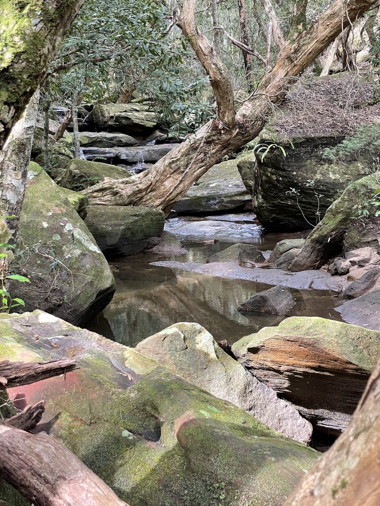
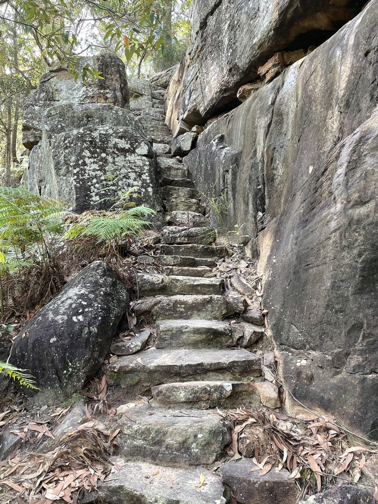
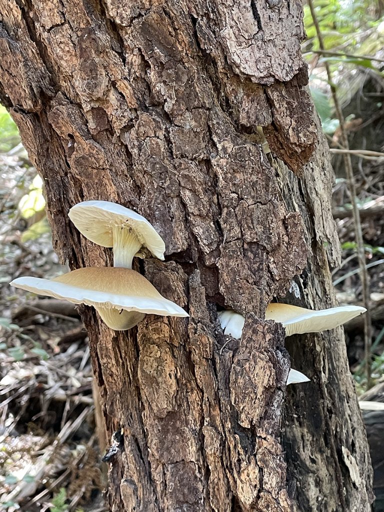
A little way along Sams Creek there is a lovely rainforest area with huge boulders and some small cascades. The walk this side of Crosslands Reserve is much busier than it had been south of the reserve and there are a couple of groups having picnics here. Finding the trail is a little harder as we rock hop across the creek, markers are fixed to boulders and trees and it takes a bit of hunting to find some of them. The track heads north up a very steep incline which seemed to never end. Jen is much better on the uphill stretches that I am, but after a couple of stops for rests on some conveniently placed benches, we both made it to the top and breathed a sigh of relief.
At this point the track intersects with the Berkeley fire trail and we can choose to turn right and go up to Berowra Station, or left and head towards Berowra Waters. Just a short way down the trail is Naa Badu lookout so we head that way to take in the view while we think about the options.
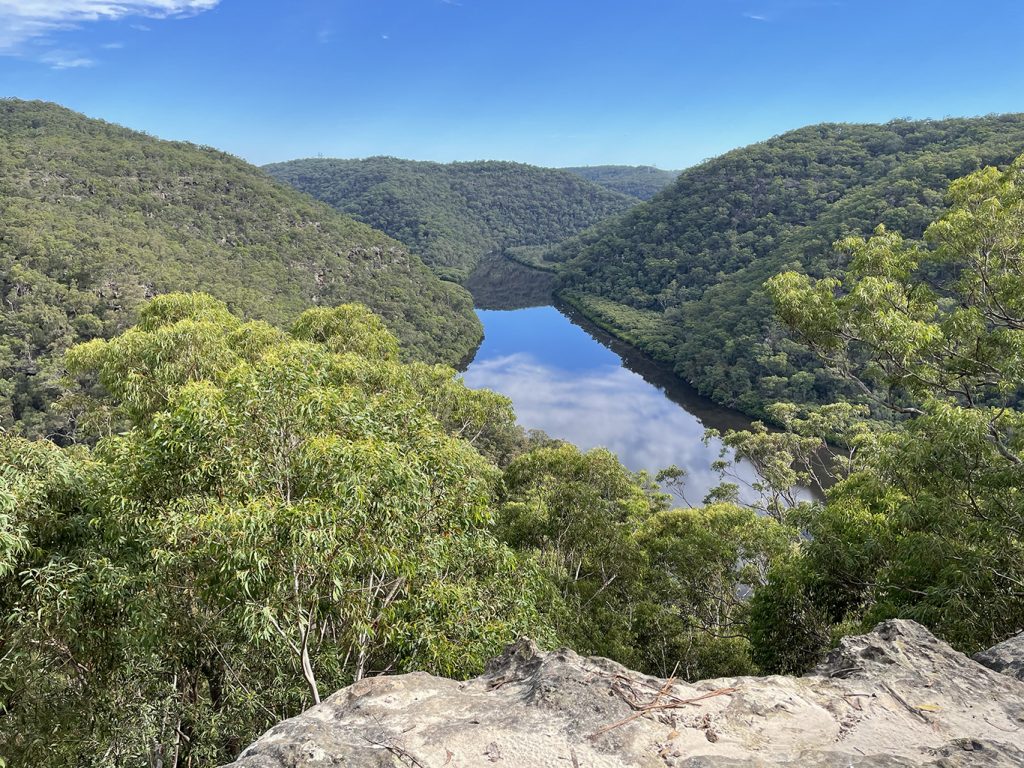
Naa Badu Lookout offers magnificent views south over Berowra Creek as well as over Sams and Calna Creeks. Naa Badu means ‘See water’ in the Aboriginal tribal language of the Dharug people. It is believed that Berowra Creek was the boundary between the Dharug and Guringai Aboriginal peoples. The lookout is on a rock platform and has a bench seat and a picnic table and a fair amount of natural shade.
To continue to Berowra Waters seems a bit much for today so we check the map and see that there a fire trail link through to the streets of Berowra Heights at Berekley Close, a quick phone call to our pickup driver from the look out and he is waiting for us when we get there.
This post is not a comprehensive guide to the GNW, more resources for these walks can be found at http://www.thegreatnorthwalk.com
