Gibberagong Track
"Place of Rocks"
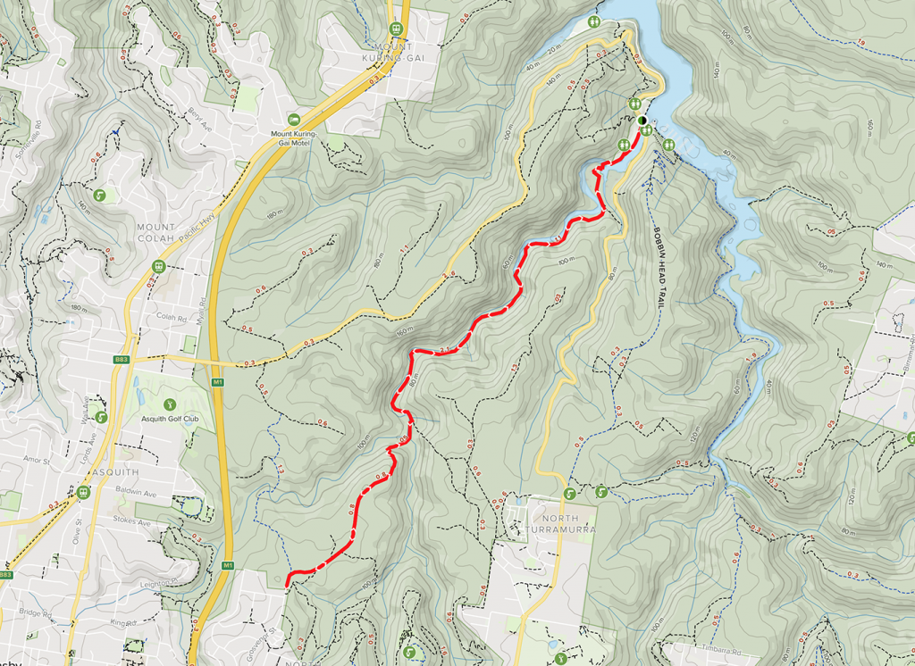
Ku-ring-gai Chase NP | 6.4 one way | moderate
A group of friends and I did this as a one way walk after dropping a car at the Bobbin Head car park and driving back up the hill to Grosvenor Road. You can do the return walk if you are feeling particularly energetic, but be aware that there is no public transport to Bobbin Head so if you are only going one way, either way, you will need two cars. Wahroonga to Bobbin Head is downhill, Bobbin Head to Wahroonga you will be climbing uphill.
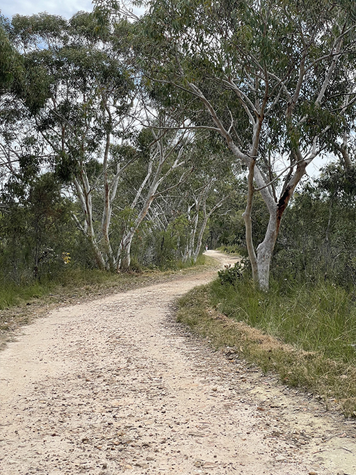
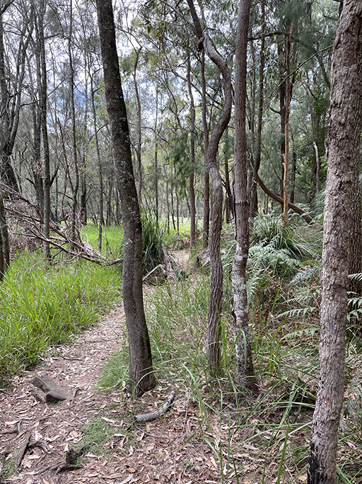
Starting at the end of Grosvenor Rd, passing a locked gate, the first 1km or so follows the ridge along a wide management trail, taking you straight from suburbia and immersing you into bushland.
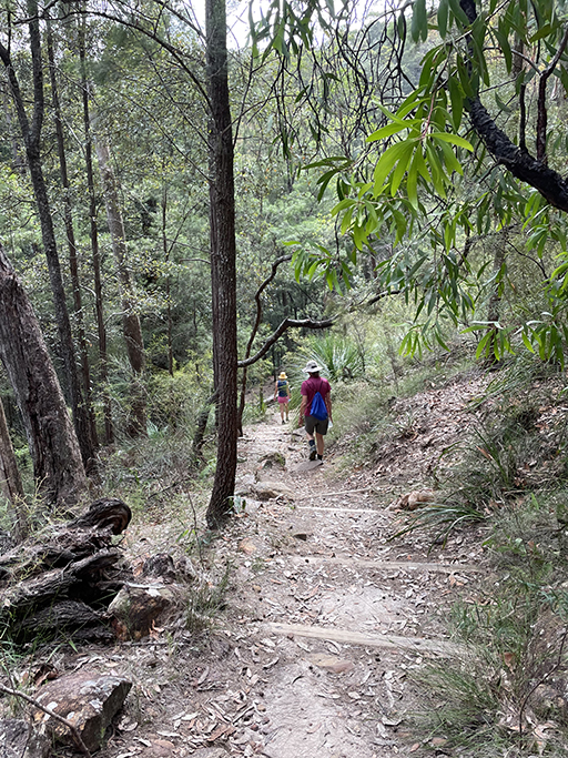
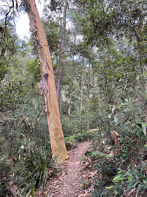
At the end of the ridge the track starts to descend into the valley. The path becomes a narrower and more rugged bush track. There are timber and stone steps as you head downhill for about a km, nice in this direction but a good workout if you are planning on coming back up. The path at this point is easy to follow winding through scribbly gums and casuarinas, further into the valley the forest starts to become more dense and moist.
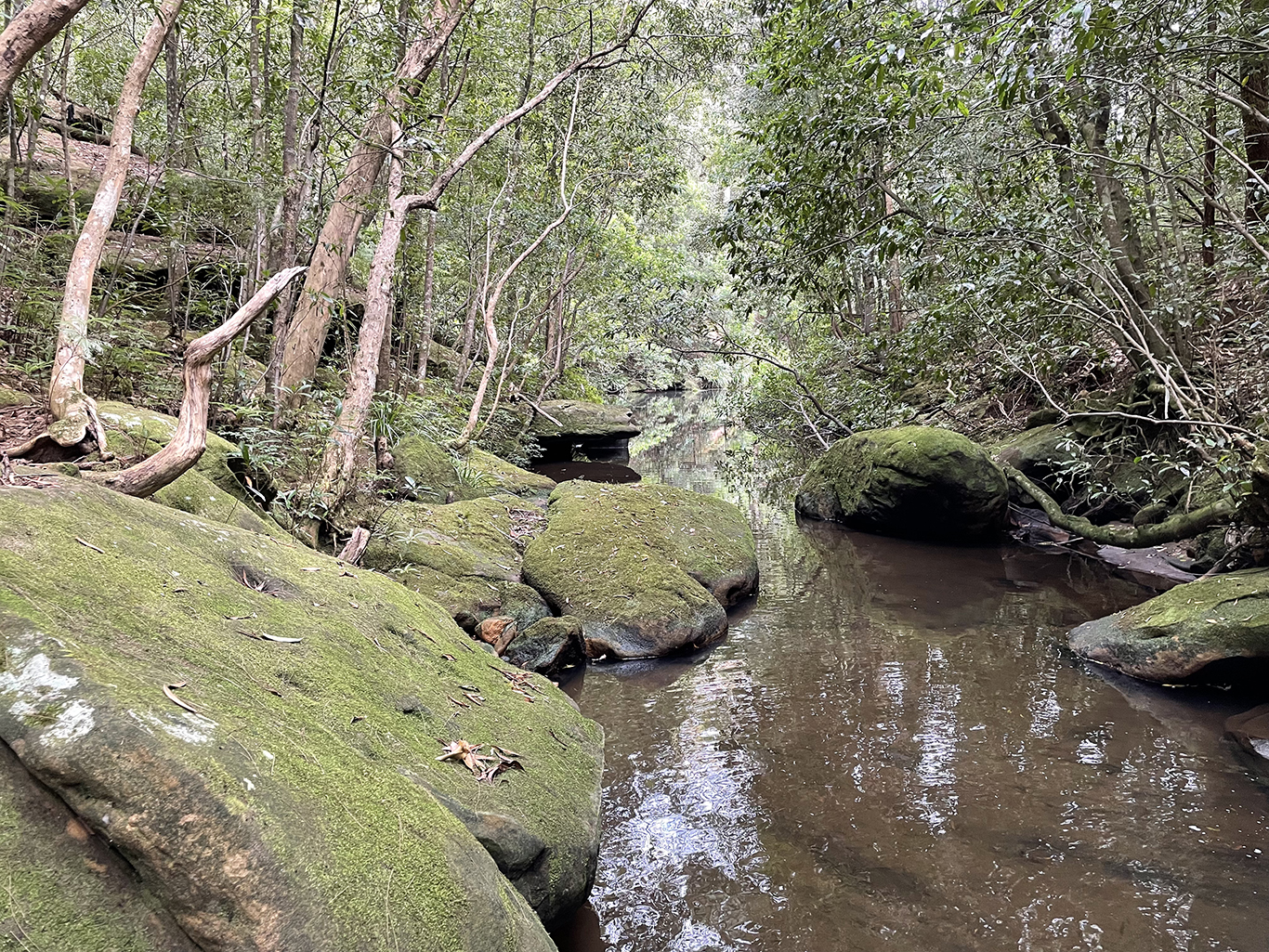
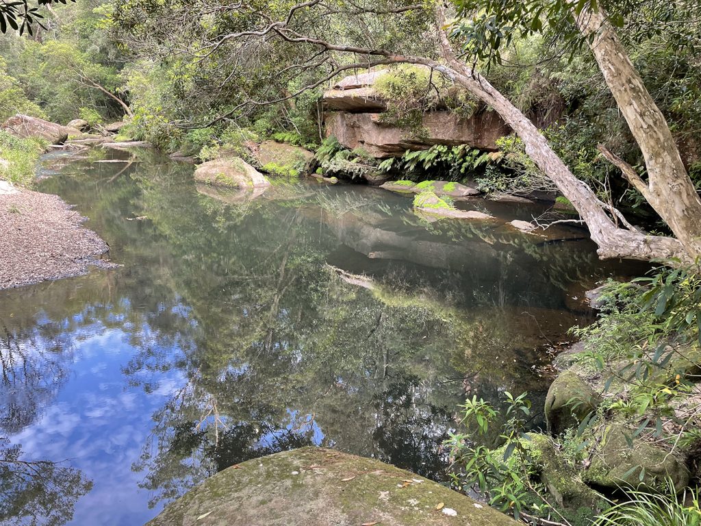
At the bottom of the gully the walk takes a dramatic turn and you enter a little rainforest oasis. This is Lover’s Jump Creek, large boulders cover in moss and surrounded with vine laden trees. The temperature drops several degrees in this beautiful, shaded gully. Watch your step on the mossy rocks as you cross the creek using the steps carved into boulders on each bank. The path on the north side of the creek is a little difficult to spot. If you head directly over the creek, and then turn left along the other side, you should see the track leading downstream.
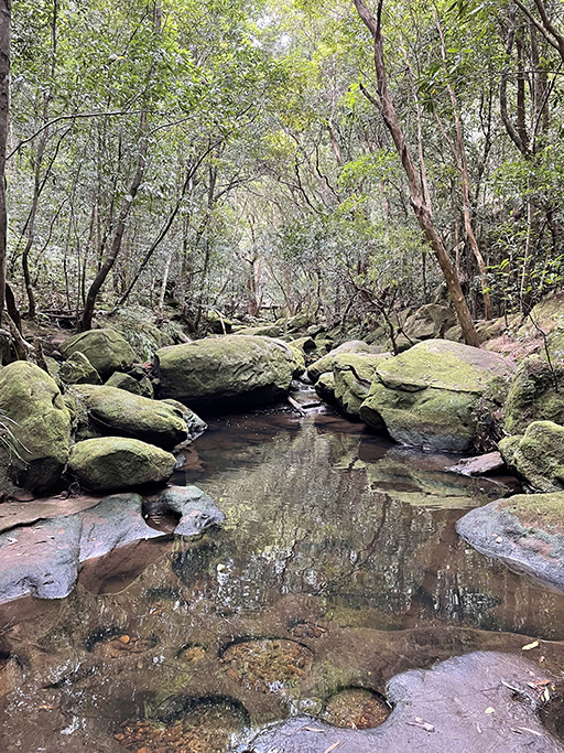
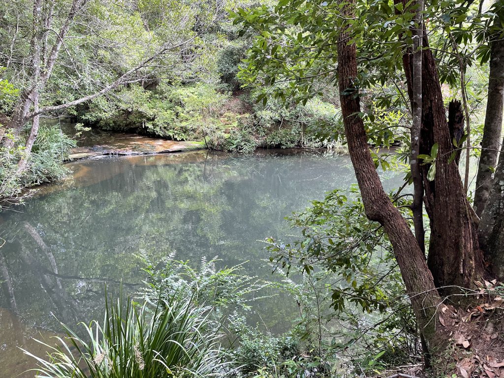
Shortly you will come to the intersection of Cockle Creek and Lover’s Jump Creek at a large turquoise pool, this is the first of the Gibberagong Waterholes. Gibberagong waterhole is an informal name for a wide section of Cockle Creek that runs for about 150m north of here. A short distance after the creek crossing there is a three-way sign with a turnoff to the right that leads up the hill to Murrua Rd. We however are following the Bobbin Head sign which veers a little to the left and crosses another water trickle to bring us to the next waterhole at the river bend. If it’s hot and you are feeling adventurous you could have a swim, there is a large rock platform overlooking the waterhole, perfect for a rest stop.
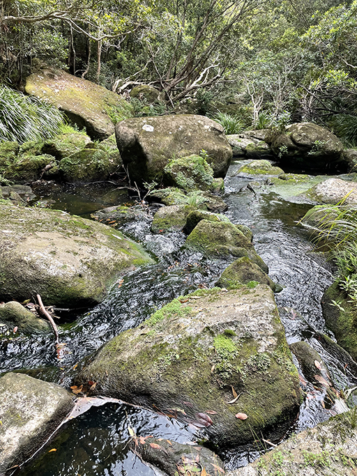
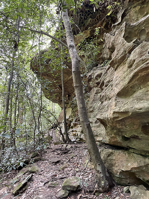
Lovers Jump Creek and the waterholes were definitely highlights of the walk for me although the creek continues to be very pretty. The bush track is easy enough to follow but does have a bit of scrambling up and down rocks and the occasional boulder with carved steps to climb over. You will pass several rock overhangs as the track gently undulates along the side of the hill staying within sight of the water.
Fun Fact: Aboriginal middens were mined in this valley during the 19th century, for use in the production of lime and mortar.
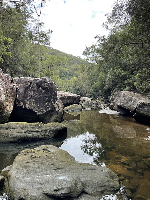
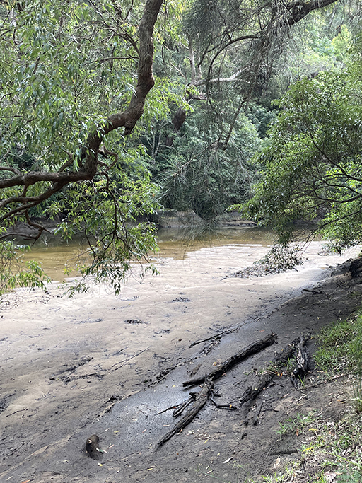
Gibberagong is the aboriginal name for Cockle Creek and means “place of rocks” and there certainly are plenty of rocks. As the creek heads downstream it widens and you’ll come across little sandy beaches edged with bracken, lovely spots to take a paddle or just sit and relax. The path turns a little away from the creek, through long grasses and casuarinas with mangroves lining the waters edge. By now the creek has becomes tidal and it will eventually flow into the Hawksbury.
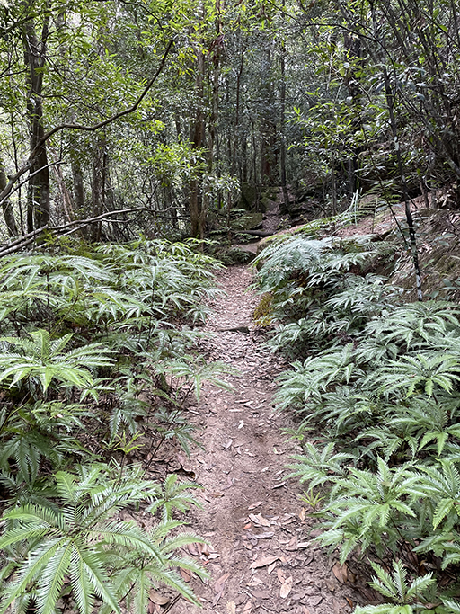
Heading uphill to the top of a ridge you will come to an intersection where there are signs to Bobbin Head or back the way we came to Wahroonga. The third option is to add a little side trip to your walk. The detour to the rainforest is about 500m return from here and will take you down to a well-protected patch of rainforest beside a small creek.
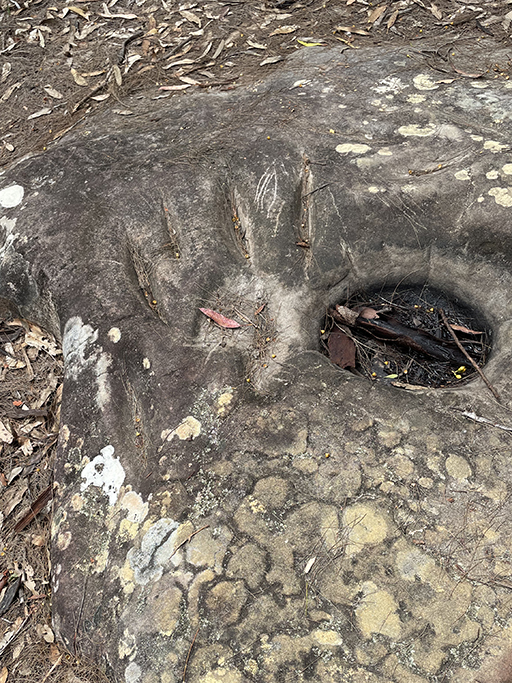
Following the sign to Bobbin Head you will pass an Aboriginal axe grinding site where there are 23 oval shaped grooves worn into the rock. Aboriginal people would use this rock platform, with water from the nearby creek, to sharpen stones into tools. Directly over the path there is also an engraving which is not signposted and is easy to miss.
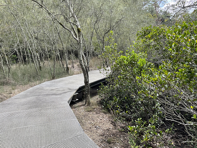
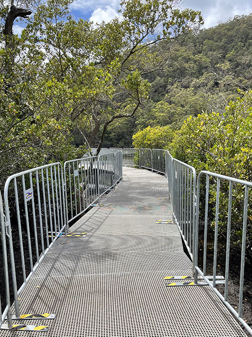
The path from here is much more heavily trafficked, with walkers starting from the Bobbin Head end of the track coming up to explore the mangroves and rainforest. Follow the sandy path along the ridge with glimpses of water views before dropping down some sandstone steps and through a cleft in the rock. At the bottom you will find a flat boardwalk through the mangroves. The boardwalk has recently been upgraded and was closed for some time while work was being carried out. It is not completed yet and much of the boardwalk has temporary fencing along the sides. Enough is done to allow walkers to start using it and I am sure it will be spectacular when it is finished. Make sure you stop at the viewing area and be amazed by the hundreds of tiny crabs scuttling around in the mangrove mud.
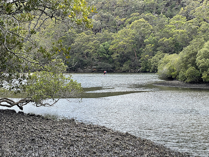
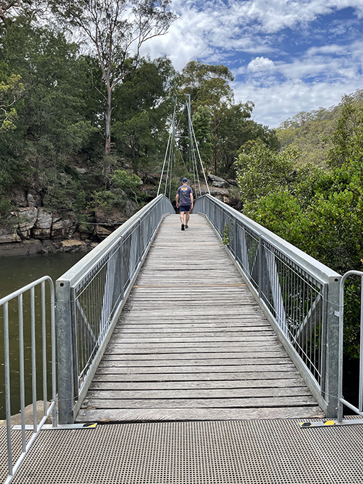
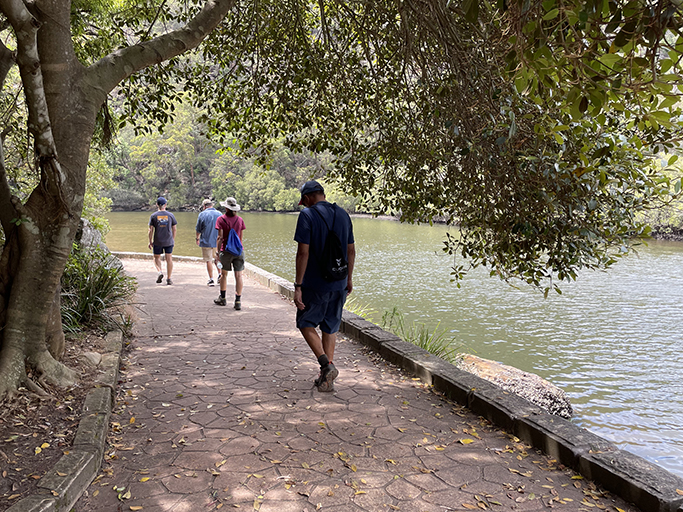
The walk finishes by crossing over Cockle Creek is via a cable-stayed foot bridge with great views of the convergence of Cockle Creek and Cowan Creek. On the other side of the bridge a paved path takes you along the waters edge, past a sandstone cave and a timber bench, and finishes at the Bobbin Head car park.
Bobbin Head
Bobbin Head is a historic recreation area which is still popular today for picnicing, walking, canoeing, and fishing. There are three main areas – north, south and east.
South Bobbin Head is a popular picnic area with plenty of parking and many picnic tables, electric BBQs and a large playground. A popular spot for launching kayaks and canoes. There are toilets and ‘The Station’ which is a sheltered BBQ area that can be booked for larger groups. Here you will also find in the old ‘Bobbin Inn’ built in the 1930s – which is home to a café as well as the park information centre.
The northern area is known as Orchard Park and is a more formal picnic area. There is a large picnic shelter, several smaller shelters, and toilets. The road to Apple Tree Bay boat ramp runs north from this area. The sandstone wall along the waters edge is a great spot to throw in a fishing line.
The eastern side of Bobbin Head is home to Empire Marina, a restaurant/café and a public wharf.