Mt Wondabyne and More | GNW
Woy Woy to Old Mooney Mooney Creek Bridge
Woy Woy to Old Mooney Mooney Bridge | Approx. 19km | 7 Hours | Hard
As the walks get further out of Sydney the logistics get a little harder and we are asking bigger favours of people to drop us off or pick us up, therefore it seems like a good idea to start making the walks a little longer. Or is it?
Meeting J at Old Mooney Mooney Bridge she parks her car and our favourite driver takes us to Woy Woy Landfill to start our days adventures. If we hadn’t finished our previous walk by coming out this way, I am not sure we would have been able to work out how to get into Dillions Fire trail. To the right of a very large locked gate there is a small gap in the fence which we squeeze through before we can start the trek back up the fire trail.
Retracing our steps from last week, at the top of the hill we find the walking track from Patonga on our left and to the right the Tunnel Fire Trail takes us north through Brisbane Waters National Park.
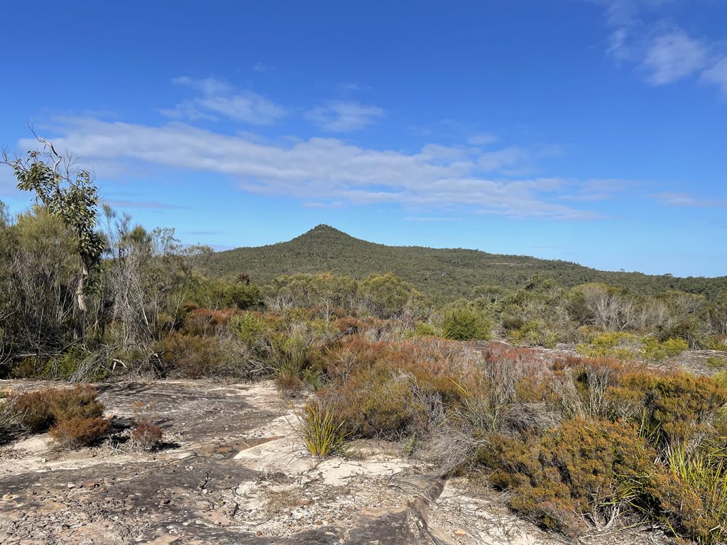
Mt Wondabyne
Following the signs for ‘Girrakool’ and ‘Mt Wondabyne’ the track winds uphill until we come to Mt Wondabyne campsite, a basic campsite for those walkers more adventurous than us who are doing multiday hikes. A couple of hundred meters further along there is a turn off to go to the top of Mt Wondabyne which I would love to do, there is an old trig point up there and the 360° views are meant to fantastic. We are however already pushing ourselves to do the planned 17.5km today and don’t want to overdo it by adding in extra side trips. I might have to come back some time and just do the summit loop.
After the intersection with Mt Wondabyne Peak track, the trail goes into a forest and starts to head downhill to meet Mullet Creek Trail. The GNW sign points left here and then shortly to the right again back down the walking track toward ‘Girrakool’. Another section of fire trail takes us over rocky platforms with views through the valley and back to Mt Wondabyne.
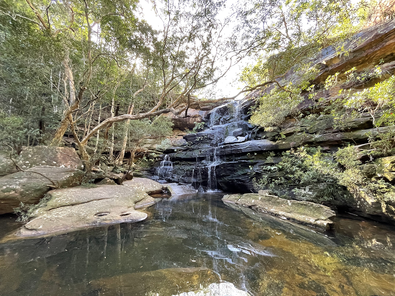
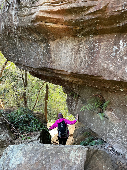
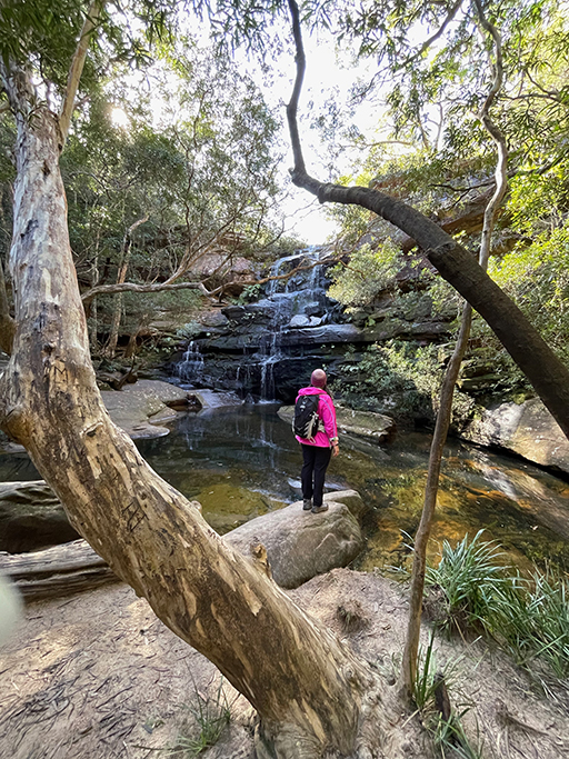
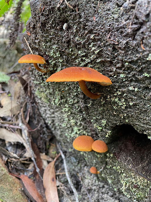
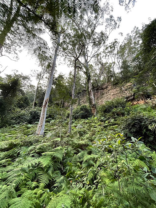
The track becomes steeper as we head down toward Kariong Brook Falls. Winding down past rock walls and through a large sandstone overhang we are greeted with a little oasis of waterfall and ferns. The rock pool looks very inviting and I can imagine spending a little time here on a warmer day. Today however is not that day as there is quite a chilly wind and after walking 7.5km I still haven’t taken my jacket off.
The track from the brook leads fairly steeply out of the densely forested valley then back down to cross Myron Brook and up again onto more rocky platforms through heath and scribbly gums.
Eventually we meet the Wondabyne Station Management trail where a left turn would go down to Wondabyne train station, but we are going to the right towards Girrakool. As we are now over halfway to our destination we decide to stop and have some lunch before heading up the trail.
The management trail leads up and over rock platforms until after about 900m we come to a ‘No Entry Beyond this Point’ sign. The fire trail from here leads past the rifle range and is a no-go area for the general public. We turn away from the ‘No Entry’ sign and follow the ‘Girrakool’ sign which heads us left along the Scopa’s Peak track. After heading along the ridge the track climbs steeply to the top of Scopas Peak and offers some nice views as we climb. Heading back down, the track is quite steep in sections. Every now and then we get glimpses of the Mooney Mooney Bridge, but it still looks quite a long way away.
For a while now we have been able to hear consistent loud cracking noises and have been coming up with all sorts of theories as to what they were. As the sounds get louder, our theories get wilder, until we realise that we have been listening to the sound of gunfire from the rifle range and at one point we can see the lights from the range on our right. I guess the ‘NO ENTRY’ sign along Rifle Range Fire Trail should have given that away earlier. We wondered how far rifle bullets travel, but were reassured by the notion that this is a public trail that authorities would have placed at a safe distance.
At the bottom of the valley there is an easy creek crossing over a solid sandstone platform and the track continues until we meet the Girrakool track. If we turned right the track leads about 2km up to Camp Kariong, a well established Scout Camp. We however, are heading left toward the Piles Creek and Phil Houghton Bridge.

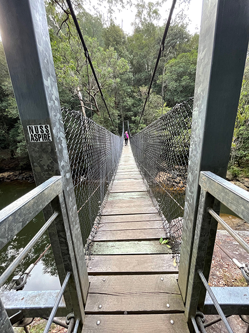
The Phil Houghton Bridge over Piles Creek
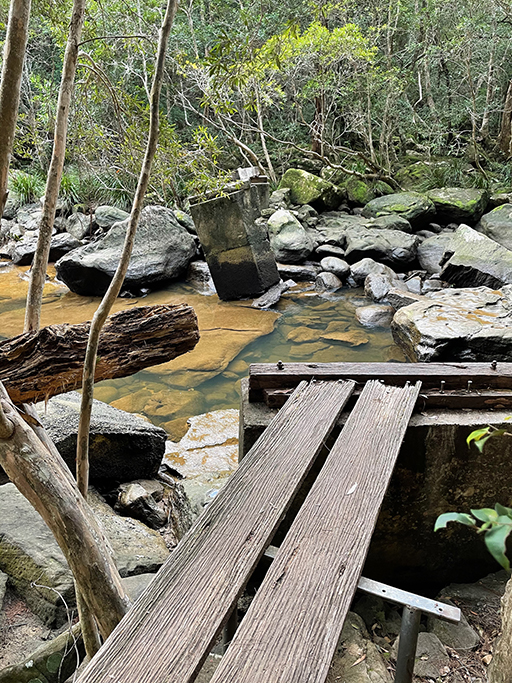
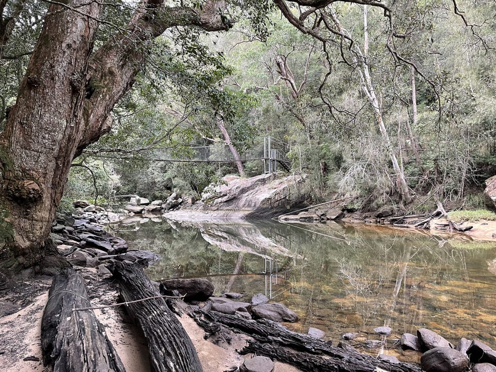
A steep and rocky track takes us down to the tidal Piles Creek, we pass what is left of the old bridge and are very grateful that there is a new bridge. Climbing the stairs on to the Phil Houghton Suspension bridge there are lovely views up and down the creek. On the other side of the bridge there is a clearing that has been used for camping.
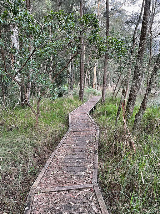
Keeping the creek on our left, the walk follows Piles creek through eucalyptus forest and along timber boardwalks. Piles creek eventually meets Mooney Mooney creek and the track follows this waterway until we can see the Old Mooney Mooney bridge.
We estimated this walk at 17.5km but it ended up being 19km which is the longest we have done so far. As we climb the stairs up onto the bridge I think we are both glad to be at the end of our walk for the day and looking forward to a soak in a hot bath.
This post is not a comprehensive guide to the GNW, more resources for these walks can be found at http://www.thegreatnorthwalk.com
