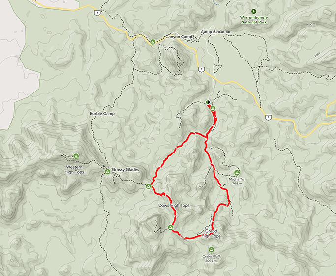
The Bread Knife and Grand High Tops Circuit
An iconic NSW walk
14.5km Loop | Summit 960m above sea level | 5 – 6 hrs | Hard (many steps and steep in sections)
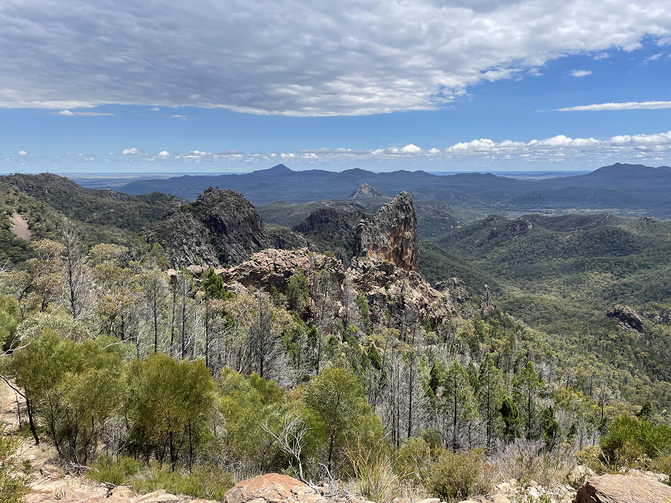
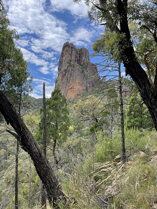
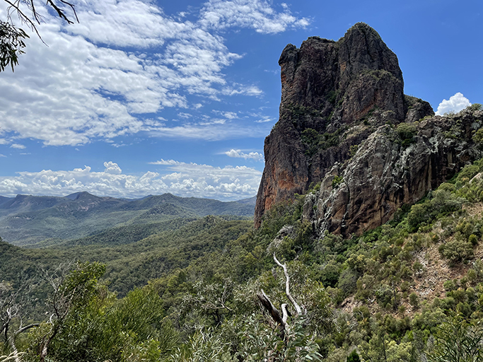
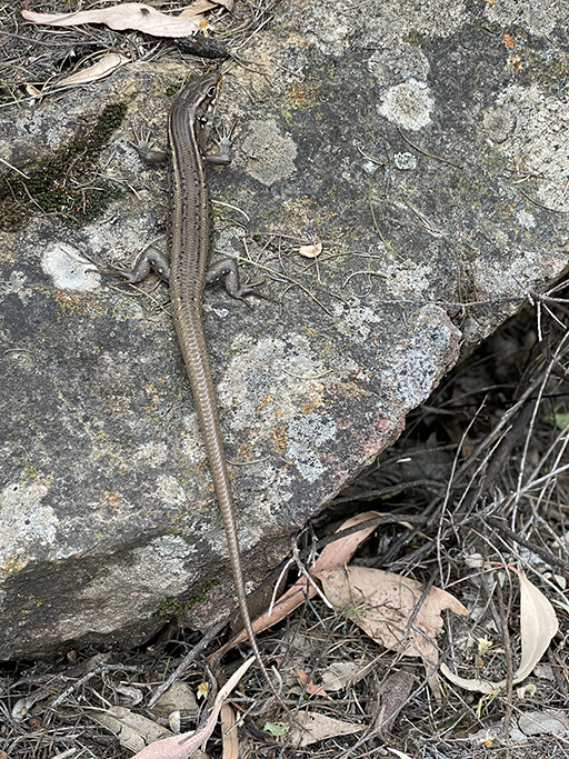
The unusual peaks and rocky outcrops of the Warrumbungles are the result of millions of years of weathering and erosion. There are many unique and interesting landforms to explore. The spectacular Breadknife, the most recognisable feature within the park, is a volcanic dyke. Created when lava was forced through a crack in the side of the volcano, this 90m high, 4m wide rock, stretches for half a kilometre. Bluff Mountain is the largest lava dome of the Warrumbungle volcano with a very imposing, near-vertical, 250-metre high face.
The breadknife can be reached by a 12km return walk following Spirey Creek or, instead of returning the same way, you can continue from Dagda Saddle to complete the circuit past Bluff Mountain and through Ogma Gap. The circuit route only adds about 2km to your trek, and given the choice I will always choose a circuit. There is something much more enticing about not having to walk back the way you came.
The Breadknife and Grand High Tops Circuit is recognised as one of the best walks in NSW, with fabulous views, as well as an opportunity for close up inspections of some of the parks unique landforms.
If you have only enough time and energy to complete one hike in the Warrumbungles, this is the one you should do!
Since we arrived in the Warrumbungles I have been blown away by the scenery. Every turn you take reveals another stunning rock formation. Even the view from our camp are spectacular (read more about camping in the Warrumbungles here) Walking Grand Hightops Circuit is a fabulous opportunity to get up close and personal with some of these landmarks.
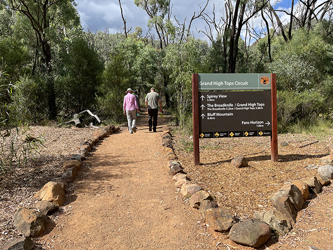
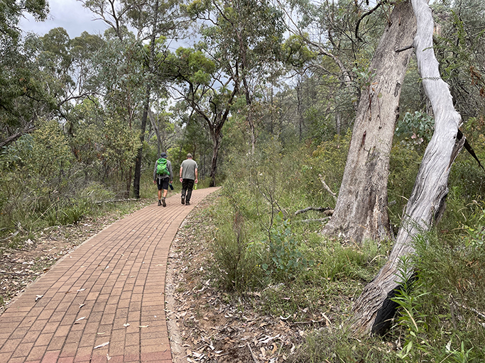
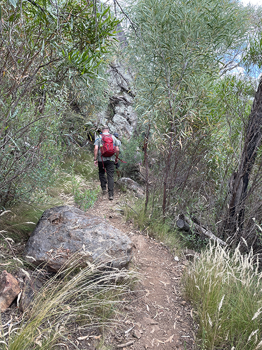
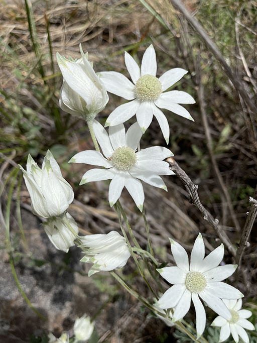
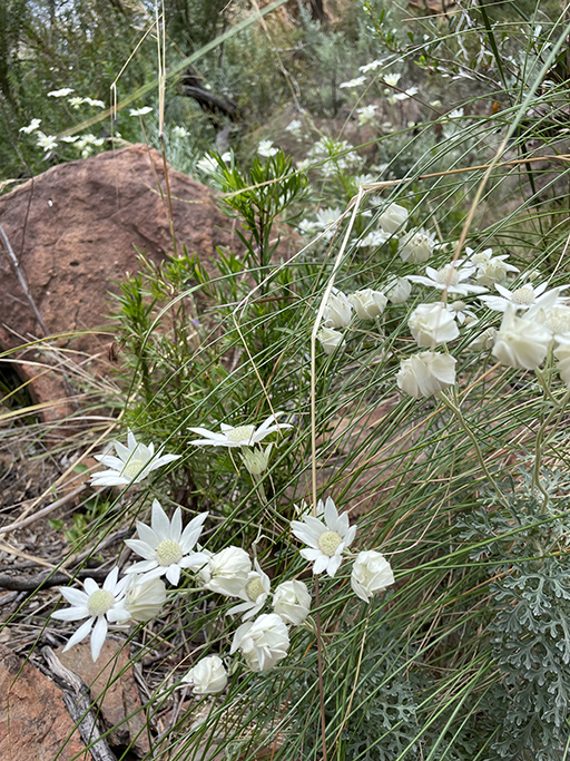
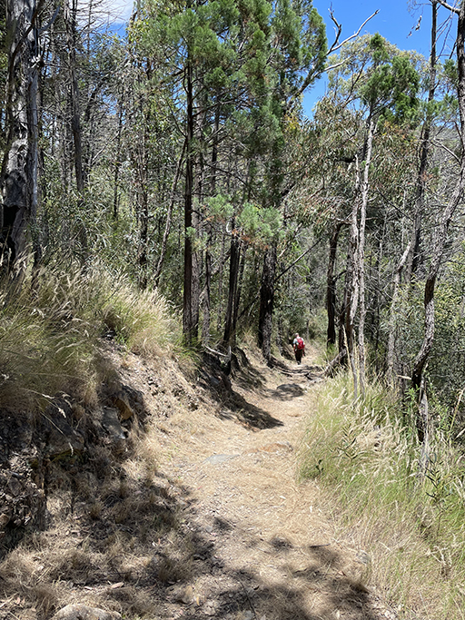
Starting from the Pincham carpark the first section of the walk is not just a well formed track but is actually paved! Enjoy it while it lasts, strolling gently uphill along Spirey Creek the tall eucalypts and wildflowers distract you from the increasingly steep gradient.
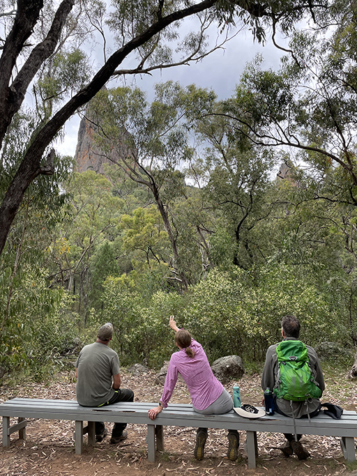
There are several remote campgrounds along the track, the first, which you come to very quickly, is Camp Pincham. Shortly after this you will pass the turnoff to Goulds Circuit and then Spirey View Lookout. We took advantage of the wooden benches at the lookout for a quick snack while admiring the imposing Belougery Spire, the remains of one of the volcano’s many vents.
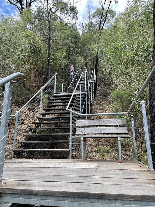
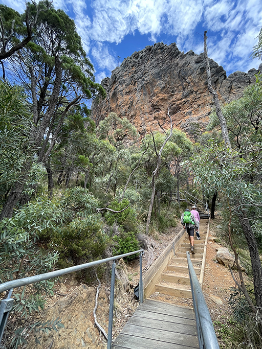
Shortly after we get going again the stairs begin. For as far as the eye can see metal stairs stretch up the mountain side. There are benches dotted along the way for a welcome break, as you work your way up to the base of the breadknife. Turning right at the top of the stairs will take you to another remote campsite, Balor Hut, apparently a great spot to stay if you’re equipped for an overnight hike and want to spend some time exploring the rock formations. Sunrise would be magnificent as it hits the Breadknife.
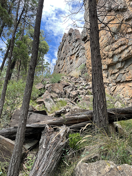
We, however, are taking the left hand turn at the Balor Hut intersection. to follow the base of the Breadknife. The track reverts to boulders and gravel and runs along side the massive volcanic rock formation. It is hard to imagine that the cliff face towering above you is only a few meters thick. As you get closer to the southern end of the breadknife a path veering right leads to a dip in the ridge. If you’re feeling brave you can walk out onto the thin line of rock and look down at the earth dramatically dropping away.
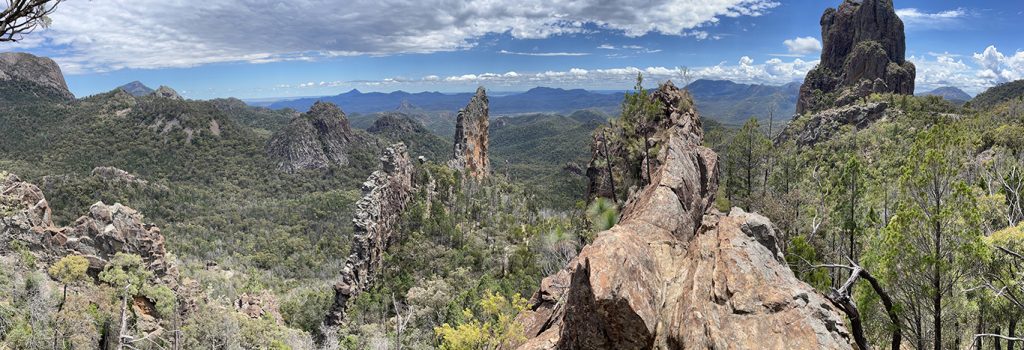
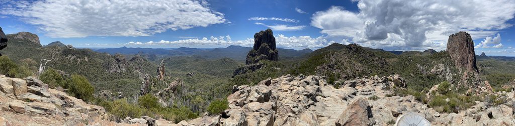
The track continues behind another smaller volcanic dyke, Lugh’s wall, which you can also walk out onto, from this vantage point you are looking north over the breadknife and the panoramic views are worth soaking in for a few minutes. When you are ready to go on, follow the yellow markers for the scramble up to Lugh’s Throne, the ‘high’ in Grand High Tops. From the summit, 960 meters above sea level, the vistas stretch in every direction. To the east Belougery Spire and to the north the Breadknife, while to the south more rock formations can be seen, the pillars of Crater Bluff and Tonduran Spire. Mother nature at her best.
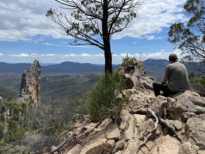
After taking a well deserved break on the breathtaking Grand High Tops summit, begin the descent through forest to Dagda Saddle. Here you will find the turn off to Balor Hut if you want to do the shorter return walk via Dagda Shortcut. As we are doing the circuit we continue past the intersection and along the range to Nuada Gap, past the turnoff to Bluff Mountain.
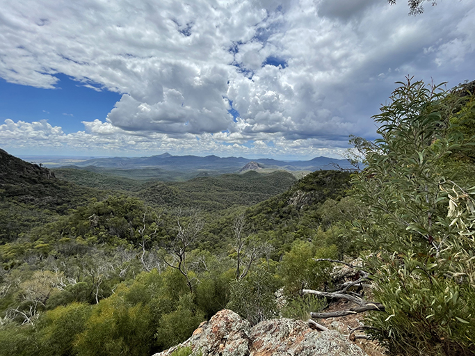
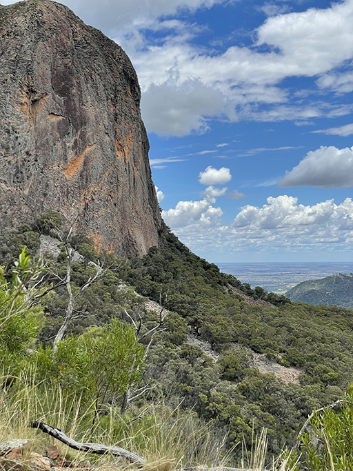
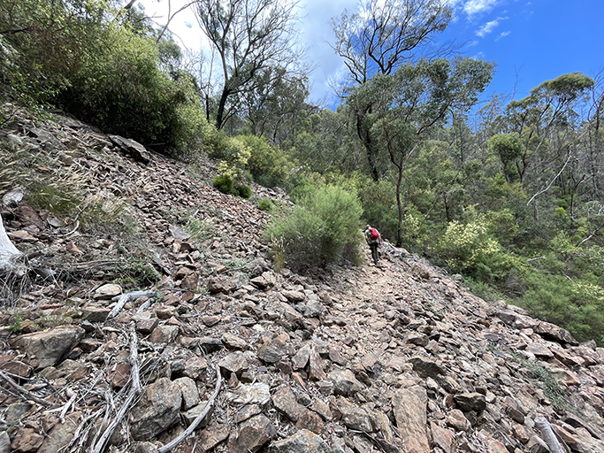
This section of the circuit is less trafficked than the walk up to the breadknife and therefore the tracks are a bit rougher, a bit more ‘back to nature’. The walk through Dows High Tops is lower and less open than the Grand High Tops, but there are still several spots with good views, especially of the dramatic cliffs of Bluff Mountain which changes constantly as you walk around its face. Further north you can see Mount Exmouth, which at 1296m is the highest peak in the park and looking east the white dome of Siding Springs Observatory glistens in the sun.
Fun fact: ‘Dow’ High Tops and Camp ‘Dow’ are named after the person who built the Park’s walking tracks – Carl Dow. All of the work was done by hand, by Carl and his small team of workers. Dow’s Hut (removed in 1980) was Carl’s self-built home for three years while he and his team blazed the mountain trails.
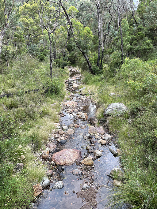
From here the track descends to Ogma Gap where there is another remote campsite and then zig zags steeply into the valley to West Spirey Creek. The track levels out at the bottom of the valley, and criss crosses the (mostly) dry creek bed for the last few km’s, until meeting up with the paved path along Spirey Creek and heading back down to the carpark.
We did this walk in January, and although warmish, it has been a very mild summer this year and we were lucky with the weather. Most years it would be much too hot to walk in this area over the summer months. The flys were annoying, really annoying, so don’t forget the insect repellant, and plenty of water as there is no place to refill along the track. This is a spectacular walk not to be missed, very steep in places, but the views are well worth the effort.