Two Creeks Track
The best walks should always include a café
Lindfield to Roseville | 7km one way | Moderate
There are a few possible starting points for this walk, and for that matter a few places to finish as well. Mix and match to make the perfect walk for you! Jen and I elected to start from ‘Seven Little Australians’ park in Lindfield, but you can also start from the corner of Slade Street and Tryon Road or pick it up behind Lindfield Oval. There are access points further along at Ulmarra Place, Carlyle Road (via Moores Creek Track) and Ormonde Road. The whole track return is over 13km but there are ample options to make it into a shorter loop by including some street walking.
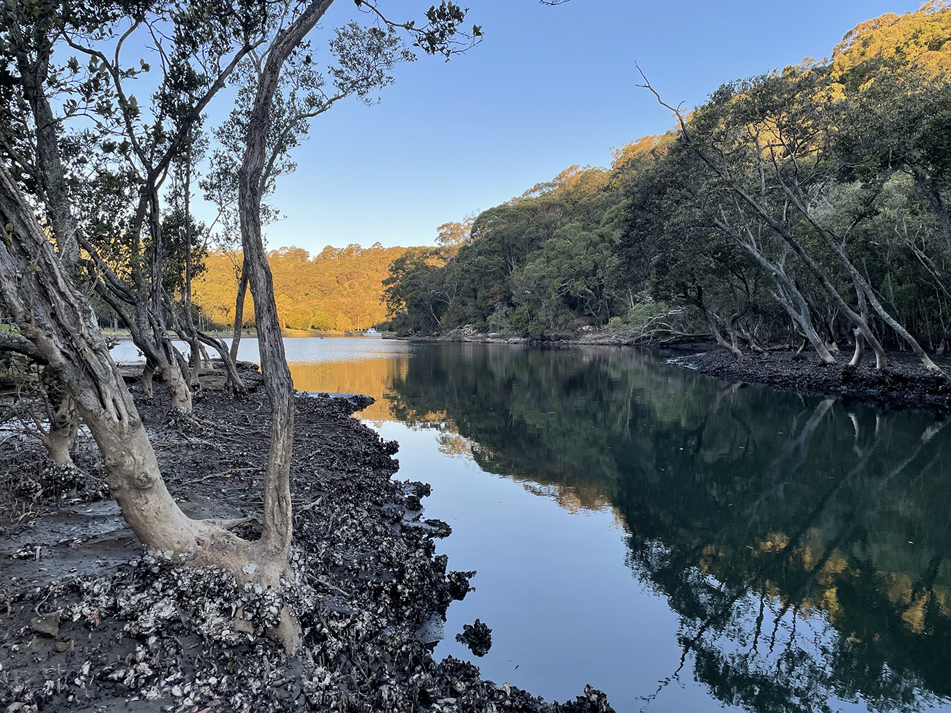
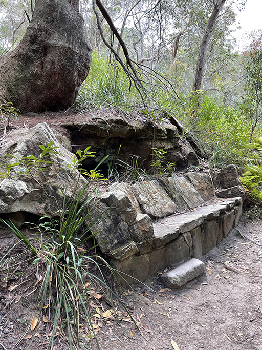
I had chosen our starting point because I had read about a rock overhang that is supported by sandstone pillars. These supports and some of the surrounding cobbled tracks were built by WW1 soldiers as part of their training. Sadly my research was incomplete– we needed to start from the Slade Street entrance to walk past the cave. We did wander over some cobbled paths but we will have to go back for the sandstone pillars.
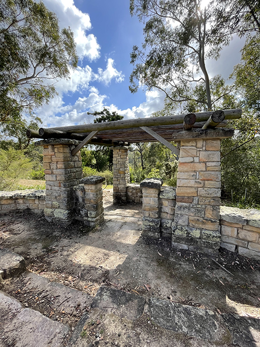

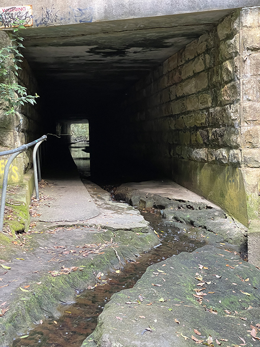
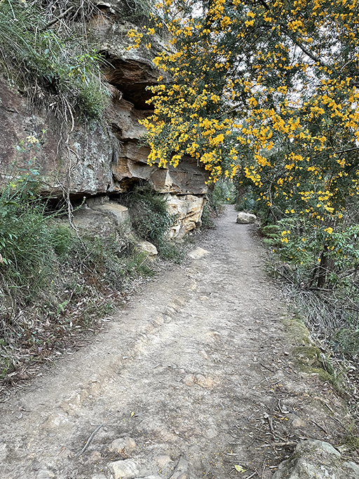
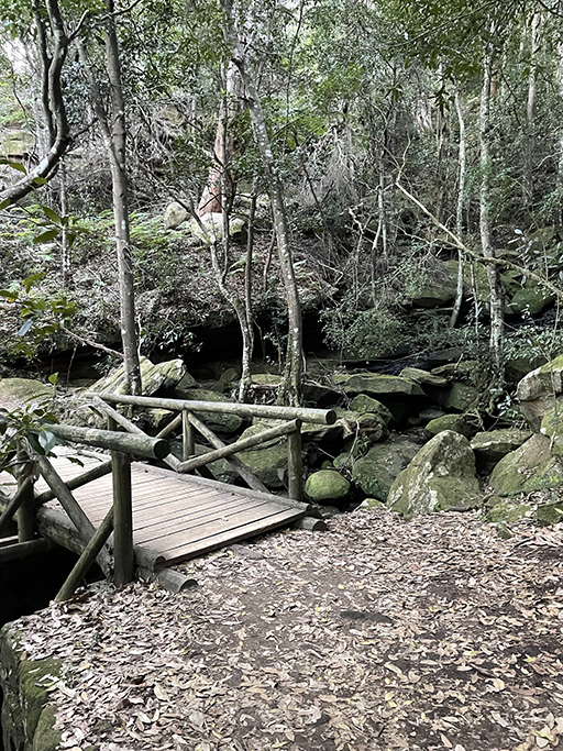
The walk winds its way downhill from the park and over a timber bridge crossing Gordon Creek. At the t intersection turn left and follow the creek to a storm water tunnel under Eastern Arterial Road. The tunnel can become impassable after heavy rain, in which case there is a track up to the road, but it can be quite busy to cross so you will need to be very careful. The tunnel comes out onto a rock platform over which the creek cascades.
Steps to the right lead up to a service trail. After doing just a small section of the walk we were very disappointed to find a temporary fence over the trail announcing it was closed for bridge repairs, sad face emoji. Checking our options on the map we noticed an alternative track closer to the creek. Back down the stairs we found a very feint track heading along the creek bank, it didn’t look like it had seen a lot of traffic. But it was either this or go back the way we had come, so we decided to give it a go.
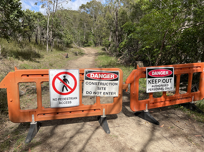
Following the creek, the path was a bit of a scramble and after a couple of hundred meters lead us back up to the service trail. No warning signs in sight. Happy to be back on a proper track we ambled along until we came to another ‘track closed sign’, only this time we were on the wrong side of it! Opps. Well, whatever the repairs are that they are doing, we didn’t see them, so I guess no harm done.
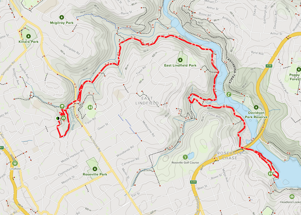
Gordon Creek meets Middle Harbour Creek
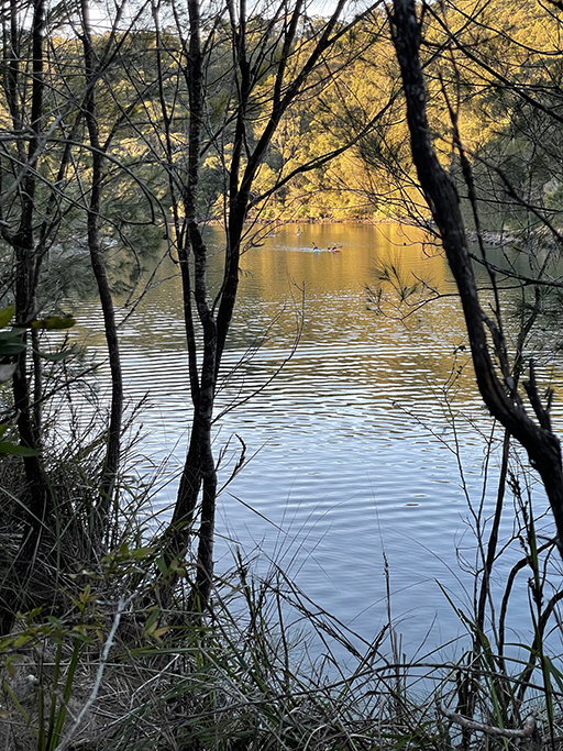
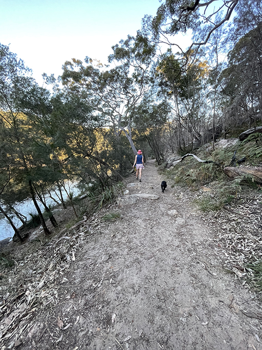
The service trail follows high above Gordon Creek, passing briefly through Garigal National Park. You will see glimpses of the creek and pass the Gordon Creek Pipe bridge. Shortly after this the service trail ends, the track narrows and starts to head uphill. After winding along the side of the hill you slowly descend towards Middle Harbour Creek. The track along this creek is mostly flat, very well formed and maintained. The views of the creek and the bush on the far bank are beautiful, and you will undoubtedly see kayakers enjoying the waterway.
An easy track to walk along there is ample opportunity to admire the scenery. By the time you get to Moores Creek you have now reached water level there are mangroves and rock platforms along the creeks edge. As the track turns right at intersection of Moores Creek it is worth stopping for a rest in this very pretty spot, Davidson Park can be seen on the other side of Middle Harbour Creek and looking along the other side of Moores Creek you get a glimpse of what is yet to come with palms and lush vegetation.
The track along Moores Creek passes sandstone overhangs, and the mangroves give way to a tropical oasis. Turn left over the timber bridge and on the right you will pass the track to Carlyle Road and the Little Digger Track. Keep heading left over another bridge and follow the other side of Moores Creek back to Middle Harbour Creek.
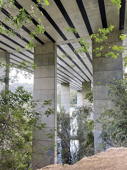
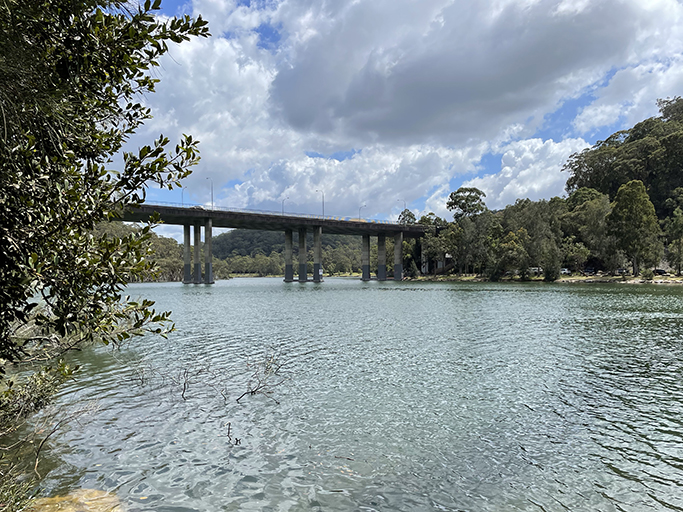
As you get closer to Roseville Bridge the traffic noise become more distinct and walking under the bridge gives you quite a different perspective on a piece of engineering I have only ever viewed from above.
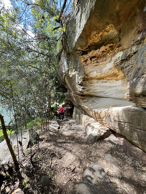
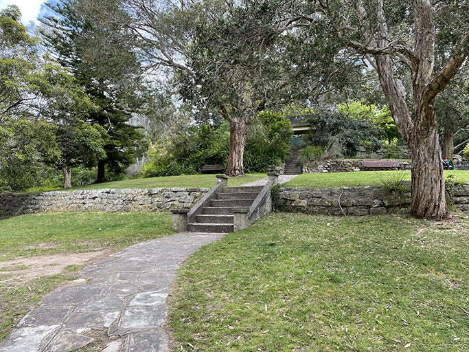
Shortly the track splits, take the lower option along the creek past more rock overhangs and a small sandy beach. Soon you arrive at Echo Point Park. This multilevel park was once farmland and now boasts three levels of parkland with something for everyone. The lower level has picnic tables and bbq’s as well as access to the water. The middle level has playgrounds for the kids and a sloping path from here leads up to the top level with grassy slopes, terraced gardens, tables, bbqs and toilets.

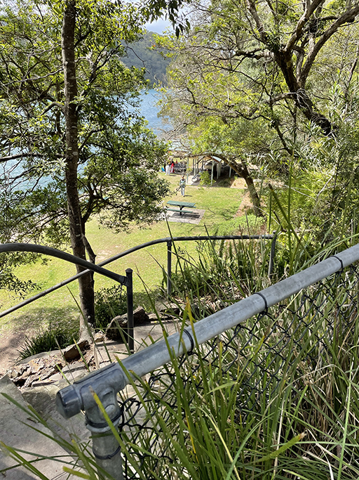
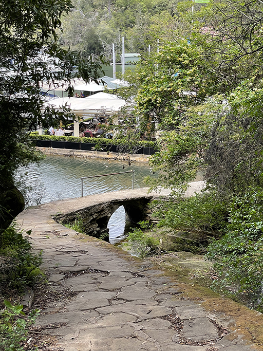
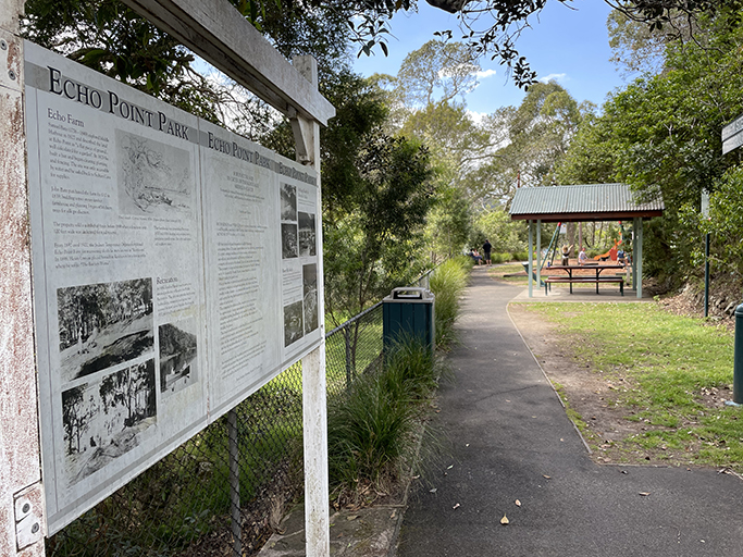
Continuing through the lower level of the park we pass a set of stairs on the left which lead down to the water, there are kids swimming and at low tide apparently another little beach. Following the path a little further, brings us to Echo on the Marina Café at Roseville Marina. If you are after a table it is best to book in advance, but takeaway is readily available and a berry smoothy was a welcome treat on this very warm day. More info here https://www.echoonthemarina.com.au/
We take our drinks and head back up to the park, wandering to the top of the gardens while we drink. Heading right down to the end of Babbage Road there are stairs back onto the walking track if you are doing the return trip.
For the most part an easy walk, particularly the middle section, and a great place to see some beautiful Sydney bush. A large portion of the walk is puppy friendly, just avoid the northern section that goes into the National Park.