Budderoo National Park
Walks and waterfalls
Buderoo National Park sits just two hours south of Sydney, tucked between the Southern Highlands and the south coast of NSW. This weekend we are exploring the waterfalls and lookouts in the Southern Highlands side of the park where the western escarpment of the Budderoo Plateau descends to Kangaroo Valley.
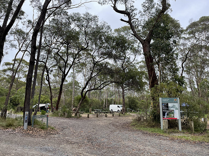
There are no entry fees for this section of the National Park, but there is a small fee if you wish to camp at the only campground available which is at Carrington Falls. A small camping area with 4 campsites for tents ‘camping beside your car’, no caravans or camper trailers. The camping sites are grassy and relatively flat, each surrounded by a set of bollards to define your allotted space. The reality of ‘camping beside your car’ is really ‘camping quite near your car’, the use of awnings on cars and roof top tents doesn’t factor into the concept. We were camping in a swag and in order to have the added protection of the awning we have on our car (the forecast was for a small amount of rain) we had to park within inches of the wooden posts and squish the swag up to the other side of them. Other campers were in converted vans and roof tops – we only saw one tent all weekend.
Just next to the camping area is the day visitor carpark for Blue Holes. There is a drop toilet here which services the camping area too. Sadly, no campfires are allowed.
Walking
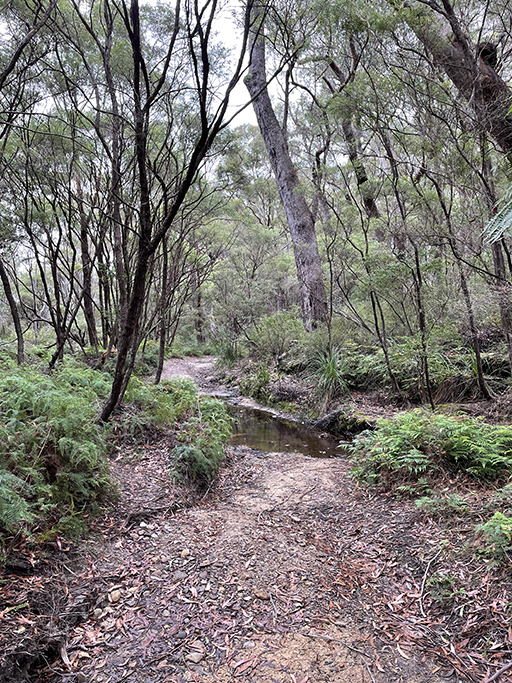
Blue Hole and Nellies Glen | 400m one way | Moderate
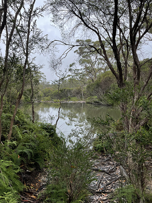
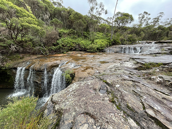
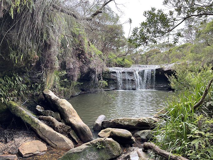
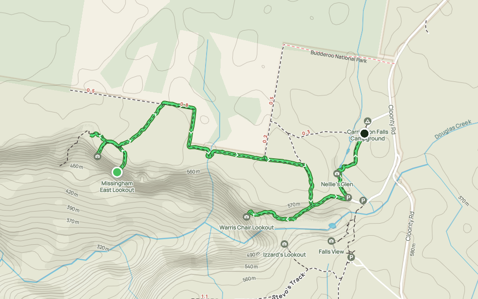
From the campground, and day visitor area next door, you have a choice of walks. Blue Hole is only 100 meters away, and Nellies Glen about 140 meters further downstream. The pool wasn’t very blue on the day we visited as it was very overcast and threatening rain, I am sure a sunny day would bring the colour out. Following the track downstream brings you to the top of the waterfall at Nellie Glen where it cascades into the swimming hole. The Glen is a lovely picnic area and swimming hole which has been a popular with locals since the 19th century, and it’s not difficult to see why. The waterfall and natural swimming hole surrounded by ferns is a great spot to stop for a dip.
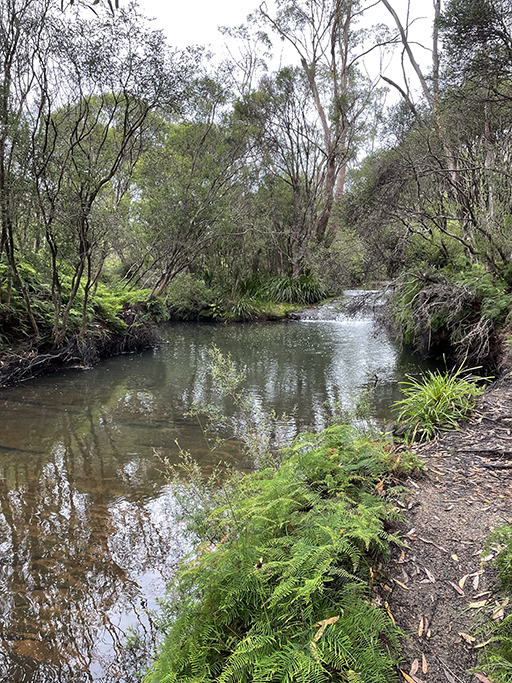
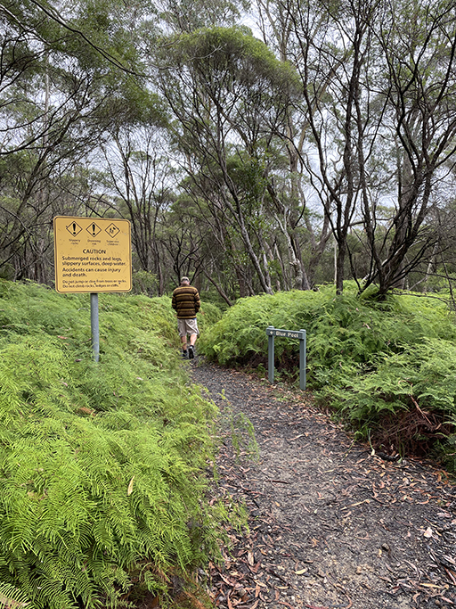
To get to the other side of the swimming hole you need to cross a creek. A quick contortionist act through a narrow gap behind a boulder and then a balancing act on a fallen log over the stream is all it requires. From this side of the swimming hole the view of the waterfall and fern covered overhang is even prettier. The spring water that flows through Blue Pool and Nellies Glen continues from here into the Kangaroo River before tumbling over Carrington Falls into the lower Kangaroo Valley River. Continuing along the track for another 150 meters will bring you to the Nellies Glen Carpark.
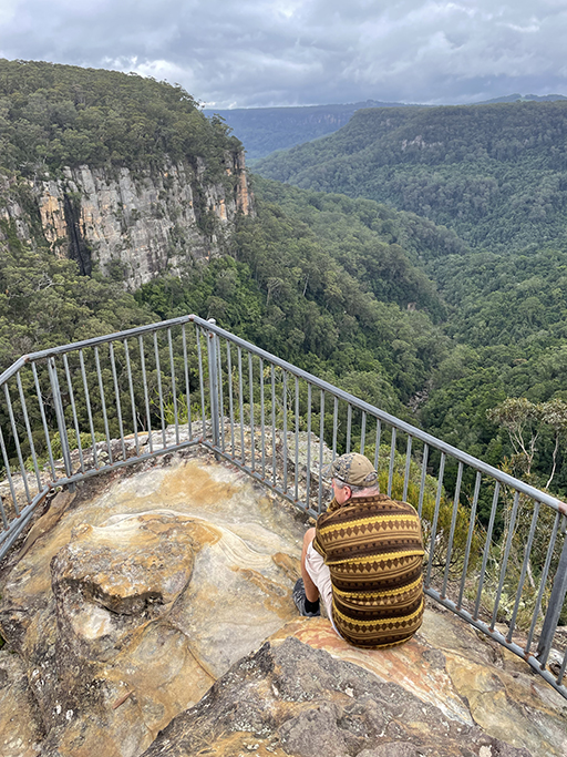
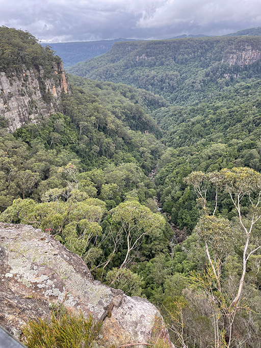
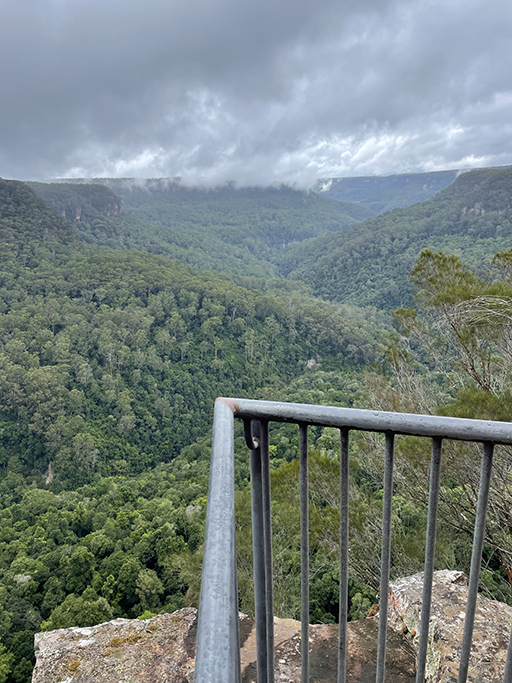
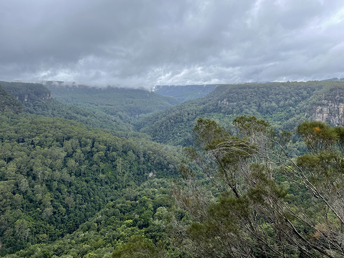
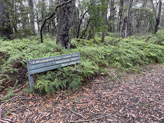
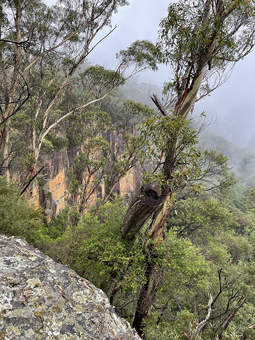
From Nellies Glen Carpark there are tracks Warris Chair Lookout, Missinghams Lookout and Missinghams West Lookout. Each of these vantage point has stunning views up and down Upper Kangaroo Valley but you can’t actually see Carrington Falls from any of them.
Warris Chair | 1km return | Easy
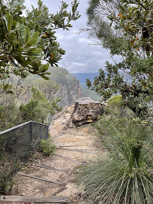
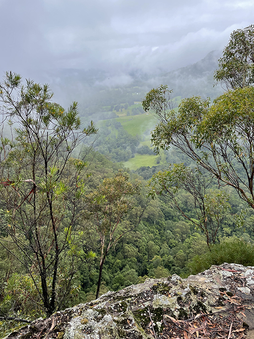
From Nellies Glen carpark it is an easy well-formed track to the spectacular lookout at Warris Chair. The track follows the edge of the escarpment through woodlands of banksia, where you can tantalizingly hear water thundering into the valley below but never quite manage to get a glimpse of the waterfalls. The lookout sits atop a rock formation jutting out into the valley and offers impressive views across the last remaining pocket of rainforest protected by Budderoo National Park.
The lookout was named for Lady Warris – I have been unable to find any information about who she was, but she certainly had great taste in lookouts, the sandstone rock here forms a fabulous seat on the edge of the escarpment to sit and soak in the views.
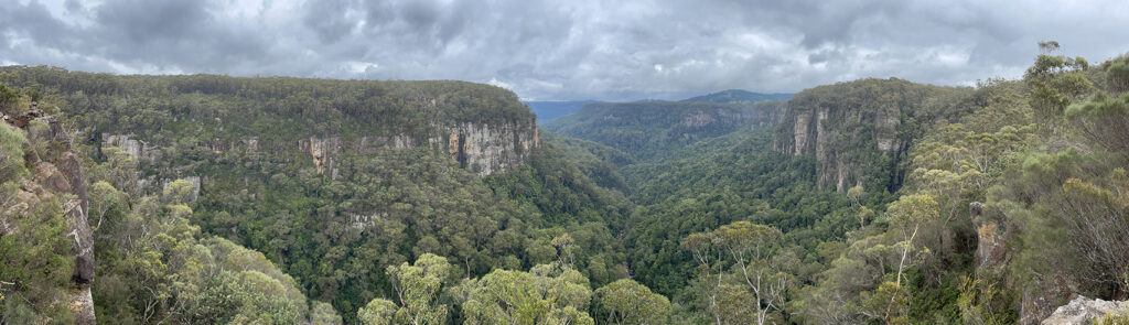
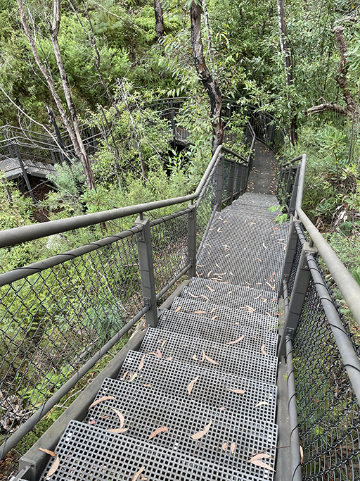
Missingham Lookouts (East and West) | 3.8km return | Moderate
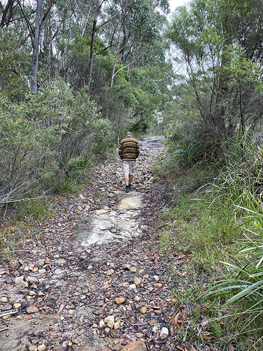
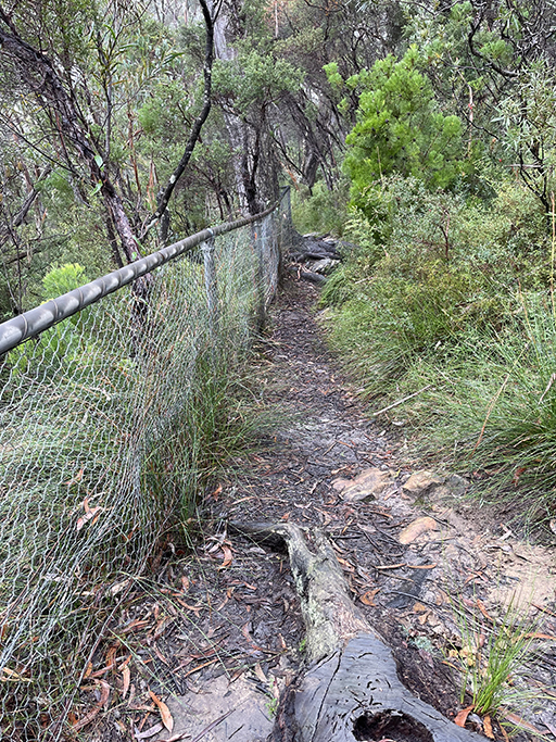
The walking track to Missingham’s Lookouts is a bit longer but still not a difficult walk. From Nellies Glen Carpark the track is a wide dirt trail that undulates through forest and across a couple of small creeks. For a while the path follows the edge of the national park where it borders with farmland, you walk with towering trees on one side and green pastures on the other, before diving back into the forest and towards the edge of the valley. The views from this western edge of the escarpment show off Kangaroo Valley in all its glory.


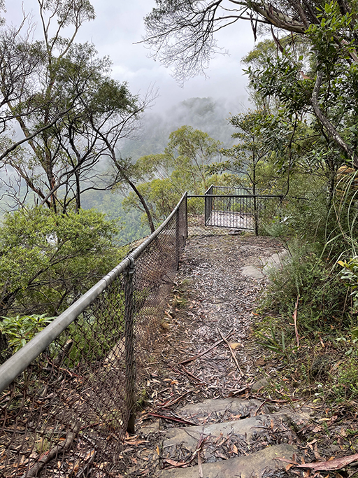
Missingham Steps
After visiting Missingham West and Missingham East Lookouts, the track continues on to Missinghams Steps. A grade 6, 6km, 300m decent into the valley below. The recommended time for this adventure is 4-5 hours and is not for the inexperienced bush walker. The steep steps cut into the sandstone cliff were originally carved by workers at the mill. John Missingham convinced his labourers to complete the project during their annual holidays, giving access to the valley below.
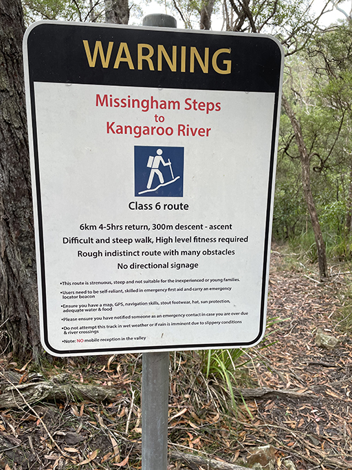
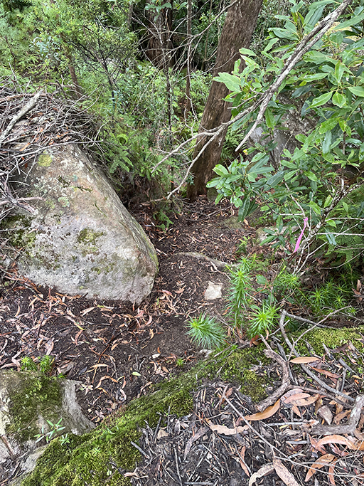
We walked from the campground through Nellies Glen, to all of the lookouts and on to the top of Missinghams Steps, stopping at the point where the track started to become more vertical than horizontal. The total return walk was roughly 6.4km.
For the history buffs
John Missingham and his wife Mary moved to Carrington Falls in the 1880s. From humble beginnings John worked hard to improve himself, and life for his wife and eight children. He was active in the community, a councillor for the Shire Council and sat on several local committees. He also developed a passion for the bushland around Carrington Falls. In the early 1900s John purchased a timber mill and established his sawmilling business, logging on private property and from the surrounding forests. Hardwood trees were felled and hauled to the mill along the steep escarpments by teams of bullocks. Four generations of Missinghams worked the family sawmill until it closed in the 1980s.
Chasing Waterfalls
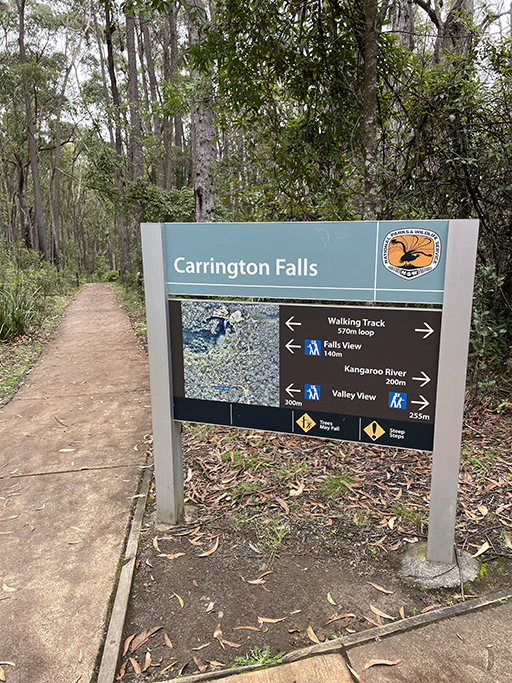
Carrington Falls | 600 m loop | Easy
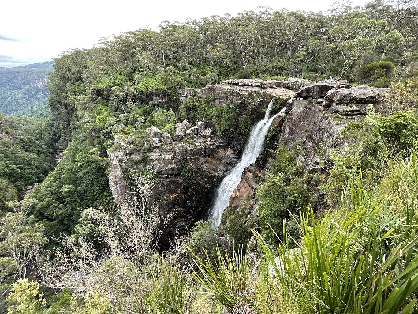
Carrington Falls is a spectacular 90m single drop fall, cascading down a sheer rock face, into the Kangaroo River below.
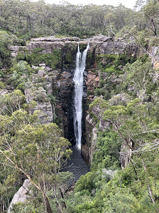
To see Carrington Falls you need to cross to the other side of the valley. Cloonty Road crosses the river at the top of the falls and it is a short drive from here to the Carrington Falls Picnic area. A 600m loop walk takes you along paved path and metal stairs clinging to the top of the cliff. There are three lookouts offering three different perspectives of the cascading water. Near the lookout closest to the falls you can step down to the water’s edge just above the falls.
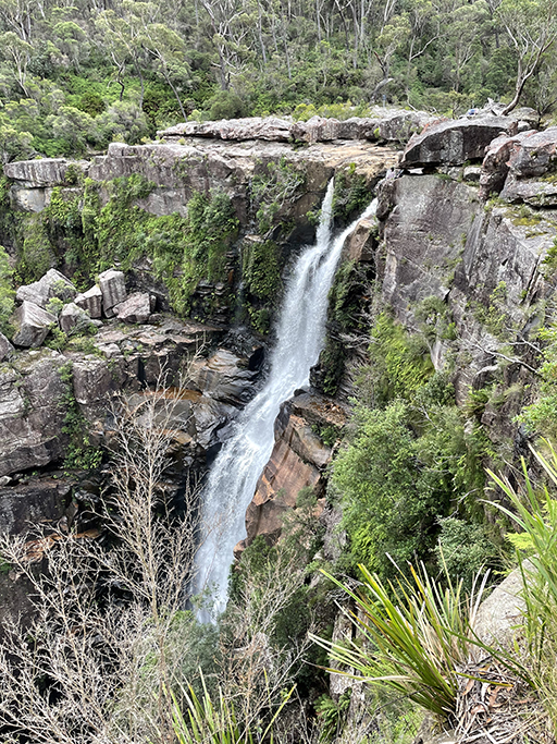
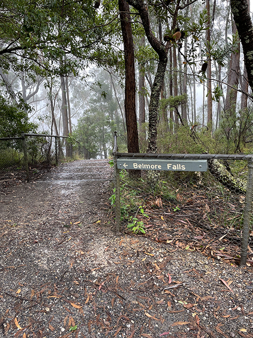
Belmore Falls | 1.8km return | easy
Belmore Falls is beautiful plunge waterfall a short drive from Robertson, in nearby Morton National Park. A plunge waterfall is one that doesn’t hit the cliff on the way down. The water fall loses contact with the rock and falls straight down. Who knew? Not me – never too old to learn something new. It actually has three tiers, although you can only see the top two from the lookouts. Barrengarry Creek plunges over the escarpment into a large pool, which overflows down the cliff into the valley.
The access road to these lookouts is a loop and has two carpark areas. We parked in the first one, from here the closest lookout is Hindmarsh Lookout which offers sweeping views down the valley, but not of the falls. Sadly, this lookout was closed at the time we visited; it was also very foggy so we probably wouldn’t have been able to make the most of the views anyway.
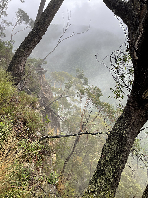
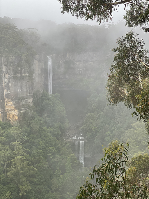
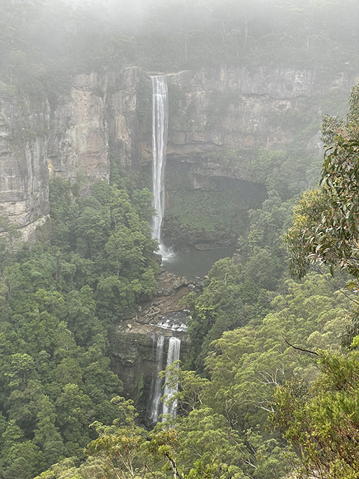
Continuing to the right, the rough dirt track hugs the fence along edge of the cliff. The next lookout is about 200 meters away and as the mist rolled up the valley glimpses of the tumbling water came and went. Closer to the falls the third and final lookout has a less obstructed view and when the mist cleared the view of the falls was worth the wait.
After you have admired all the views from all the lookouts you can get back to your car by retracing your steps or cutting back along the road.
If you continue along Belmore Falls Road it crosses a ford over the river, just above the falls, where the water looks deceptively calm before it plummets over the edge of the cliff.
