Milsons Point to Wollstonecraft
No.5 Walking Sydney Harbour
Having triumphed over the coastal walk from Palm Beach to Manly, Jen and I have embarked on our next challenge – walking around the foreshore of Sydney Harbour. This is number five in the series – 9.5km from Milsons Point to Wollstonecraft.
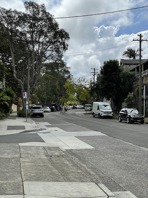
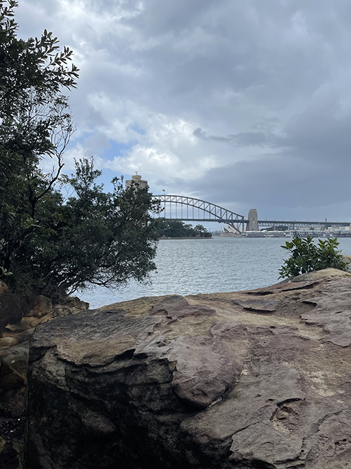
Finally a section that works with public transport. Starting from Milsons Point Station it’s all downhill till you hit the harbours edge. I might be slightly biased, but Sydney is a nice looking city and this walk promises to have some pretty good views of the city from a variety of angles. It also promises a fairly good shoreline to street walking ratio with North Sydney Council offering a nice selection of parks to walk through.
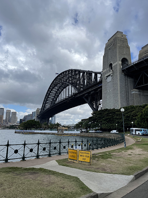
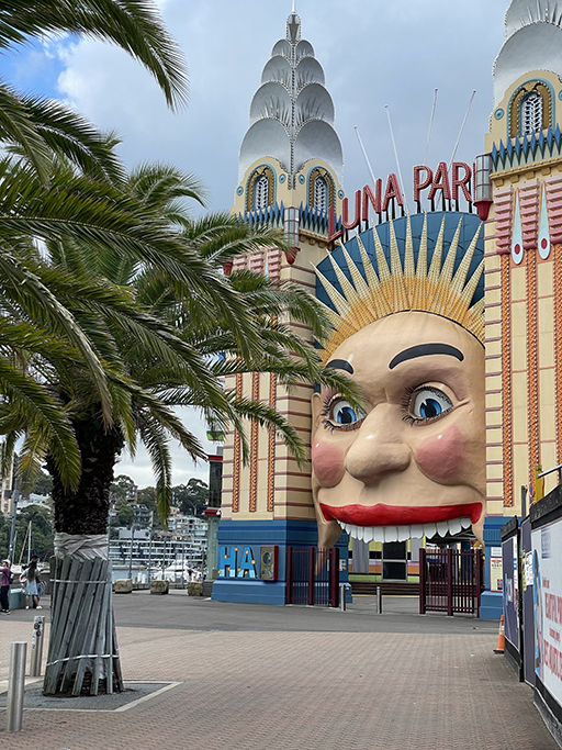
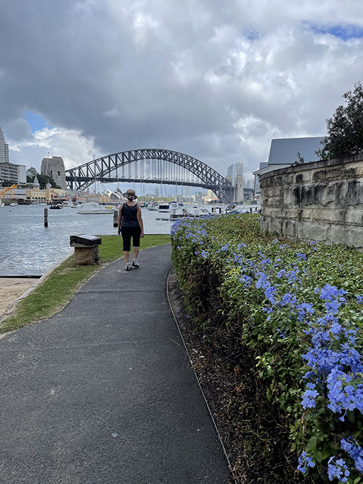
Follow Olympic Drive under the mighty coat hanger (or Sydney Harbour Bridge if you prefer) to greet the smiling face of Luna Park. The boardwalk continues alongside the fun park and on to the Peter Kensington Walkway around Lavender Bay. At the head of the bay, just opposite the ferry wharf is a passage under the railway line and stairs up towards North Sydney. If you have the time for a little detour, about halfway up those stairs is Wendy Whiteleys Secret garden.
The garden was built by Wendy as she grieved, after her husband, renowned artist Brett Whiteley, passed away. It is an amazing slice of paradise amongst the urban chaos and well worth a visit some time, if you can’t fit it in to this walk you must come back another day.
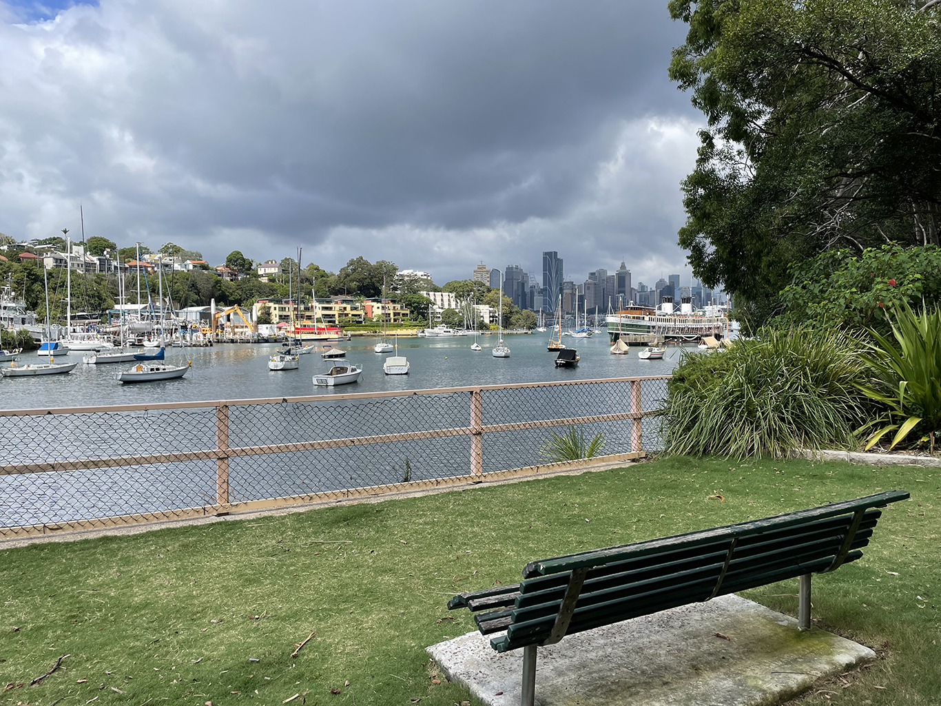
Follow the shoreline through Quibarre Park past the old slipway and onto a pathway that will turn right up an impressive set of stairs through Bob Gordon Reserve. At the top of the reserve on Bay View Street turn left and follow the road until it turns left into East Crescent Street and head down to the corner. Take the walkway on your left marked ‘Pathway to Ferry and Bus Stop’ which will bring you down right behind Sails Restaurant and McMahons Point ferry wharf.
They are doing construction work in a section of Henry Lawson Reserve, for the new train tunnel under the harbour, which blocks some of the shoreline access. We head up Henry Lawson Road to Blues Point Road and turn left down into Blues Point reserve.
On your right Blues Point Tower rises high above the point. When it was built in 1962, this was the tallest apartment building in Australia, and one of the first strata-titled apartment blocks in New South Wales. The 25-story tower was part of a concept plan in the 50’s by a group of architects that included Henry Seidler. It was originally designed to be one of eight towers combined with other residential and commercial buildings, a hotel, community facilities, a yacht club and a restaurant. The single tower was the only thing that was constructed before public outcry put an end to the plan.
The reserve runs around the edge of the point at the base of the tower until the shoreline returns to private ownership and we head up the stairs on our right to Blues Point Road. Head uphill to West Crescent Street. Don’t let the Dowling Street Reserve fool you – it doesn’t go anywhere and what goes down must come back up!
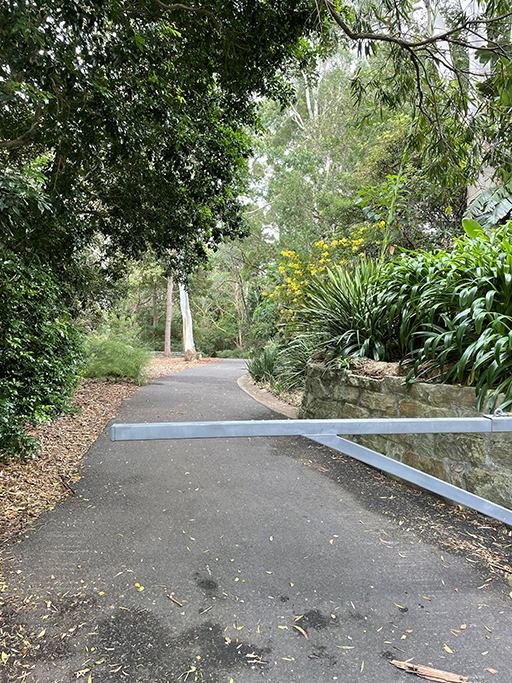
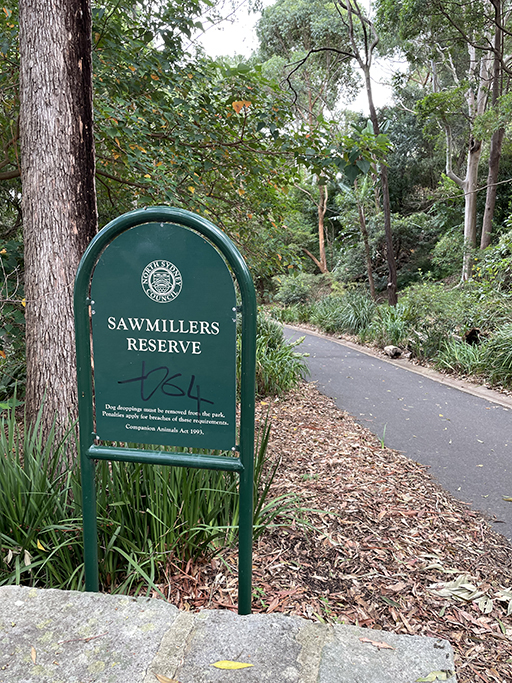
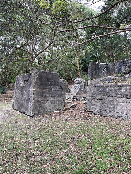
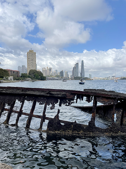
West Crescent Street looks like it ends with a dead end but keep going straight ahead into the 10kmh shared pedestrian area and you will come to a gate into Sawmillers Reserve. As the name implies this was once the site of a sawmill, in its heyday the timber yard had its own powerhouse, two sawmills, an engineers shop, a joinery shop, a blacksmiths shop and its own wharf. Today all that remains are some concrete foundations nestled amongst the trees. Just off the shore is another slice of forgotten history. Remnants of a jagged metal wreck, that was once a MSB hopper barge, wallows in the shallows.
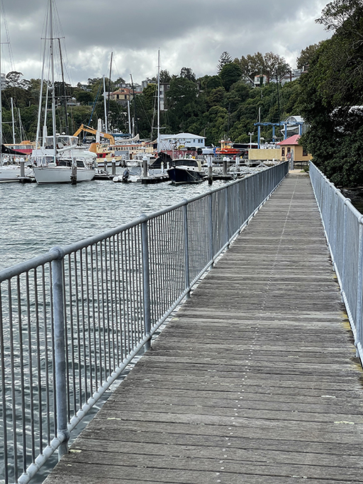
At the northern end of the Sawmillers Reserve continue along the boardwalk and path up to the boatyards and the bottom of Munro Street. The walk up Munro Street seems to go on for ever, when you eventually get to the top turn left over the railway line into Victoria Street and then follow Dumbarton Street along the railway. Turn left down John Street and head back under the railway line and to the end of the street.
Where the track splits into two take the low road which will take you around the top of Berry Bay through Waverton Park. Continue around the shore and then up the timber stairs and turn left down the peninsula. This former oil storage site was re-purposed for recreational in 2005, and there are still plenty of reminders of the reserve’s industrial history. The path passes several semi-circular cuttings in the sandstone cliffs that once held huge above-ground storage tanks.
At the end of the reserve take Balls Head Road and turn left up the stairs to Balls Head Drive. Just over the road is the Coal Loader, an ex-industrial, heritage listed site. From the 1920s to the 1970s the Coal Loader was part of Sydney harbour’s working waterfront, now it’s a public space dedicated to history, culture, industry, nature and community. On the street level there are open spaces and community gardens to wander around (and toilets). There was a café here last time I visited but it seems to be closed. If you aren’t quite ready for a pit stop we will be walking back past again, down near the foreshore, after circling Balls Head.
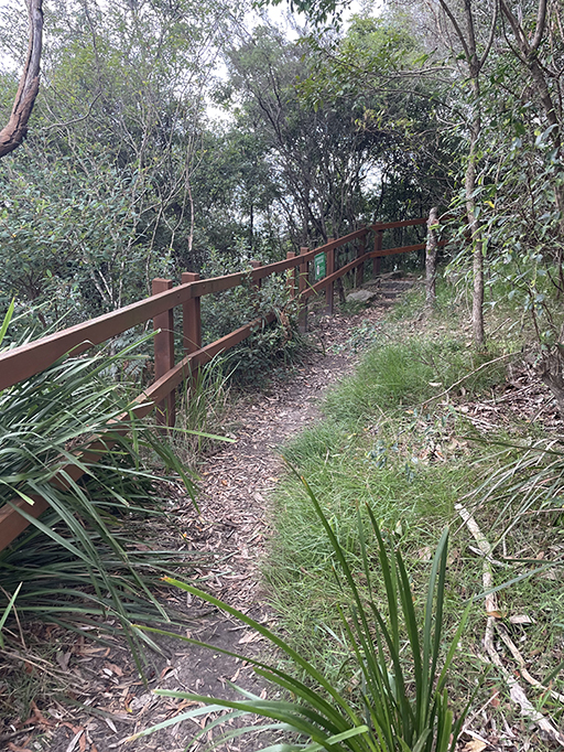

Heading down Balls Head Drive, after you pass some buildings on your left, the path ducks into the bush. Follow the track around the headland reserve, past the site of some Aboriginal rock engravings and back to the Coal Loader – but this time at water level.
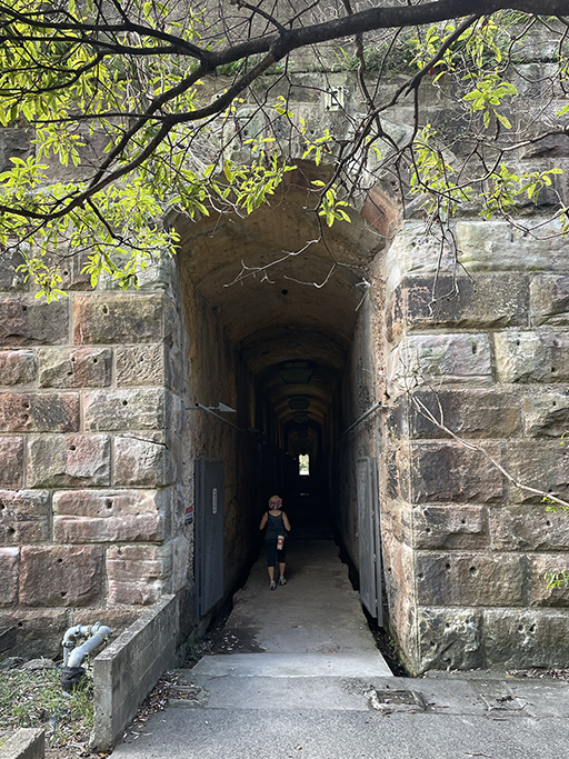
The bush track ends at a rather imposing sandstone wall with tunnel opening in it. This tunnel is one of four old coal loading tunnels, and the only one with public access. A second tunnels can be seen on a history tour and another is home to special population of Eastern Large Bent-wing Bats.

When you emerge back into the light head up the hill and past HMAS Water Hen – along Balls Head Road towards Waverton Station. There are shops and Café here if you need refuelling before we turn down Horace Street and back to the waterfront.
Sugar Works Reserve leads along the foreshore into Oyster Cove Reserve. Unsurprisingly the site was once a sugar works. Then it was a kerosene works, then a gasworks. Some of the original buildings, including the large chimney, have been preserved and incorporated into the residential development along the shore.
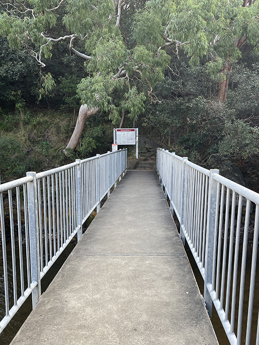
At the end of the grass head over a little metal bridge and up the track through Badang Reserve to Tyron Avenue.
Turning left down Shirley Road would take us down to Berry Island – that can wait till next time. We turn right at Shirley Road and head about 0.5km up the hill to Wollstonecraft Station and home on the train.

