Ourimbah to Kulnura |GNW
Jilliby State Conservation Area
Ourimbah Creek Road to Greta Road | Approx. 15km | 5 Hours | Hard
Leaving a car at either end of this walk requires quite a bit of driving but there isn’t really any way around it. The 15km walk translates to a 40km drive from one end to the other around the Jilliby State Conservation area. Meeting at Greta Road we hop into one car and start the drive to Ourimbah.
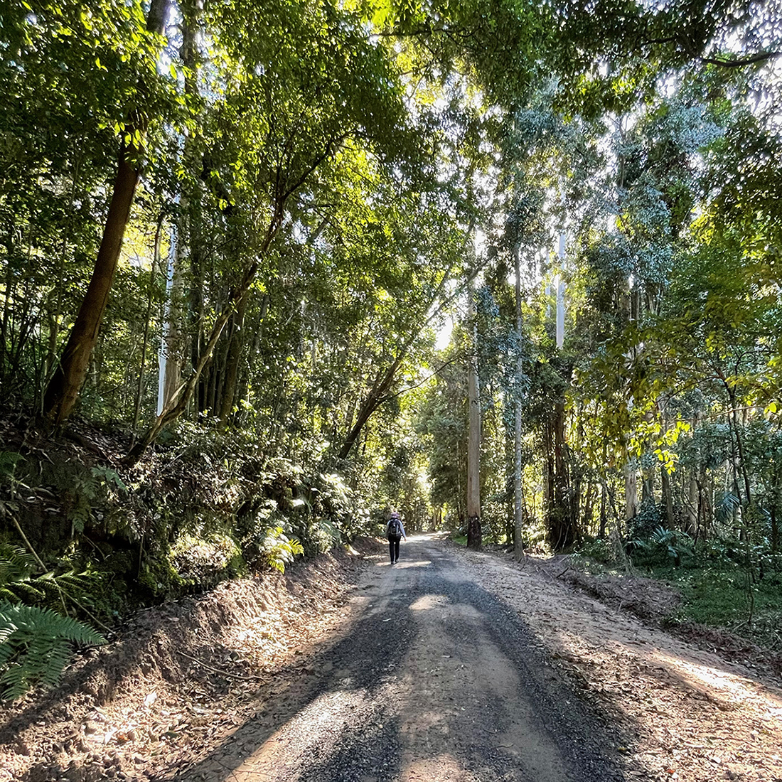
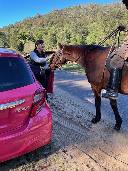
We are starting our walk from the picturesque Ourimbah Creek Road. Driving along here was a complete surprise. After exiting the M1 we turn back under the motorway and follow Ourimbah Creek along a beautiful valley, surrounded by forest and filled with small acreages, horse paddocks and beautiful rural homes. Side streets have cute names like Lyre Bird Lane and Wombats End. About 10km in we park the car and get ready to start walking. As we are strapping up our boots some horse riders come past for a chat and a pat, it really feels like we are in the country.
As we pass Platypus Creek Lane on the right, there is a locked gate which we walk around. The sandy and at times muddy road winds through rainforest along the banks of Ourimbah Creek until we come to Cedar Brush Track. There are warning signs here that the track may be impassable due to landslides, but we assured by a group walking in the opposite direction that it isn’t too bad. Worst case scenario we get to a spot we can’t pass and turn back, so we decide to push on.
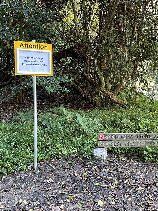
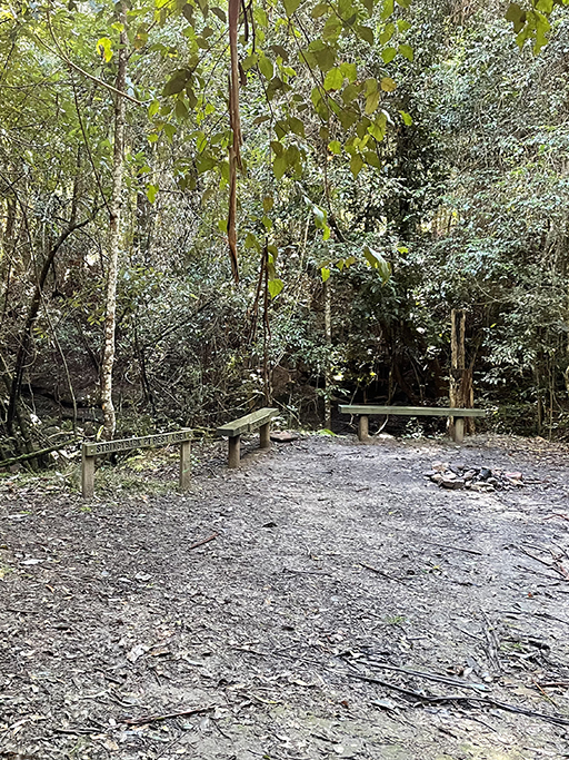
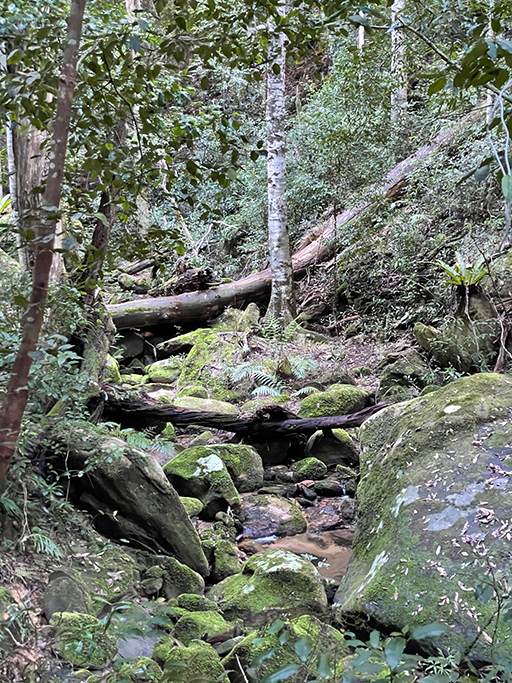
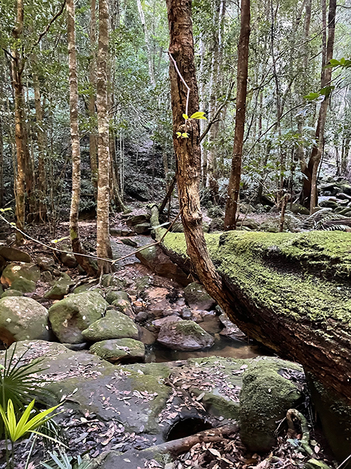
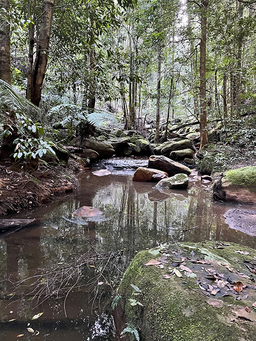
There are indeed a couple of sections of creek bank that have eroded but nothing impassable for those on foot. The first point of interest is a campsite in a small clearing at Stringy Bark Point, just near a timber bridge over the creek. It is only a small campsite with room for a campfire and a few tents. This is a pleasant mossy area with many ferns and near a wide sandy section of Ourimbah Creek.
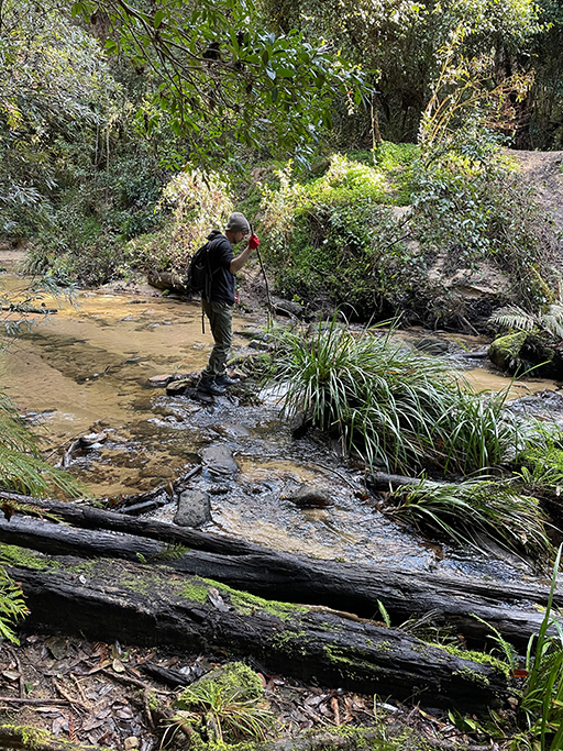
A bit further on we cross Ourimbah Creek. The crossing here is not straightforward and may become impassable after heavy or prolonged rain. There are steppingstones but they are quite widely spaced and the opposite bank is very steep. We thought about taking our shoes off and wading across but there was nowhere to put them back on before we scramble up the sandy bank and get filthy. With the help of some sturdy sticks for extra balance we manage the crossing without any incidents and climb up the bank to the next section of track.
Walking up the ridge through dense forest to Tooheys Road is steep and long and there are lots of leaches. You can see them walking (do leaches walk?) over the track. This was a great incentive to keep going even when my lungs suggested it was time for a rest. Stopping briefly every now and then for an ankle check the final tally was two leaches. Thankfully they had only made it onto my shoes and socks and hadn’t started munching on me.
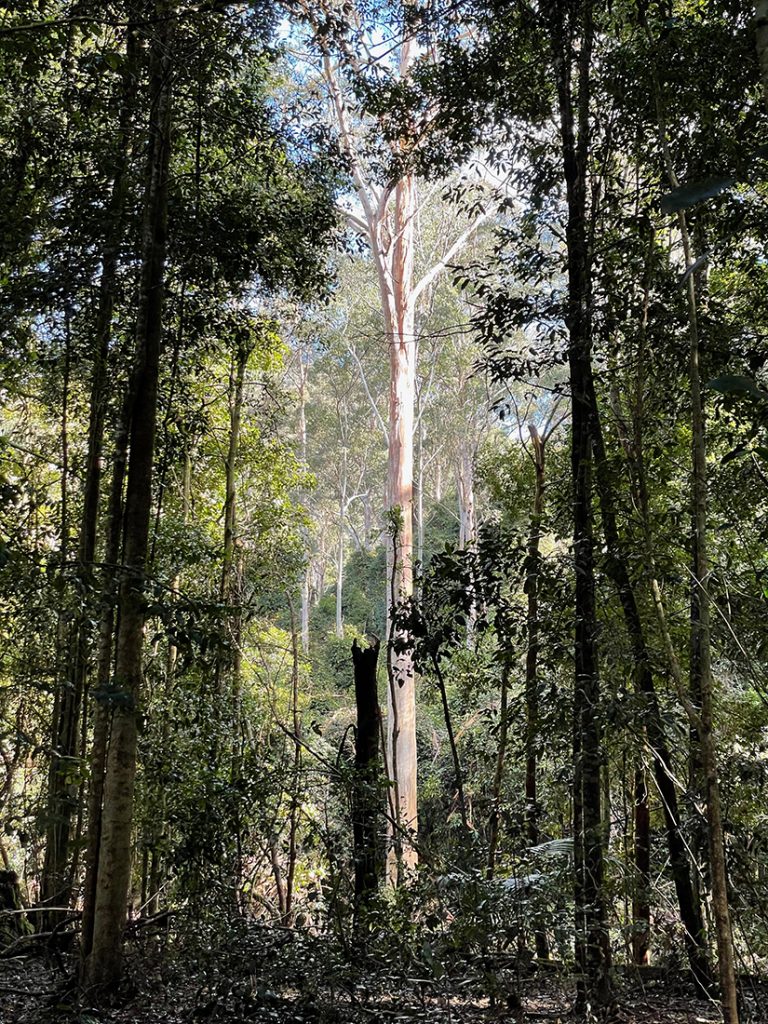
At the top of the hill where the surroundings dried into eucalyptus forest we sat down and took off our boots for a thorough leach check. Thankfully we were all clear, I hate those little critters!
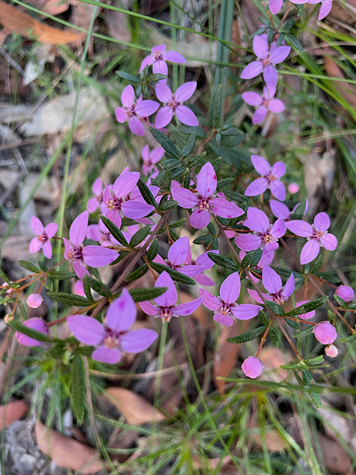
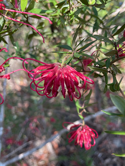
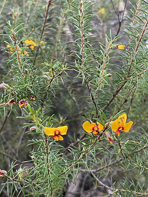
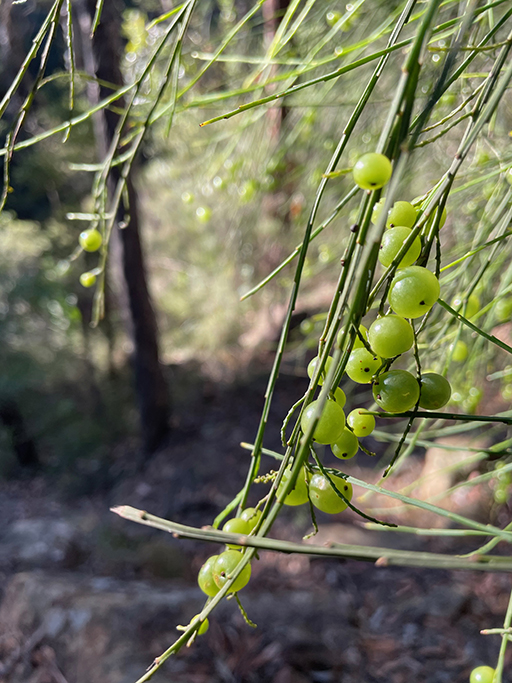
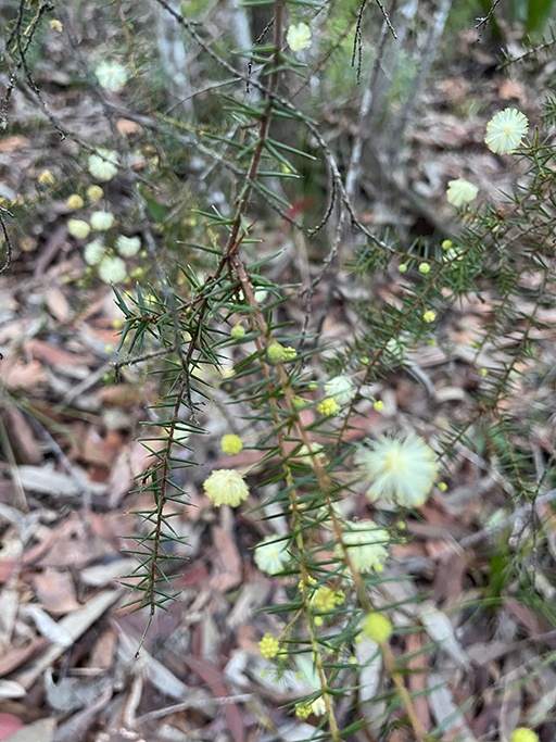
Despite the leaches the Jilliby State Conservation area is very beautiful and the number of wildflowers on display for this time of year is a pleasant surprise.
Once on the open ridge we stopped for lunch on a rocky outcrop. From here the track flattened out and widened into a dirt road. This is Tooheys Road which will take us up over a saddle and along the ridge for a couple of kms. Some sections are quite steep, and the rack is eroded badly in spots.
Our plan for this weekend had been to stay overnight at Yarramalong and do another walk tomorrow. However while we are walking Tooheys Road we get a call from our host to let us know that Sydney and the Central Coast have been put into Covid Lockdown and if we come to stay we will have to stay for a fortnight. As tempting as this is we decide to abandon our plan and head home at the end of this walk.
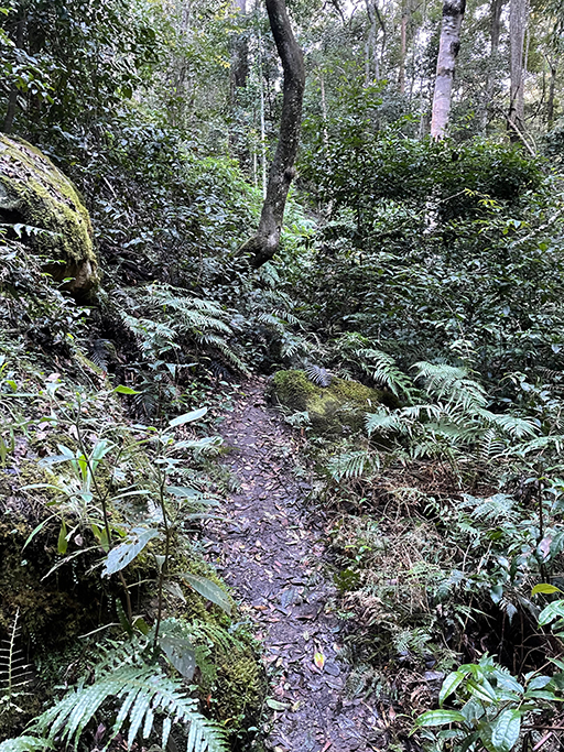
We turn left off Tooheys Road at the Great North Walk sign, along a narrow track down to the cool and mossy Dead Horse Creek. This area is again quite damp so we keep up a good pace to try and avoid picking up any hitchhikers. After crossing the creek we follow the sign zig zagging up the hill and along the valley through dense forest and ferns. Climbing out of the valley the forest becomes dryer and more open until the track leads to the side of a large high tension power-line tower and meanders through a heath and scribbly gum forest to Cherry Lane. After about a 1.5km road slog we arrive at Great Rd, jump in the car, and set off to retrieve the car we left at Ourimbah earlier in the day.
In total today we have driven 65km from home to Greta Road, 40km from Greta Road to Ourimbah x 2 (before and after the walk) plus 70km home again. Which is about 3 hours of driving for our 5 hours of walking. I am definitely ready for a long soak in a hot bath when I get home.
