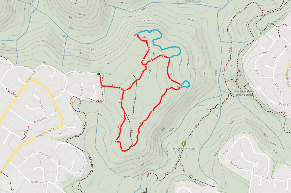
Refuge Rock and Natural Arch
Moderate | 3.1km
At the end of Trevors Lane in Cherry Brook there is a locked gate and small sign to mark the edge of Berowra Valley National Park. Skirt around the gate and follow the service trail along the side of the houses until you come to a walking track heading off to the left. The walking track is an easy level walk and before long you meet the Refuge Rock Trail at a t-intersection.
This walk is a loop, and you can go either direction, but I chose to turn left. The management trail is an easy but unremarkable walk and after about 400m there is another service trail off to the left just asking to be explored. The trail comes to an abrupt end at an electricity pylon.

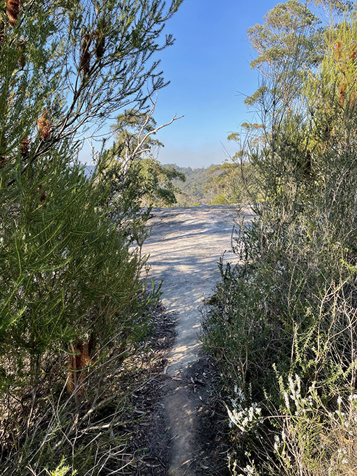
The thought of backtracking up the fire trail was uninspiring, and I noticed a walking track, not marked on my map, diving down and to the right. I don’t have anywhere else to be today and it is a lovely day for some more exploring. My newly discovered path follows around the base of the rocks and appears to be reasonably well trafficked. It is also much prettier than the fire trails. I can see from my GPS that I am staying within reach of the main trail so I am quite comfortable following wherever the path takes me.
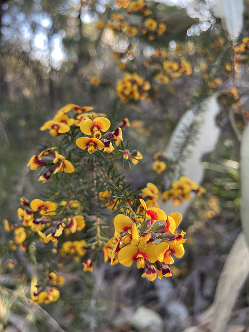
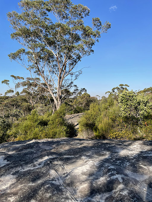
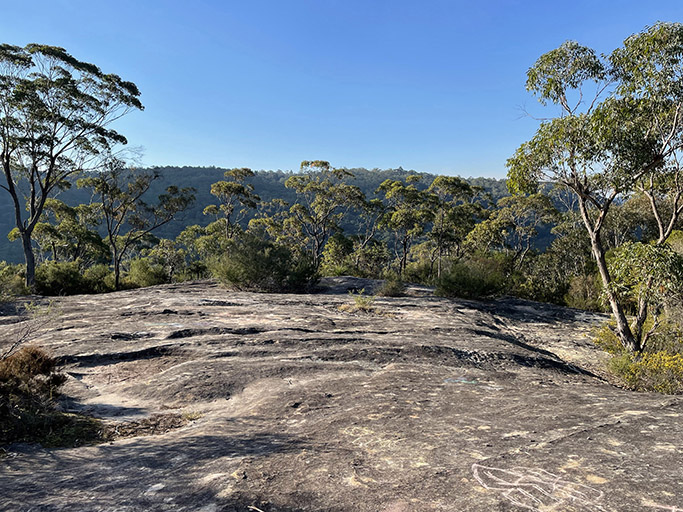
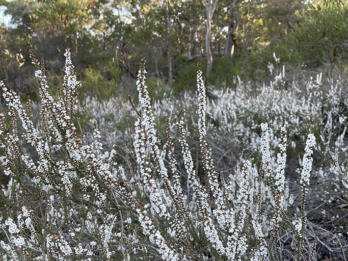
After a while the trees thin and I am on a large rock platform, Refuge Rock. Actually a series of rock platforms over hundreds of meters, broken up by patches of eucalypts and banksia shrubs, with lots of little trails connecting them. Wandering around the platforms and admiring the view down the valley feels like you are much further from suburbia than you really are.

Bonus history lesson
Apparently Refuge Rock acquired its name from being a safe haven for firefighters carrying out controlled burns, due to the large expanse of naturally clear space. I didn’t realise at the time, but it was also used as a target area during military training around WWII and there are a number of visible marks in the rock surface from mortar shells, I will have to go back and look for them.
These markings were created in the early 1940s, when General Macarthur used the area as a target for field artillery located at Cherrybrook. He was given authority over all of the allied naval, land and air forces in the South-West Pacific Area.
This was a desperate time and threat of Australia being invaded was all too real. Macarthur thought that Australian militiamen needed to be trained, including in the use of mortars and large artillery, and refuge rock, being large and reasonably isolated, seemed like a good target. The troops were stationed in nearby Cherrybrook and fired repeatedly on the rock, leaving behind the pitting which you can see today, if you are lucky, you might even see the remains of some of the mortar shells in the pitting.
Back to the walk.
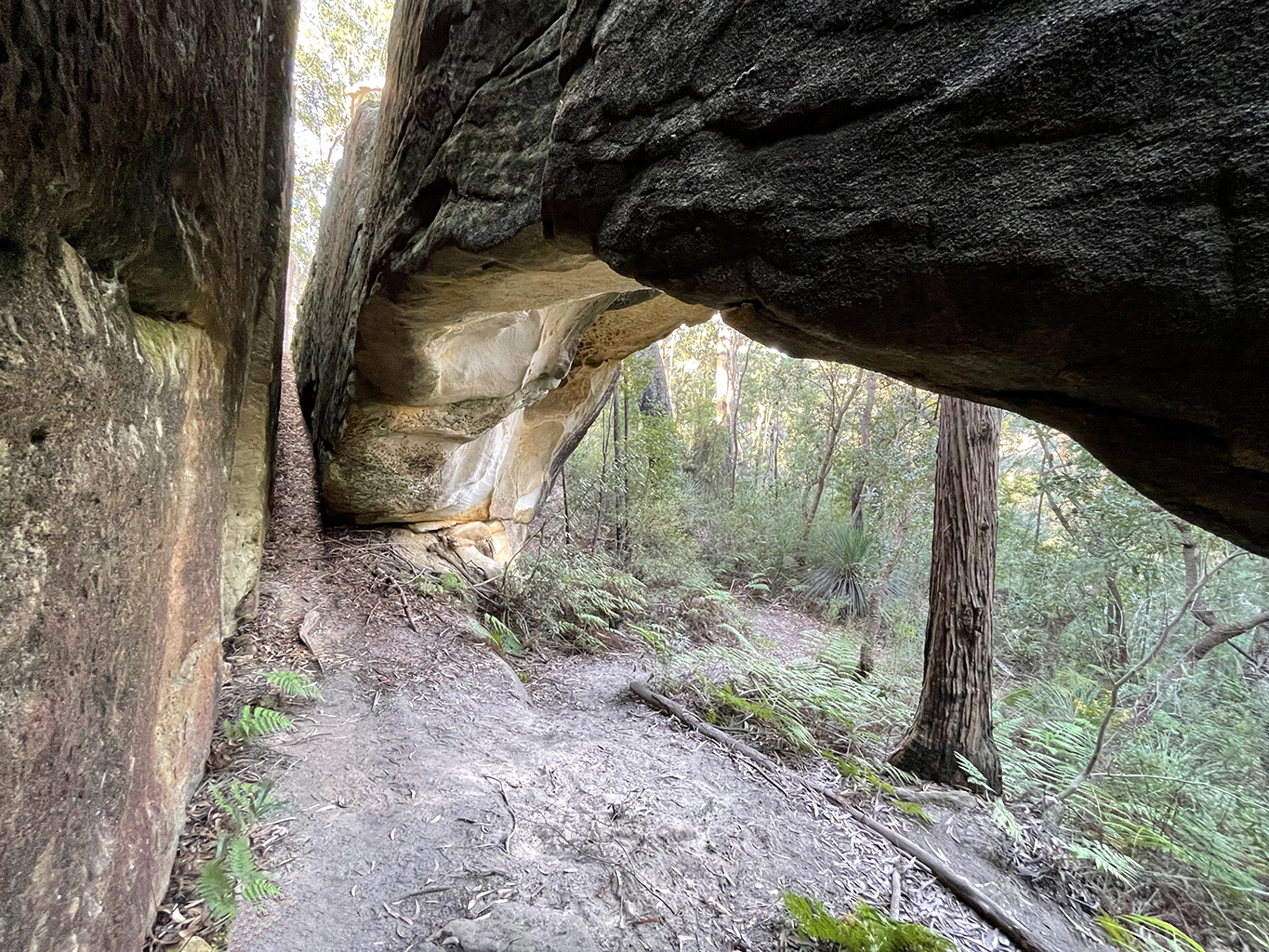
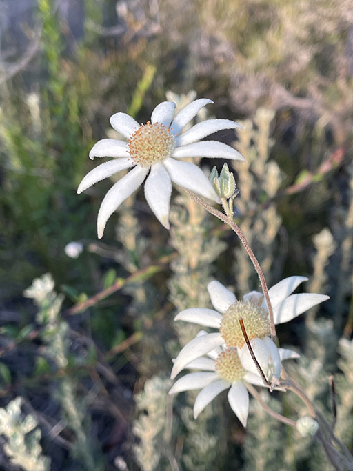
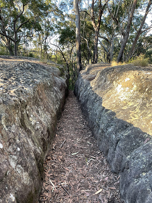
After exploring the rock platforms and admiring the fields of white wild flowers I head south along a bush track. Coming to another rocky outcrop which is divided by narrow slots in the rock, I calculate that I must be close to the Natural Arch but wandering around aimlessly fails to reveal it. A group of walkers appearing up along one of the narrow slots solve the mystery for me and I disappear down from whence they came. Dropping down between the rocks and heading to the right there is an indistinct track around the base of the outcrop. It requires a small amount of bush bashing but eventually reveals the formation I have been looking for.
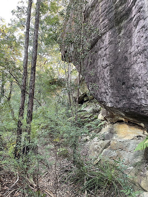
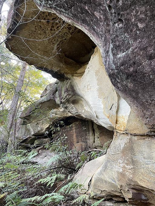
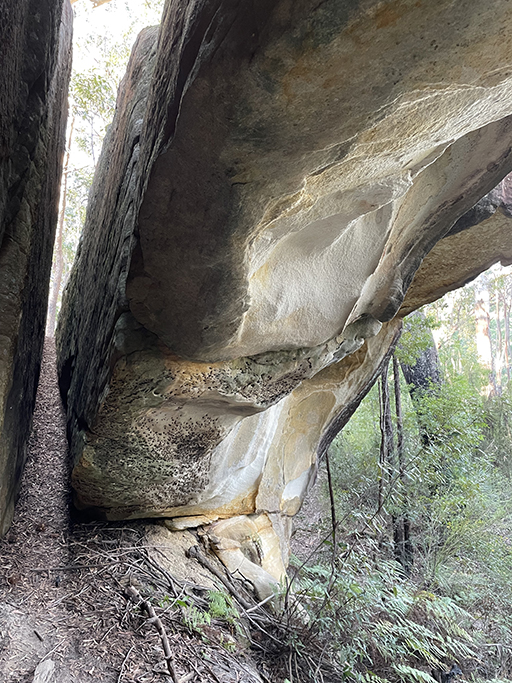
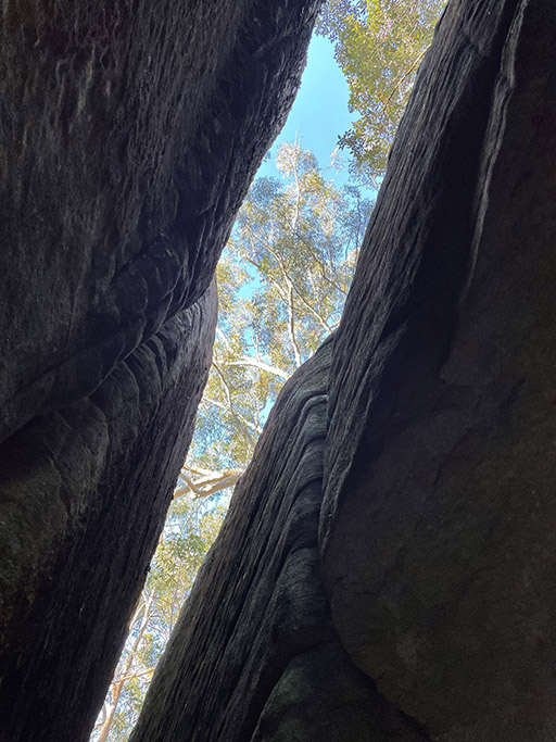
This natural arch, known locally as ‘London Bridge’ is formed below a long, narrow block of rock at the edge of the larger rock platform. From above the arch is barely visible, and as you approach it from the bush it looks like a shallow cave. The arch is formed from a block of rock that has separated from the wall behind it. I think I was expecting something more out in the open and am initially a little underwhelmed. But standing underneath the arch surrounded by ferns, looking up between the rocks at the trees and sky, I realise that it is actually quite amazing. You don’t really appreciate its beauty until you are right underneath it.
You could climb out from under the arch through the narrow slot in the rocks if you wanted too. I wasn’t convinced that my backpack and I would fit so I headed back the way I came around the base of the rocks. Now that I knew where the arch was, I checked it out from above and could see why it was easy to miss.
Back on top of the rock outcrop a bush track heads west, when you get to the electricity tower don’t be tempted to turn right up the access trail. Head straight across and keep following the bush track. This will soon meet up with the bottom of the Trevors Lane Fire Trail which will complete the loop taking you back up to the intersection with Refuge Rock Fire Trail.
All in all, a surprisingly interesting little walk. I am glad I chose to start the walk in a clockwise direction. Exploring the rock platforms before finding the rock arch seemed like a much better order of events. If you only have a couple of hours and need some time in nature, I would highly recommend it
https://www.alltrails.com/explore/trail/australia/new-south-wales/refuge-rock-and-natural-arch-via-trevors-lane-trail
