Sydney Coastal Walk
The short version
Jen and I did this walk in several stages, broken up into bite sized chunks over several months. So far we have got from Palm Beach to Manly, and have now embarked on a journey around Sydney Harbour. I assume we will get to South Head and continue down the coast, I can’t tell you when that might be but I will keep this post updated.
There is a longer description of each stage in links throughout the story. The idea of a coastal walk was very appealing but when I was started to research it there was very little information available. The maps were very general and descriptions of the tracks few and far between.
Palm Beach to Manly is supposedly 36km, and the whole Sydney Coast Walk is over 80km, we will see how far we get… We have kind of made it up as we go, some sections are very obvious and others a bit more patchy. Make of it what you will, this is just our version of the Sydney Coastal walk.
Below is a quick description for anyone who just wants to get on with it and requires some sort of directions to follow, without having to wade through the longer posts. I hope you find it helpful and enjoy the walk as much as we did.
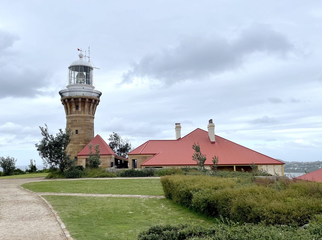
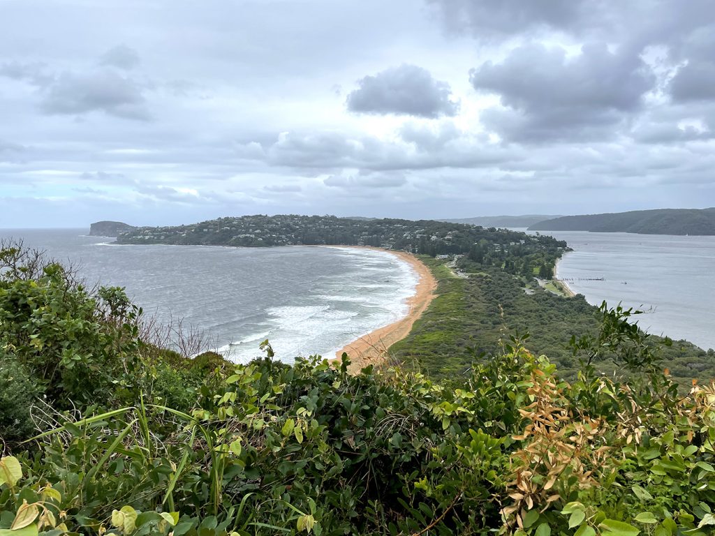
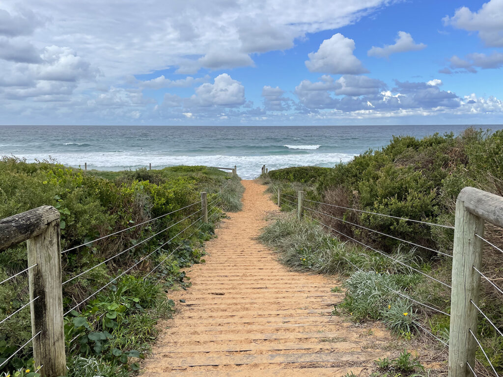
Barrenjoey Headland | 2km
- Start at Governor Phillip Park and walk north through the car park.
- You will pass toilets and water, use them if you need to as there are no facilities at the top of the headland
- Turn left toward Station beach and walk along the sand until you see a sign pointing up the hill
- Choose Smugglers track (steeper but shorter) or follow the access trail (longer, steady gradient) to the top of the headland
- Return to start by either track
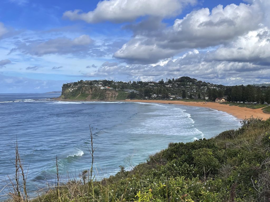
Palm Beach to Avalon | 6.5km
Palm Beach to Whale Beach
- Head south along Ocean Road. Head for Palm Beach Rock Pool at the south end of the beach. Walk along the sand or the road, whatever works for you
- Behind the ocean pool is a set of timber stairs up to Whale Beach Road
- Follow Whale Beach Road until you reach Surf Road
- Turn left down Surf Road to the beach
Whale Beach to Avalon
- Walk along the Strand to the south end of the beach (or on the sand)
- Between the public toilets and the ocean pool are stone steps heading up the hill to Malo Road
- Detour to left to lookout at end of road
- Head up Malo Road to intersection with Whale Beach Road and turn left
- Hal Berry Reserve – nice views
- Continue along Whale Beach Road and turn left into Milga Road, Watkins Road and then Marine Parade OR Take track to Bangalley Headland which will also take you through to meet marine Parade
- Follow marine Parade over Avalon Headland and down to the track trough Des Creagh Reserve, OR walk along beach to surf club (toilets, water and cafe)
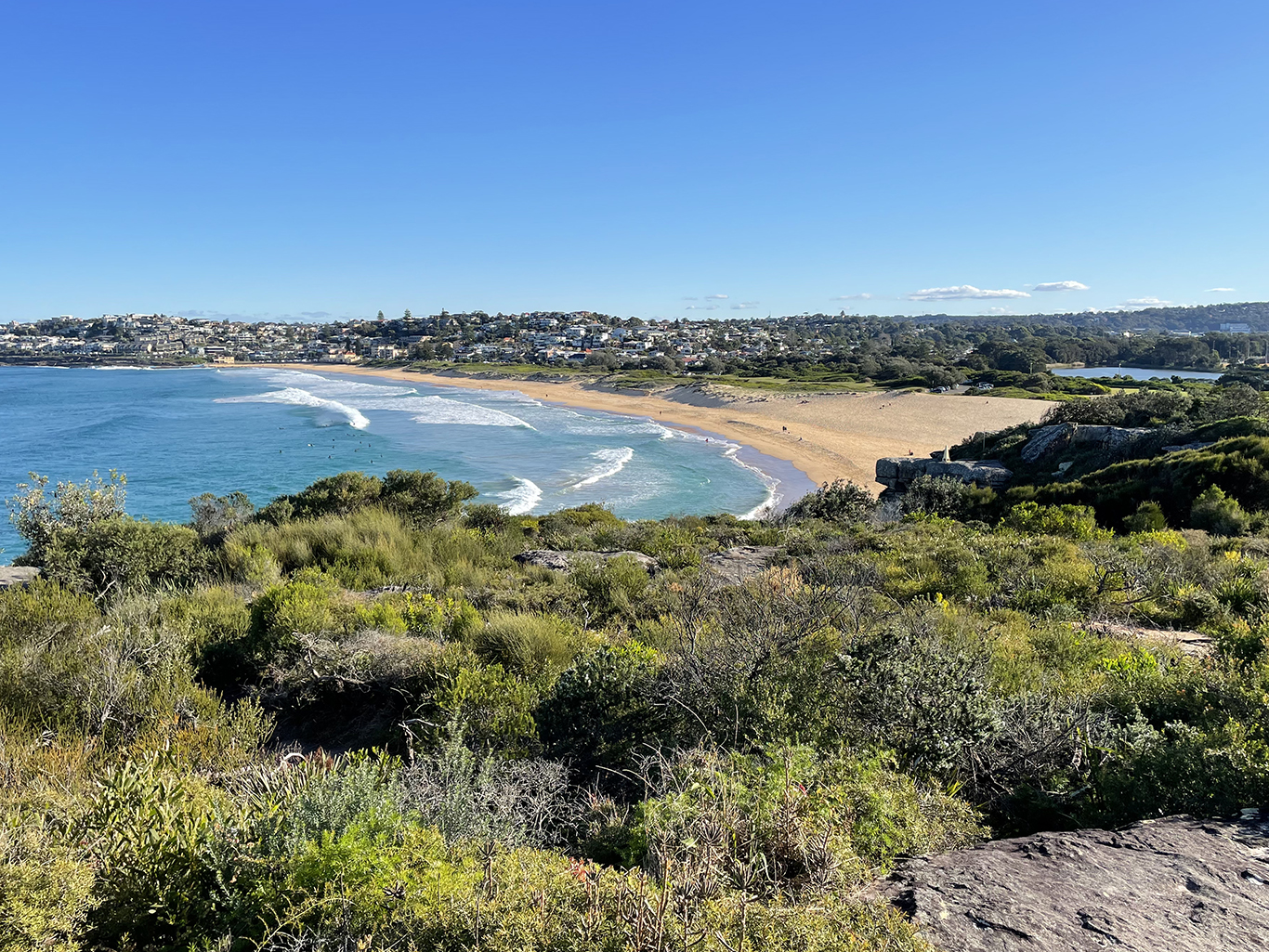
Avalon to Bungan Beach | 7km
Avalon to Bilgola
- South of the surf club walk up the concrete stairs to Avalon Parade and Surfside Avenue
- End of Surfside Ave take path to Barrenjoey Road
- No sidewalk! Walk carefully behind the barrier to The Serpentine and turn left
- Follow The Serpentine past North Bilgola Lookout, not a lot of foot path so take care
- Between numbers 20 and 22 turn left down timber stairs to the north end of Bilgola Beach
- Either walk along beach or Allen Ave and Bilgols Ave back to the Serpentine
- Turn down driveway to beach and surf club (toilets, water and cafe)
Bilgola Beach to Newport
- Between surf club and toilets, take stairs up to Eric Green reserve
- Follow path around headland, past South Bilgola Headland Viewing Platform until it comes out at the carpark for Newport SLSC (toilets, water and cafe)
Newport to Bungan beach
- There are a couple of choices here – if you want to get to the ocean pool you will have to walk along the beach, then back track to an access path to Calvert Parade. OR you can follow the path through Bert Payne Park (near the surf club) up to Myola Road, turn left at The Boulevard and right into Culvert parade
- Right into Queens Parade, left into Melaleuca Street
- At the end of Melaleuca Street walk through reserve to Bungan Head Road and follow around Headland
- At the end of the point there is a lookout and over the road is Bungan Castle
- Continue along Bungan Head Road to Betty Morrison Reserve and turn down a long steep driveway to Bungan Beach SLSC
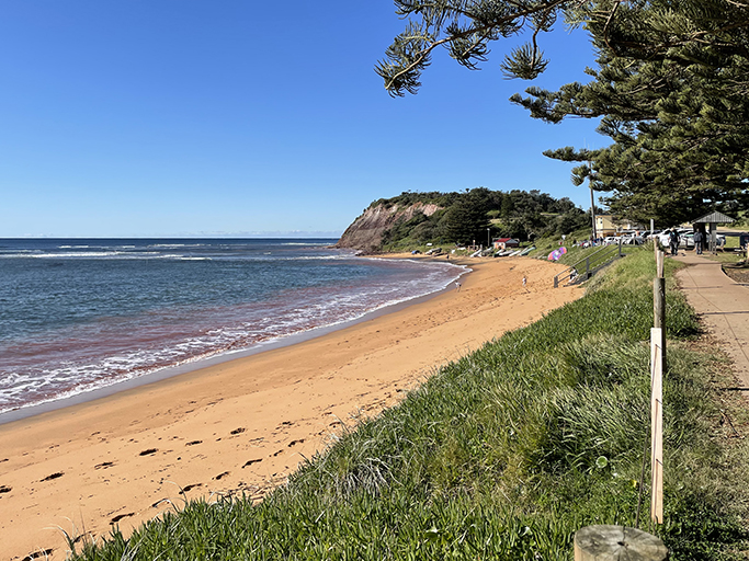
Bungan Beach to North Narrabeen | 9km
Bungan Beach to Monavale
- Walk along sand roughly half way down beach. Look for the red emergency box and then a few meters north you will find a track through the dunes. Follow track up to a shared driveway and to Karloo parade.
- Turn left on Barrenjoey Road and follow to Hillcrest Avenue
- Follow Hillcrest Avenue to the end at Monavale Headland reserve
- Walk through reserve to find stairs leadind into bush
- Follow track around headland to the end of Grandview parade
- Take track on left (still in cul-de-sac) down to Basin Beach
- Walk along beach OR take track to Surfview Road, continue to the beach carpark (toilets and water)
Monavale to Warriewood Beach
- Continue along Surfview Road to the end and take pedestrian path alongside golf course
- Turn left through Robert Dunn Reserve and at the top of the hill onto Narrabeen Park parade
- Next to 103 find concrete steps and path signed “Bicentenial Coastal walkway’ and turn left towards beach. At fork in path keep left and follow path to beach carpark.
- Continue to other end of carpark and past SLSC.
Warriewood to North Narrabeen
- Just past Warriewood SLSC are steps leading up to Warriewood reserve, follow path around headland
- There is a small detour to left to lookout over Warriewood Blowhole, not much can be seen from the clifftop, and we don’t recommend climbing down for a better view – many have got themselves into trouble doing so.
- Back to the track following the stairs up and the path around Turimetta Headland until you reach Narrabeen Park Parade again
- Turn left along the street. There is one track that goes down to the beach but we chose to turn left over the grass and just before you get to the housesand follow the track that runs along the reserve between the houses and the beach, signposted ‘Coastal Walk’.
- Follow the track past the south end of Turimetta Beach and around Narrabeen Headland
- Timber stairs lead to carpark. Optional side trip to left – North Narrabeen Rockpool
- Through carpark to Ocean street (unless the lagoon channel is blocked and you can cross on beach)
- Continue along Ocean Street, left at Waterloo Street to Pittwater Road where you can get the bus.
North Narrabeen to Curl Curl | 12km
Narrabeen/Collaroy to Dee Why
- Continue down Ocean Road, or along the beach
- Past the ocean pool at the south end of Collaroy Beach continue around the headland
- On the southern side of the headland take the timber stairs up Fox Reserve
- Follow Beach Road and Anzac Ave to past Long Reef Golf Club
- Follow walking track around Long Reef headland, keeping golf course on your right, through to Long Reef SLSC
- From carpark of club EITHER walk along beach if lagoon entrance is closed, OR if water is flowing and blocks access walk 1.5km along Pittwater Road past the lagoon and turn left into the reserve
- Continue to Dee Why SLSC
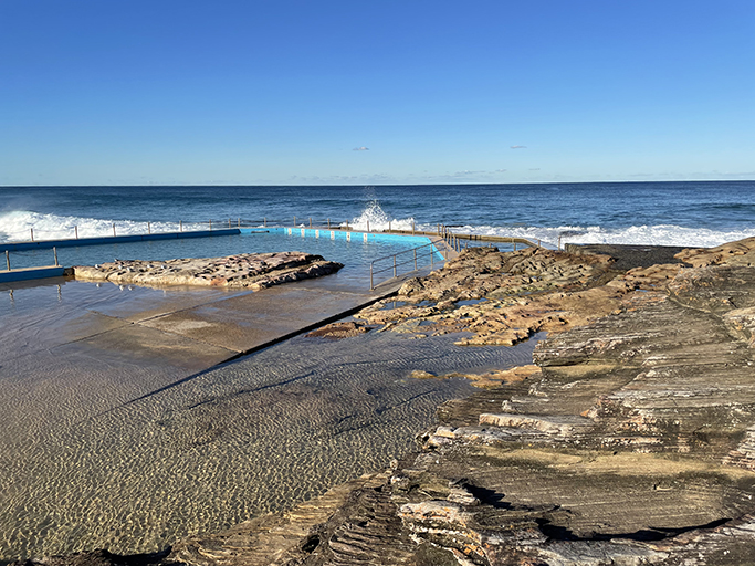
Dee Why to Curl Curl
- From Dee Why SLSC continue south and take stairs near ocean pool up to Oaks Ave
- Walk though one way carparking area and then left onto Coastal Walk track
- Follow track along cliff tops to North Curl Curl SLSC (optional side trip down to North Curl Rockpool)
- Just after SLSC building take track to left down to lagoon
- Walk along beach or reserve in dunes to South Curl Curl SLSC and ocean pool
Curl Curl to Manly and North Head | 15km
- From ocean pool take boardwalk long top of cliffs
- Left of Freshwater Head lookout take path down to rock platform
- Continue around rock platform past Freshwater Rockpool
- At south end of beach take stairs up through Undercliff Reserve
- Bridge Street over headland and down to Queenscliff Beach (optional side trip to end of Queenscliff Road to look at view)
- Manly Wormhole (low tide only) – walk past Queenscliff Rockpool and around rock platform to end of headland and tunnel
- Back to the walkway along Queenscliff and Manly Beach
- At the south end of the beach follow the paved path to Shelly Beach
- At the far end of Shelly Beach take stair to headland walk
- Follow path past carpark and up to North Head
North Head
- Through gate in sandstone wall into Sydney Harbour National Park (no dogs)
- Follow Bluefish path, cross Bluefish Drive
- Path continues through the Barracks Precinct, cross parade ground and turn left toward Avenue of Honour and Fairfax Lookout
- Take loop to Hanging Swamp
- Back on main walking track continue south past gun emplacement 2 and onto Memorial Walkway
- Fairfax track and lookout – if open
- Follow walking track to Visitor Centre and Café
- Take stairs over road to boardwalk and back to main walking track, turn left
- Third Quarantine Cemetery
- Follow signs to Manly – track almost opposite cemetery entrance
- Past Harbour lookout and North Harbour lookout
- Turn left following sign to Manly
- At North Fort Road turn left to North Head Scenic Drive
- Left at Collins Beach Road, downhill to AIPM, walking track to right of gate to Collins Flat Beach
- North end of beach take stairs up to Skinner’s Reserve
- Cross Stuart Street and follow path around Little Manly Point Park
- Turn left (follow Manly sign) to Little Manly Beach
- Continue along Stuart Street and The Esplanade back to Manly Wharf
